The Great Basin is the only place that the Continental Divide splits, creating a basin. Official CDT routes go around it East and West. I think the best route is right through the middle. Leaving the Oxbow Nat. Forest I suggest cutting cross country to Wamsutter which puts you right in position to cross the Basin in three long days of hiking. This was my experience:
As it turned out, the dragon was fairly tame. I had given much more thought to the Great Basin than was necessary. I left Wamsutter, Wyoming, with two gallons of water and my purifier. I made the crossing in three days and found plenty of water along the way.
My original plan was to head straight north from Wamsutter until I reached a junction with the official CDT route and follow the trail west to Atlantic City. An hour after I left Wamsutter, I was still considering other options. According to my map, the Hay Reservoir was off to the northwest which held the promise of water and a much more direct route to Atlantic and South Pass City.
Shortcuts do not always work out the way you plan them. I considered the Donner Party and their peril as they took the shortcut through the Sierras in the 1800s—one good reason not to deviate from my original plan worked out with the Bureau of Land Management staff. But in this case, my original plan had no more merit than any other cockamamie idea I could come up with. I decided to take the shortest route to the Sweetwater River, the only water source I knew I could rely on.
Because of gas exploration and development in the lower Basin, there are roads going in every direction. Even here in this remote and barren moonscape, the Earth seems in chaos, dealing with the constant onslaught of man. When in doubt which road to take, I pulled out my GPS and cut across the sagebrush until I junctioned with a road that seemed to be going in the same direction that I was. Even though I had not seen a rattlesnake in over two months of hiking, I kept thinking about my breakfast tutor (Oldtimer who told me there were rattlesnakes all over the basin) and looking for serpents on top of each of the million plants I brushed.
The second morning, I found a flowing well at Lost Creek Fork. By noon I ate lunch near the Hay Reservoir, and, though it was dried up, I found enough puddles to pump water through my purifier and wash down my cheese tortilla. The morning of my third day, I passed Scotty Lake which was not saline as I had been told and there was plenty of water. At this point I cut cross country and north around the west side of Picket Lake to reach the Forks-Atlantic City Rd., a two-track which would lead to South Pass City.
During the afternoon, I came across another flowing well near a stock tank. By evening, I was sitting on the shore of the Sweetwater River, drinking my fill. Because of cloudy overcast days with sprinkles now and then, I was able to hike thirty plus miles each day, reaching the trail to South Pass City on the third day.
For me, the Great Basin was a quiet land of solitude with its own magical landscape. I sat in the ruts of the Oregon Trail and looked back over the terrain and time. I realized, once again, that knowledge and experience turn fears into facts, dragons into friends.
For nearly a hundred miles, I could see the Wind River range to the northwest. It seemed like an oasis to be reached, rewarding me for crossing this dry alkali basin. I could see rain from the Winds dissipate as it was blown across the basin.
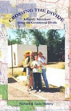
From "Crossing the Divide" by Richard Mallery
thenewspaperthatwalks.com


No comments:
Post a Comment