Wednesday, June 27, 2007

Continent Divide Trail--Winter arrives early on Continental Divide Trail


If you become a southbounder you will have to deal with Colorado in the fall. Here is a heads up on when winter can come to Colorado and the San Juan Mountains.


Staff ReportPublished September 22, 2006


The weather on the Continental Divide Trail has taken a turn for the worse in southern Colorado.
Things aren’t looking so good right now for getting through the state without taking a lower route. I am in my tent in the Cochepto Hills watching the snow pile up outside.
It has been snowing for 12 hours straight and there is no sign of it letting up. The forecast for the next two days is for more snow.
I can hear the wind swirling outside, but fortunately I am staying cozy and warm inside my tent, camped in a wooded section of the trail. Coming up a few days from now, however, the trail climbs back above 12,000 feet and is exposed well above timberline as it goes through the San Juan Mountains.
The San Juans are supposed to be one of the highlights of the CDT with magnificent ridge walking, surrounded by 14,000-foot peaks.
Another hiker earlier this year said about the Crede cutoff, "Anyone who skips the San Juans shouldn’t be out here."
But in weather like this, it can be dangerous. In 1848, the John C. Fremont expedition lost a third of its men in a severe blizzard a few days south of where I am now. In 1874, Alfer Packed killed and ate his companions when they were caught in the snowy mountains of the San Juans. I’m out here by myself, so if I get stuck in the snow I don’t even have anyone to eat.
Going over 12,500-foot Hope Pass a few days ago during the last cold front, I experienced a bit of how dangerous it can be above treeline in bad weather.
It was some of the nastiest weather I have ever hiked in–definitely the worst I have been in alone.
I left early because I had heard that snow was forecast for later in the day. It was raining when I got out at the trailhead. I passed a hunter who had a roaring fire going. As I proceeded up the hill the rain turned to snow. It was snowing hard, but I only had three more miles to go to the top of the pass. At first the snow hitting the trail melted, but soon the trail, too, was covered in white. It was still easy to follow though.
The weather wasn’t that bad until I climbed out of the forest about a mile from the pass. The wind whipped the snow in all directions. Each time a cold blast of snow whipped past me I had to stop and bury my head until it passed and I could look up again to see where to go. The wind was coming from all directions.
At one point the wind was blowing a blast of snow down one side of the bowl beneath the pass when another gust came from the opposite direction. The two blasts collided then turned and headed toward me. The force of the wind made me take a couple of steps backward while I braced against it. I was shivering and my hands and face were ice.
At that point I was just below the top of the pass, but I decided to turn around. I had taken a couple of steps downhill before I saw the clouds breaking and the sun trying to shine through.
It was still bitterly cold and the wind was still stirring up whiteout conditions, but the psychological lift of seeing the sun got me to turn around. I got to the top of the pass and the other side was even windier, very little snow was on the slope on that side as the wind had scoured it clean.
I was freezing and hurried down the hill about a mile before getting to some trees that offered me a respite. Out of the wind it wasn’t that bad. I descended into the trees and by the time I got to the road at the bottom of the hill, the sun was shining and I was almost warm.
I am getting a radio station on my MP3 player right now, but it is one of those format stations and I don’t think I will be getting any local weather reports. Right now I am just hoping I will be able to follow the trail in the morning and that at some point in the day I will have a chance to dry out my tent.
The nearest road is 27 miles away. If I make it there tomorrow, I might hitch into a town, provided the road is open and there is any traffic on it.
I left Boulder, Colo., on Sept. 8 and the weather has been mainly cold and snowy since then with a few warm sunny days in-between.
Winter is coming early this year to Colorado. The aspens normally change color at the end of the month and into October. Now they have not only changed color, they are losing their leaves. The usual date for hikers to safely get through the San Juans is Oct. 1, but that isn’t holding true this year.
I hiked out of Boulder with Recess, a friend from the Pacific Crest Trail who came out to hike for a week. It started raining on us quickly after Easy–another PCT friend who lives in Boulder–dropped us off at the trailhead. The rain soon turned to snow.
We hiked up over 12,000 feet to the open divide and into the brunt of the wind. We found a place off the crest and out of the wind to camp. Five inches of snow fell overnight.
The next morning, the weather was just as bad and–with the highest section of the trail coming up with five 13,000-foot peaks–we bailed off the trail at the next pass, hiking a gravel road 14 miles down to Winter Park.
Recess had a rental car and my parents came out the next week with their van. With the help of both of them I managed to bounce around in central Colorado, hiking the lower elevations on colder days and the higher places on warmer days.
Unfortunately the weather caused our southbound group to each do its own thing and we are now a bit more spread out. I am hiking by myself for the first time on the CDT.
There just was a local weather report on the radio–thunderstorms continuing tonight and isolated showers on Thursday and Friday with a chance of snow Friday night. Up here above 10,000 feet that means snow, snow, snow.

Tuesday, June 26, 2007

Continental Divide Trail--Great Divide Basin


Continental Divide splits southwest of Rawlins and then rejoins northeast of Rawlins, creating the nearly circular Great Divide Basin where moisture that falls remains trapped and doesn’t drain to either the Pacific or Atlantic watersheds.
Wyoming’s Red Desert and the Pronghorn
Tucked away in southwestern Wyoming, the Red Desert remains one of the last high-desert ecosystems in North America. Long before the West was settled, the region played a significant role in the lives of native peoples, including the Shoshone and Ute tribes, and its unique features helped guide pioneers on their way to Oregon, California and Washington.
Now its rich landscape offers refuge to the pronghorn, the largest migratory herd in the lower 48 states, desert elk and many species of rare birds. However, this truly untamed region is under threat of oil and gas drilling.
The Bureau of Land Management (BLM), the federal agency responsible for safeguarding much of the lands and resources of the Red Desert, has proposed to increase oil and gas development in this region, threatening this wild landscape and its wildlife.
The Red Desert encompasses more than eight million acres of public lands that contain many unique things. Among its inhabitants are the world’s largest herd of desert elk, 50,000 pronghorn antelope, historic landmarks, rare plant species and primitive rock art.
The Red Desert is as wild and rugged as it was 150 years ago when the pioneers crossed it on the Oregon-Mormon Trail. In those days, this harsh land provided the easiest path over the Continental Divide. Easiest, but not easy. Many pioneers lost their lives during the crossing, and today the area remains sparsely populated because of its severe climate, sparse moisture and barren landscape.
The CDT is becoming very well marked around the basin. I went straight across (Blue Line). I bushwhacked from Battle Pass to Wamsutter which is all sagebrush and little water. From Wamsutter I went straight across the Basin to the Sweetwater River, South Pass City. I found more water sources in the Basin than I did getting from Battle Pass to Wamsutter. The southern part of the Basin has a lot of oil/gas activity. There is water at Hay Reservoir and I found Scotty’s Lake to contain potable water. I thought it would be saline but it was not. I also came across a couple flowing wells on the north end of the basin where cattle were congregating. I would still suggest carrying a couple gallons and walking long mileage days to make the crossing a three day event.

Continental Divide Trail--750-pound bear is captured in Montana


750-pound bear is captured in Montana
Great Falls Tribune
This photo made availaable by Mike Madel shows the pad of the second-largest grizzly bear ever recorded after it was captured in the 10,000-square-mile Northern Continental Divide Ecosystem measures 7 1/8 inches across. Its claws are 3 1/2 inches long, in this photo taken May 24, 2007, in the Teton River drainage on the Rocky Mountain Front, near Choteau, in Montana. Choteau is just east of the Bob Marshall Wilderness where the CDT moves north through this incredible area.
State bear managers seeking to capture and collar female grizzly bears as part of a population count recently trapped a 7 foot, 6 inch male grizzly that weighed 750 pounds after a winter of hibernation.
Mike Madel, bear management specialist with the state Department of Fish, Wildlife and Parks, said it took two scales and a hydraulic crane to weigh the 8-year-old bruin that had 3 1/2-inch claws and a neck circumference of 4 feet.
"This bear was just a beautiful bear," Madel said.
Madel said the big male with the bronze head, golden back and dark chocolate legs could weigh as much as 900 pounds by the fall.
"This is really a large male," he said. In fact, it is the second-largest male grizzly ever recorded in the Northern Rockies Region, Madel said.
Madel captured the bear he dubbed "Big Daddy," on May 24. He was trying to capture female grizzlies near Choteau to fit them with radio collars to track their movements and whether they have cubs.
"We actually were trying to avoid males," Madel said.
But he decided to put a radio collar on the bear to track its range.
Madel said he didn’t know the big bear even existed.
"Here’s a bear that’s down on the Front, and he’s accustomed to moving in and around human activity, and he’s never caused a conflict before," Madel said.
The average-sized male grizzly along the Rocky Mountain Front is 600 pounds, while females are around 300 to 325 pounds.
Madel, who has been managing bears on the Front for 24 years, wonders if the bear he trapped this spring was sired by the largest male grizzly ever recorded in the Northern Rockies: an 8-foot, 800-plus pound bruin trapped in 2003 in the Blackleaf Wildlife Management Area northwest of Choteau.
"This bear," he said, "looked very much like that bear."
Madel collected hair from the 2003 bear, but an Idaho lab lost the samples, making it impossible to know if they’re related.
Madel said the younger bear captured this spring hasn’t reached its full size.
"He’s got some growing to do," Madel said.

Thursday, June 21, 2007

Continental Divide Trail--Route Options


The CDT (Continental Divide National Scenic Trail) is currently very fluid. The constant volunteer work being done to complete the trail will eventually make it easier to follow but it will still remain a trail with many route options. It is the King of Trails for many reasons but one would be the fact that it intersects so many National Forests, Wilderness Areas and Federal Parklands. When I hiked the trail in 1999 there was little routing information available, yet I found the challenge of working my way north not all that difficult. Admittedly I was lost a lot, but that is not always a bad thing. If you have the time to do this long trail, part of the adventure will be setting yourself completely free to find your way in some of the world’s premiere and rare protected land. I am already planning a second hike along the CDT and have done many sections that I think I can make much more interesting. It is very possible to do the CDT and the GDT in one season if you can do long miles everyday and spend less time route finding. With the information available today on the route, and the much improved trail developed over the past decade the CDT/GDT is shaping up to be the true King of Trails.

Tuesday, June 19, 2007

Continent Divide Trail--2007 Hikers


By: MARGA KELLOGG


Paul Longton will take the first step next week in a 3,100-mile journey that, when finished, will put him in company as rare as the air he’ll breathe along the way.Longton will be hiking the remote Continental Divide Trail, which stretches from the U.S.-Canada border in Montana through Idaho, Wyoming, Colorado and New Mexico. Across the 750-mile section in Colorado, the trail averages over 11,000 feet in elevation, with the highest point being Grays Peak at 14,270 feet.
The trek is attempted by only about 50 people a year — and finished by about half that many, said Josh Shusko, with the Continental Trail Divide Alliance, a nonprofit group formed in 1995 to assist federal land agencies in completing and maintaining the trail.
Longton, 58, said he aims to finish the hike by the end of October. The trail is particularly grueling because only 63 percent of it is complete, forcing hikers to pick their way through some remote and difficult terrain."The challenge of route-finding and more isolation" is part of the draw, said Longton, who works as an architect in Oceanside."Stepping back 150 years, (into) herds of wild horses, Mexican gray wolves — that’s a strong lure," he said. "The country’s more rugged and it’s harder to actually complete the hike."Longton and partner Nancy Imbertson will start the hike with Washington resident Derek Jackman, whom they met while hiking the 2,600-mile Pacific Crest Trail in 2004.Imbertson will return home when the trio reaches South Pass City, Wyo., 1,172 miles into the journey. Longton and Jackman will continue on from there.Horses and wolves aren’t the only wildlife in the remote wilderness along the trail, which ranges in ecosystems from tundra to desert."That’s grizzly country," Longton said of Montana and Wyoming, adding that he’ll be packing pepper spray in case of an attack.On Monday — the week before their June 21 departure — Longton and Imbertson were busy organizing "resupply" boxes, navigational equipment, ice axes and all manner of survival equipment in their Oceanside garage.Oatmeal is a staple, said Imbertson, 42, who works for a construction company in Encinitas.The first step in packing for the trip, she said, was to go to Costco and buy about $1,000 in bulk food.She and Longton then stuffed more than a dozen file boxes filled with things such as shrink-wrapped dried noodles, precooked bacon, vitamins and energy bars, which will be shipped ahead to various post offices along the route where the hikers can pick them up.Other supplies will be carried along the way, including six days’ worth of food, a couple of cooking pans, a small sterno can, clothes, a tent and sleeping bags. Each hiker will carry a pack weighing about 35 pounds.Imbertson, who is called Izzy on the trail, said she’s looking forward most to "getting started." Longton, known on the trail as Buzz, said he is excited about the physical challenge."You’re hiking at a calorie deficit," he said, adding that he expects to average between 25 and 30 miles a day and burn about 4,000 calories daily.The couple run and have hiked in the Torrey Pines area to prepare themselves. Longton says he runsÝabout five miles, four to five days a week."It’s wonderful to be in that kind of shape," Longton said. "I was in the infantry in Vietnam and no way was I in as good a shape then as I was at 55 doing the PCT (Pacific Crest Trail)."Imbertson said it takes about two weeks to leave the world behind. Completing the entire trail will take about 7 million steps."No wonder the shoes wear out," added Longton, who has packed six pairs for the trip. He hikes in New Balance 2001 running shoes and said he will likely go through five pairs."I tried various other trail shoes and after about 300 miles, they’re junk," he said.Longton and Imbertson said they decided to try long-distance hiking after a 2002 trip that took them through 110 miles of Yosemite back country."We thought, ‘We can do this,’" Longton said."The westward movement has always fascinated me," he continued. "The Oregon Trail, they weren’t able to mail themselves any boxes, there were threats. The sense of that continuous trail captures my imagination."And Longton said this trip won’t be his last — he intends to hike the Appalachian Trail and finish what hikers call the "triple crown.""The reality is, at 58 it takes a toll on the body. If you space them out every few years, chances are good and the Appalachian is probably the easiest of the three, the movie ‘Deliverance’ notwithstanding," he said with a laugh.

Continent Divide Trail--YoYO


By Janet Reese
Francis Tapon, 37, will be "yo-yoing" the 3,100-mile Continental Divide Trail this year, hiking it twice in one season, making a round trip. He started April 7 and plans to finish before Thanksgiving. Writer Janet Reese caught up with him by phone last month.
1 Why are you yo-yoing the CDT?
To be the first one to do it. When I breathe my last breaths, I want to conclude that I lived a life that was fun and fascinating.
I also want to increase awareness of the CDT and raise money for its completion. As I hike and pass through towns, I tell people about what I’m doing. I have a website (CDTyoyo.com) and an e-newsletter that people check for updates.
2 What are your greatest challenges?
Navigation on the CDT is tricky, even with no snow. The trail is not well defined in many parts. In the San Juans, I stepped on a piece of wood, a buried CDT sign that I could barely see. I use a map and compass to find my way. It’s frustrating when you come to junctions with splits and there’s no sign to tell you which way to go.
3 What is your experience hiking through the CDT’s Colorado segment?
The scenery is amazingly beautiful. The hike is rough. I hiked from Cumbres Pass in the San Juan Mountains on May 3 and then within one hour, I threw up. I’m not sure if it was the altitude or food poisoning. That day, I vomited seven times. Then a foot of snow dumped on my tarp. The next day I endured a windy snowstorm.
Walking through deep snow 15 hours a day is tedious. On a normal trail, I walk three miles per hour; in the snow, it’s more like one and a half. On a typical day, I carry 20 pounds.
4 How do you manage the logistics such as gear, food and communication?
My mother sends food and supplies to mail drops that I visit along the way. I buy supplies at bigger mountain towns. I usually carry enough food for four days, but sometimes up to six. I use pay phones and libraries for Internet access.
5 On your previous long-distance hikes, you had partners. What’s it like hiking the CDT solo?
I feel more vulnerable. . . . I plan to hook up with some friends along the way and will see other CDT hikers this summer. Navigating Colorado’s terrain is a full-time job and my mind is constantly challenged.

Monday, June 11, 2007

Continent Divide Trail--Early Hikers


The Continental Divide National Scenic Trail
Early white travelers dreaded the forbidding Continental Divide (the high mountains separating the Atlantic and Pacific watersheds). Later settlers viewed it as a challenge to be conquered: road builders surmounted it, railroaders tunneled through it, and engineers diverted Western Slope water underneath it to irrigate farms and to sustain cities in eastern Colorado. But the Continental Divide Trail, which Congress designated a National Scenic Trail in 1978, simply takes the landmark on its own terms. With 800 miles of Colorado wilderness the route often diverges from the Divide proper because some portions are simply too rugged for travel. And therein lies the Divide’s mystique: though mapped and breached, it remains somehow impenetrable, one of the nation’s last unspoiled places. It is truly the "King of Trails."

Saturday, June 9, 2007

Continental Divide Trail--Yellowstone Grizzly Attack


If you hike the Continental Divide Trail you are going to have to deal with the fact that the trail meanders through a thousand miles of grizzly habitat in the U.S. Another thousand if you want to follow the Divide North of the border into the beautiful Canadian Rockies. It is estimated 600 to 800 bears inhabiting mountains along the Continental Divide north of Missoula, Montana. Many more, perhaps as many reside south of there into the Winds.
A sow with two cubs mauled a hiker two weeks after my 1999 CDT hike through Yellowstones Heart Lake Geyser Basin section. Resently a photographer was attacked in Yellowstones Hayden Valley—one of the most populated grizzly areas in the Lower 48. If you stay on the official CDT route you will not be near Hayden Valley. But that does not give you a free "Get Out of Jail Card."
May 24, 2007YELLOWSTONE NATIONAL PARK, Wyo. - A park visitor was attacked by a grizzly bear in May and hiked miles to safety with severe facial injuries, park officials said.The man, in his late 50s, was taking photographs of bears when he was attacked, according to a statement from the park. He told rangers he had been attacked by a sow with a cub.After the attack, he hiked two to three miles and was discovered by other park visitors around 1 p.mGrizzly bears and black bears, including sows with cubs, are active in the spring, Park Service officials said. Park visitors are encouraged to travel in groups, make noise and carry pepper spray.No human injuries from bears were reported in Yellowstone last year, and only eight minor injuries have been reported since 2000, the Park Service reports. The last bear-caused human fatality in the park was in 1986.
The wildlife photographer/hiker who was mauled will survive after undergoing seven hours of emergency surgery to repair his severely clawed face.Jim Cole, 57, of Bozeman, underwent surgery and recovered at Eastern Idaho Regional Medical Center in Idaho Falls.Berman said Cole was unable to speak and was breathing through a ventilator and being fed through a tube.Park officials said Cole was photographing bears in the Hayden Valley’s Trout Creek drainage, which is prime grizzly habitat. He was hiking alone, off trail, about two or three miles from the road when a female with a single cub attacked.Berman said the bear hit Cole twice on the head and face with its claws. It was the second time Cole was mauled by a grizzly.In 1993, he was hiking with a friend in Montana’s Glacier National Park when he surprised a young grizzly. The bear tore a hole in his scalp and broke his wrist before the friend used pepper spray and the bear left.Cole mentioned the experience in his 2004 book, "Lives of Grizzlies: Montana and Wyoming."He had no time to use pepper spray against the animal. Jim Cole does remember trying to grab his bear spray. He said that that he assumed that he startled the bear and the bear startled him.Park officials said Cole, 57, of Bozeman, Mont., was photographing bears in prime grizzly habitat within Yellowstone’s Hayden Valley. He was hiking alone, off a trail, and was two or three miles from a road when the female bear with a single cub attacked. He does remember topping a ridge in Hayden Valley, near the Trout Creek area,and reported that the bear "came out of nowhere." The bear struck Cole in the face and besides knocking out the left eye, the animal seriously damaged facial bones and skin. "His recollection was that the bear hit him like putty," he said. "I figured this was as traumatic an experience for the young bruin as it was for me," he wrote. Cole has written and taken photos for two books about grizzly bears. In his writing, he has advocated photographing Yellowstone bears from the safety of a road, but also said he had hiked thousands of miles in grizzly country. "I want to document natural grizzly behavior, not bears reacting to humans," Cole wrote in 2004. "All the same, as careful as I try to be, I certainly have made my share of mistakes."
Bear spray is an insurance, but often you will never find your policy in time.
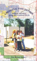
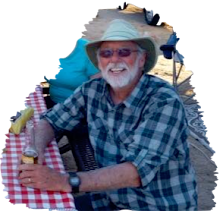
Dick Mallery Hiked the CDT and GDT in ’99 & 01. You can read his story in "Crossing the Divide, A Family Adventure Along the Continental Divide

Wednesday, June 6, 2007

Continental Divide Trail--Livestock in the Wind River Range


It almost seemed sacrilegious. I came over a rise on the Highline Trail through the Winds and there stood thousands of sheep. I had no idea they were allowed in this pristine wilderness sanctuary. Every set of eyeballs was staring directly at me. I said, I suppose you are all wondering why I called you here today—Well, I didn’t.
Livestock GrazingLivestock grazing is permitted in certain special allotments of the Wind River Range and in wilderness areas. Sheep graze the southern end of the Bridger Wilderness from July to September. Herding practices are designed to minimize contact with recreationists. Brief encounters may occur in meadows from Cooks Lake south to the Sweetwater River. Cattle graze in the Upper Green River area and some of the western fringes of the Bridger Wilderness. Animals come off these allotments in the fall, usually before hunting season starts or when cold temperatures cause them to drift down out of the mountains. Backcountry users might encounter domestic sheep and cattle in certain areas during the summer, as well as occasional cowboys on horses or sheepherders managing the herds.
Continental Divide National Scenic TrailApproximately 80 miles of the Continental Divide National Scenic Trail (CDT) runs through Wyoming. This scenic trail goes from Mexico to Canada. In Wyoming, it goes from the Sierra Madre mountains to the western edge of Yellowstone National Park along the Continental Divide. The trail passes through the Big Sandy Opening in the southern part of the Winds to Green River Lakes on the northern end of the range. The trail is marked with CDT signs, wooden signs, tree blazes or rock cairns. In some places, the trail is obscure, so it is helpful to have good maps and a compass with you. This is a very scenic segment of the CDT, making this hike a memorable one that will last a lifetime.

Continental Divide Trail--El Malpais Wilderness


I spent two days in Pie Town, New Mexico. The trail north from Pie Town is a dirt road that meanders through scrubland for about fifty miles leading to the El Malpais Wilderness.
There was no traffic on the road and few cattle. I could sing to myself at the top of my lungs and offend no one. Occasionally, I would spy a windmill to the east or west and migrate over to fill my containers.
"Don’t go through that El Malpais Wilderness. People have been known to go in there and never be heard from again." Those were the words of one old-timer in Pie Town. I assumed he was exaggerating. Everything he described sounded far-fetched. I realized I would have to deal with sharp lava rock, but deep, bubble-shaped holes you could never climb out of and crevasses that would swallow you up didn’t seem realistic.
The area is actually known as the Badlands "El Malpais", one of the best examples of recent volcanic landscapes U.S. Here the trail coincides with the 1,000-year-old Zuni-Acoma trade route, crossing rugged lava flows.
I had the opportunity to skirt the whole area. A 20-mile dirt road called the Seven Crater Byway detoured El Malpais. Articles I had read advised against hiking through this area. A day after entering this land of lava, I questioned my judgment of not staying on the road. The trail into the El Malpais quickly turned into a faint path and, eventually, game trails.
I found water just before the boundary and filled every container I had. It was the last water I would find for the next 24 hours. Some of the old-timers’ tales were beginning to make sense to me. Lava tubes, ancient crevasses and deep holes with interiors shaped like bubbles were common formations throughout this region.
Looking into these openings, I could see the skeletal remains of animals that had fallen in and did not escape. It was slow, tedious hiking around the mounds and cones of uplifted lava formations. I kept working my way northwest, trying to exit the wilderness near a forest service road that would lead me to Grants, New Mexico.
Becoming familiar with your surroundings often takes longer than a thru-hiker can afford. It was reasonable to assume that water was nearby because I could see signs of abundant wildlife.
Late in the afternoon on my second day in the badlands, I entered a campground area and a trailhead to well-known lava tubes. I was optimistic that I would find water available in the camping area but no such luck. I began following a road leading west. My only hope was to intersect the bypass or a ranch where I could find a livestock tank. I didn’t have to wait that long. An hour up the road, I ran into the trail magic I so desperately needed. A couple by the name of Ott from Austin, Texas, pulled up next to me in their SUV. They were headed in the toward the campground for a couple days of mountain biking. They had five gallons of water and offered me all I wanted. I cannot explain exactly what transpired when I met people like the Otts along the lonely stretches of this trail, but it was magical. After spending just a few minutes with complete strangers, I would be completely energized. I would pick up my pace, feel stronger, forget my blistered feet and concentrate on my next route objective. It was apparent each time I met someone. It seemed as though I had been plugged in and recharged. It felt wonderful!
Excerpt from "Crossing the Divide, A Family Adventure Along the Continental Divide--MALLERYBOOKS.COM

Some additional El Malpais information:
This sweet segment of the 3,100-mile Continental Divide National Scenic Trail (CDT) meets any definition
of remote you care to set. The closest town, Pie Town, a booming metropolis at 2,900 souls, has tempted thru-hikers on the CDT with a slogan, "Days go on, life goes by, and that’s why you should stop for pie!"
After a serving of famous "New Mexico Apple Pie," you’ll be ready to explore the geologic anomaly that is the Chain of Craters. The Chain of Craters is located within the El Malpais National Conservation Area and borders the El Malpais National Monument. Both areas lie in the high desert southwest of Albuquerque. Spanish for "The Badlands," the El Malpais region has figured in Acoma, Laguna, Zuni, and Ramah Navajo Native American cultures for thousands of years. Their ancestral uses–gathering herbs and medicines, paying respect, and renewing ties to their ancestors–continue today.
Within the National Monument the CDT shares a path with the Zuni-Acoma Trail, an ancient route connecting the pueblos of Zuni and Acoma Native Americans, which has witnessed more than 1,000 years of human travel and use. In fact, many of the rock cairns and lava bridges built by the Ancestral Puebloans are still used to mark the route today.
This unique landscape also provides for a depth and breadth of wildlife diversity uncommon to the surrounding area. This segment of trail makes for nearly 20 miles of classic high desert backpacking. Water is very scarce on this section, and daytime temperatures can easily reach the triple digits in the summer. Those unaccustomed to this climate should make sure to hydrate well and consume some salty snacks, thereby avoiding dehydration and its fatal opposite, hyponatremia, an imbalance between the body’s water and electrolytes.
This remote segment of the Continental Divide National Scenic Trail traverses a unique "volcanic badlands" across the high desert of northern New Mexico. Prepare for a long, waterless trek over fields of purple-black lava, past the ancient calderas of the volcanoes that created this arid marvel of a trail. The inspiring views of Cerro Lobo and Cerro Brillante mountains will be your reward.

Continental Divide Trail--Glenn Dunmire Route


Dunmire, an avid climber and naturalist, will hike the length of the Continental Divide, from the Chihuahuan desert in New Mexico to Canada. Though there is a Continental Divide trail, it deviates largely from the true crest of the divide for most of its length. Glenn hopes to cover as much of the journey in 2007, before winter snows close the highest passes in the Rockies. Sierra Designs will be outfitting Glenn with gear and apparel and will be following him along his journey, documenting his experiences and reactions to the products and technologies.

The Real Continental Divide:
In 2007-2008 I will walk solo along the 3100 mile U. S. section of the actual or Real Continental Divide. My goal for the trip is to stay exactly on the true geological crest that divides U.S. watersheds, east toward the Atlantic Ocean and west toward the Pacific Ocean. Almost the entire route is cross country, with rarely a few miles of trail or road. The Wind River Mountains will be the primary technical difficulty with many miles of technical climbing over granite towers and ridges. For safety and speed I will have a partner join me for technical climbing sections. The logistics of a year’s worth of food, equipment, supply drops, communications, and arranging climbing partners has been almost overwhelming as I prepare for the trip.
This trip is my rehab from a potentially career ending hand injury which left me with limited mobility and minus three carpal bones. Paired with my crippled left knee with no ACL or medial or lateral meniscus, friends ask how will I be able to do a trip like this? My response is" There are a lot of people out there with worse injuries than mine who get up every day and get after it. I’ve got no excuses!"
I will begin my journey in April 2007 on the New Mexico/Colorado border and head north. Avalanche conditions will probably stop progress November 2007 to April 2008. During that time I will hike along the Continental Divide through the desert terrain of New Mexico. In 2008 my sojourn will end in the alpine zone at Glacier National Park on the Canadian border.
Why the Continental Divide? I grew up in the Rocky Mountains and was first introduced to the Continental Divide as a seven-year-old in Yellowstone National Park where my dad was the chief park naturalist. During our first week in Yellowstone we crossed the Continental Divide, backpacked in to Heart Lake, and climbed Mt. Sheridan. From Mt. Sheridan we looked out onto the divide where it contours around Yellowstone Lake. My parents explained what the divide was and it was of course "cool" as was everything else in the sixties. Four years later we moved to Rocky Mountain National Park where the Continental Divide touches many of the trails and peaks that would become my playground until I left for college. I returned to work for many years along the divide as a climbing ranger at Rocky Mountain National Park. The Continental Divide shapes and defines our country as it shapes and defines me. I had to return to explore the entire Real Continental Divide, a combination of geography and personal history, much more than a line on the map to me.
I first tied into a rope when I was nine, fired by my father’s stories as a climber on the 1954 California Himalayan Expedition to climb Makalu. One of my first expeditions was homegrown when my brother Pete and I climbed all 54 of Colorado’s 14,000 foot peaks in 54 days pedaling bikes between them, crossing the Continental Divide eight times. Since then I have been on numerous first ascents in Alaska, Nepal, Patagonia and elsewhere. I have also participated in rafting first descents, extensive mountain treks, and backcountry science research in Alaska. Despite many successes abroad, walking and climbing along the Real Continental Divide, a feat no one has yet completed, will be one of my greatest challenges. http://www.therealcontinentaldivide.com

Saturday, June 2, 2007

Recreationists labor for a better Continental Divide trail


Recreationists labor for a better Continental Divide trail
By EVE BYRON 6/1/2007
John Gatchell spreads out the map on the hood of a car , anchoring one side of it with a rock.Oblivious to the wind whipping across MacDonald Pass, Gatchell points to dotted lines he’s drawn on the map — dots that he hopes eventually will translate to trails that connect or enhance sections of the Continental Divide National Scenic Trail.The trail theoretically could be hiked, biked or ridden on horseback 3,100 miles from Canada to Mexico, including 820 miles in Montana. But sections of it are somewhat obscure or vanish into roads, confusing recreationists trying to stay on the trail, said Gatchell.So for the past 10 months, a coalition of eight outdoor and conservation organizations has worked with the Helena and Beaverhead/Deerlodge national forests in an effort to string some trail segments together in an easy-to-use manner."This is a really tremendous resource and it’s so close to Helena," Gatchell, conservation director for the Montana Wilderness Association, said on Friday. "It takes only 15 minutes to get to the trailhead from town. It’s part of what we love — our ability to head out the door and be on the trail in minutes, on the largest quiet mountain trail in the nation."Heading south on the trail today with Gatchell is Dennis Milburn, vice president of the Back Country Horsemen, which is one of the groups involved in the effort to enhance two sections of the Continental Divide Trail between Helena and Butte in the next few years.Another stretch needing improvement is north of MacDonald Pass, between Nevada Mountain and Sweeny Creek, and one is south of Butte in the Basin Creek watershed.As a former Helena National Forest employee, Milburn knows the difficulties faced by national forests as they try to provide recreational opportunities to the public in the face of limited funding.His group has adopted trails in the Gates of the Mountains and elsewhere to do weed control, and they regularly provide the strong backs and pack horses for trail work in a 50/50 cost share with the National Forest."We do a challenge/cost share agreement, which is a creative way to find volunteers and funding," Milburn said. "We work with the Forest Service on a list of work to be done and cost estimates, then we do the work to their specifications."Today, Milburn and Gatchell stride along the trail past fields filled with larkspur and what looks like small yellow buttercups, listening to the twittering hermit thrush and ruby crowned kinglet.But they’re rerouted often by windblown, downed trees crossing the trail and try not to trip over the small granite boulders embedded in their route, which are inherent in this part of the forest.Only one trail crew this year will be working for the Helena Forest this year, which is why volunteers are coming up here next weekend with tools provided by the Forest Service for a little trail TLC.But what’s really on their minds today is a 16-mile segment south of MacDonald Pass, from Jericho Mountain into the Little Blackfoot Meadows, which might get improved in two eight-mile segments.The Jericho to Josephine segment may take a while, since it might involve crossing some private property. Gatchell said the Prickly Pear Land Trust is trying to work out a solution — whether it’s the purchase of the properties, an easement or some other method — that would allow people legal access."The Forest Service has the funding to survey and design from Josephine to Bison," which is just northeast of Little Blackfoot Meadows, Gatchell said. "… They hope to get the work done by 2008."This is for more than just the Continental Divide Trail," he added. "This hooks into other trails that provide opportunity for loops for people and horses."Those types of loops appeal to a lot of people, including members of the Helena Outdoor Club. Friday morning about half a dozen people were getting ready to hike on the Continental Divide Trail from MacDonald Pass to a meadow, then drop down some switchbacks into the Tenmile drainage near Rimini, where they had dropped off a car."It’s right in our backyard and it’s a gorgeous trail," said Barb Belt of Helena. "There’s lots of wildflowers, moose and elk."And the hikers, bikers and horseback (and mule) riders who are working to enhance the Continental Divide Trail, and those routes that lead into it, want to keep it that way."We’re seeing a lot of growth coming at us and want to make sure quiet trail opportunities remain for the future," Gatchell said, as he looked toward Red Mountain, Black Mountain, Colorado Mountain and Elkhorn Mountain from the parking lot at MacDonald Pass. "We’re willing to dedicate a lot of time working on these trails so people can come enjoy them."

Friday, June 1, 2007

Continental Divide Trail--Rabbit Ears Pass


The Continental Divide goes north from Grand Lake, Colorado, through Rocky Mountain National Park and then arcs back south through the Never Summer Range. An earlier post explains the Park Service suggested route. From Grand Lake the trail climbs northwest gaining the Divide again at Bowen Pass.
By the time I reached the Pass, the wind was trying to knock me over. The trail was strung out along a border between Routt and Arapaho National Forests. The views at 12,000 feet were magnificent!
The second morning was spent following rock cairns straight up to the top of Parkview Mtn. where I could see most of Colorado. On the top was a Forest Service Communications building manned by a marmot. (Someone forgot to shut the door.) I wanted to shortcut a big dogleg around Troublesome Pass but decided to stay on the CDT and see where it led me. It led into Trouble! Unfortunately, I found two Troublesome passes (as if one were not bad enough). The first was designated by Arapaho NF. I knew it wasn’t the location I was looking for, so I bushwhacked west about a mile along the Divide until I came to the pass described in my Colorado CDT guidebook. It was late afternoon and, again, the wind was trying to rip me apart. I put my rain jacket on as a windbreaker, put my head into the wind and trudged on. It was quite late before I found a flat spot to camp, high along the Rabbit Ears Range.
To reach Rabbit Ears Pass the following day, I was up with the first light. During much of the trip, I was up with the sun and down with the sun. It provided the warmth and light I needed to travel, and forced me to rest when often I could have continued hiking.
The morning’s dim beginning was ferocious with wind. I was trying to follow the CDT guidebook, which I have to read backwards because it goes north to south. I was trying to enjoy the panoramic vistas around me and keep from getting knocked over by the wind. I disturbed a herd of over 50 elk that were bedded down along the Divide. They groaned in disgust and ran from me into a drainage to the south. I should have followed them. Instead, I made a wrong turn that cost me an extra ten miles. I didn’t want to stay on the Divide because of property rights issues in the Rabbit Ears Pass area. Usually, I don’t let that stop me, but in this case I had heard that the Forest Service was negotiating with the owner for trail access. So I decided to be good and go around. I would regret this later. Wilderness boundaries are fluid. Compromising common sense for political purpose only creates added controversy. I ended up coming off the Divide too early, in the wrong drainage and trespassing across the Buffalo Creek Ranch.
I was walking through a forest service campground near Rabbit Ears Pass in the rain searching for my family. I felt a tap on my shoulder. It was trail magic again. The tap was from Dawn Weller. She asked me if I would like to join her family in their pop-up camper for dinner. I explained that I was looking for my wife and daughter and had been on the trail for several days and smelled very bad. She said, "If you don’t find them, you’re welcome to join us." As it turned out, I didn’t find them and returned to a warm, dry welcome— pork steak, red peppers, green beans, potatoes and red wine. These folks adopted me on a rainy night in the mountains, and it is hard to explain how wonderful that feels. You have to imagine how wet and smelly I was after days of hiking hard in very rugged terrain. Trail Magic is one of the most rewarding feelings that you gain from long distance hiking.
Excerpt from "Crossing the Divide, A Family Adventure Along the Continental Divide--MALLERYBOOKS.COM

Wednesday, May 30, 2007

GDT Great Divide Trail


Read your post on the CDT List. Can you tell me a few things about the Great Divide Trail. I'm thinking of hiking it this year. Can I find stove alcohol along the way?


Here is my take on the GDT. It’s an incredible hike. I didn’t take any maps. I used Dustin’s book and it is all you need. You lose the trail occasionally and his GPS Coordinates will bring you back. Several times I had to bushwhack to get back to one of his points--no fun very thick tangles in some areas. The biggest problem is the clear cuts and that is where Dustin’s book is golden. Much of the Crown Land is heavily cut and log roaded. The people I talked to along the trail said it was because the Americans have such an appetite for their timber. A majority of the trail goes through protected areas.
The difference you will notice from the CDT is bigger water and more bears. I had two crossings I could not make at the trail proper--had to work up toward headwater to find a safe crossing-- and two Grizzly encounters. Fresh scat and mud prints are a very common sight. Let me give you a sure fire cure. I had a big male grizzly outside my Akto tent at Dutch Creek, which is Crown Land and heavily cut over.
No-see-ums were swarming about me en masse as I hung my food bag on the opposite side of the creek. On most nights I would sleep under my rain shelter only. With this horde of insects, I decided it would be wise to erect my tent inside the rain-fly if I wanted a good night’s sleep. I piled everything near the tent, threw it all inside, dove in myself and zipped the mesh door behind me.
It was fortunate that the bugs were menacing that evening, forcing me into the added protection of my fine-screened inner tent. I awoke suddenly in the early morning hours to a grunting sound outside my tent. With the fly open I had a clear view of a large male grizzly pacing back and forth, shaking his head and grunting as if he were irritated. Instead of grabbing my bear spray I grabbed my camera and completely opened the aperture in hopes of getting some pictures in the low light. I held it against the fine mesh tent wall and shot a roll of film. After exhausting the film I became concerned and started thinking about items that were still in my pack next to me in the tent vestibule. Fragrant things that should have been in the food bag, like baby wipes and toothpaste, were still in pack pockets and might be reason for this abrupt wake-up call. I decided it would be smart to subtly let the bear know I was in the tent, if he hadn’t figured it out already. I first cleared my throat. When that had no effect I coughed a couple times very loudly. The bear continued to pace and violently shake his head. What I did next could be better protection than bear spray. It worked so well I have had thoughts of sharing the procedure with the Forest Service. I took a deep breath and began to sing as loud as I could, "I’m in the mood for love. Simply because you’re near me. Funny but when you’re near me. I’m in the mood for love."
That bear went up the trail like a rocket leaving the Cape. He must have thought, "This guy not only smells bad, he’s horny." Never saw him again. The only other one I had to deal with personally was in the White Goat Wilderness. I do a lot of Robert Service poetry, especially "Bessie’s Boil" works as well if not better than my musical selections. I hiked in what the Canadians were calling "The Year of the Bear" so they may have stocked the area with more bruins for the celebration.
I use a zip ztove so know nothing about alcohol. I had no problem finding Crown Royal. In fact the last time I got a lot of heat (pun intended) from this list was when I said I used a zip ztove. Scathing posts about me using up endangered resources like ground litter--as if fueled stoves run on resources that have no impact.
I don’t want this to sound too much like my attitude on trespass, BUT--If you can stay on schedule from Waterton to Jasper your better packers than I. I told Dustin from the get-go that was impossible. He, of course, had to take the official stance that you pick your stops and stop at your picks but I think he realizes how impractical that is. I did the trail in 30 days, 21 of which were rain. I paid for my extended backcountry permit in Waterton (price has probably changed). I had to tell them every campsite I would use on each day. I did try hard to do that to keep myself on schedule. I had limited time. Unfortunately I never stayed in the right one once. Seldom found other hikers in any campsites (July 3rd to Aug 1st). Never found an occupied warden cabin.


Here are some high points (or maybe low points): Pages are from Dustin Lynx Book


1.I had problem at La Coulotte Peak, pg.24. Probably a stupid mistake on my part but I found it confusing. Ended up dropping into Castle River valley and walking through cold streams, game trails and logging roads to make it back to Castle Mtn. Ski Resort.
Mistake No. 2, pg. 76. was listening to a very nice fisherman who invited me to dinner. He said the last hiker he invited had been Chris Townsend. I would usually have gone but I was on a schedule. I hate that. Anyway he had seen a sow griz and two cubs near The Crown and told me I should go around. Once you leave Dustins trail info. you are on your own and its not fun. I ended up truly crawling through some thickets to get back on Dustins route past The Crown. Next time I would fight with a bear rather than listening to a generous fisherman.
Mistake No. 3 pg. 146 was trying to cross a small tributary at the very beginning of the David Thompson Heritage trail. The trail hasn’t been worked on since David went through. This is as close as I have ever come to getting seriously flushed into unforgiving water. I ended up finally going upstream just a ways and finding a very safe and easy crossing then dropping back down to the trail. More descriptive in the book.
When you reach the Howse River Delta pg. 160 just before The Crossing you will be better off staying on the main trail. Unless the water levels are down it would be painful to cross the many tribs to follow the Glacier Lake Trail. I tried several times because I’m not that smart. Follow the main trail all the way to Mistaya Canyon where you find a great foot bridge and it’s very scenic. The Saskatchewan River Crossing has restaurant, laundry, rooms. I can’t imagine they wouldn’t hold a package for you.
Overview: Good and well marked trail through parkland. Dustin’s book is very precise. I had few surprises. I can’t help you with food drops. Unlike most LDH’s I take my whole family with me when I go. Their job is to pick me up when I emerge and not spend too much money while I’m gone.
The Sunshine area was very distinctive. I never saw the lodge but the trail turned into a regular expressway through the ski area. I couple good shelters at Bryant Creek and Eygpt Lake. Bryant was empty but I didn’t stay there, Eygpt was packed to the gills and I did. Did I ever mention I hate shelters.
Leaving The Sas. River Crossing the trail becomes a compound angle. You follow a steep, rockysided streambed that climbs for several miles. The forest that border the stream is to thick to maneuver in. Slow going but well worth the price of admission once you reach the top. Then easy climbing.
Pinto Lake to Cataract Creek into the White Goat were confusing to me but I followed a tributary and finally hooked up again. If I had stayed on the main trail I think I would have found a junction but I got impatient and decided to play Daniel Boone again.
It’s is a wonderful trail. They call the Highway the Calendar Highway, the trail is much more magnificent.

--Keep Smilin’, Dick E. Bird

Monday, May 28, 2007

CDT--Glacier National Park Section


If you are a northbounder on the Continental Divide National Scenic Trail you last week on the trail will be spent in Glacier National Park. It will be 100+ miles of the most beautiful trail on the planet.

The breathtaking vistas of Glacier National Park draw visitors from all over the world.
This 1-million-acre national park preserves some of America’s most gorgeous country — including 106 miles of the Continental Divide — and the abundant wildlife that inhabits its wilderness.
Rochester, Minn. "We hiked to Avalanche Lake yesterday. I had my bear bells on, so I was protected."
Barnhart and her sister, Paula Muschinske of Great Falls, didn’t see any grizzly bears, but they were amazed by the wildlife that didn’t fear them.
"We had a deer pass us (within about 10 feet) on the trail," Barnhart said.
"And we’ve been watching the goats here," said Muschinske, standing on the Goat Lick Overlook along Highway 2 near Essex.
Each year, nearly 10 million out-of-state tourists make a pilgrimage to play in Montana.
Glacier and Yellowstone national parks attract more than 60 percent of summer visitors to the state — more than half of all Montana’s visitors each year, according to the National Parks Conservation Association.
It also found that tourism is estimated to account for 12 percent of Montana’s economic base.
Park visitors make up 75 percent of all expenditures by Montana’s summer visitors.
Summer visitors tend to stay in Montana longer if they visit a national park. Of more than 5.5 million summer visitors to Montana in 2001, 62 percent visited Glacier, Yellowstone or both parks, spending an average of five nights in Montana.
In Montana’s gateway communities, within roughly a 30-mile radius of a national park, visitors spend about $226 million a year, according to the report.
Roughly 1.6 million tourists pay to enter Glacier from June through September.
But it’s not just the out-of-staters. Many Montanans also flock to Glacier.
Glacier National Park has been revered by the Plains Indians for many generations.
Archeologists have found evidence of human activity in the Glacier Park area that dates back 10,000 years.
These early people may have been the ancestors of the Blackfeet, Salish and Kootenai Indians.
Meriwether Lewis came close to the southern tip of Glacier in 1806, checking how far north the Missouri River watershed extended.
White explorers kept searching for the perfect mountain pass through which to run a railroad line over the Rockies. Although many of the region’s Native Americans knew the location of Marias Pass, the Blackfeet guarded it closely.
In 1889, an explorer for the Great Northern Railway, John F. Stevens, finally figured out where Marias Pass lay. Marias was the lowest mountain pass between Canada and Mexico. Its low altitude and easy grade made it perfect for trains to cross the Continental Divide.
The mountains east of the Continental Divide were acquired from the Blackfeet in 1895 and designated a national wilderness forest preserve in 1900, opening it to mining.
President William Howard Taft signed the bill to establish Glacier as a national park in 1910.
"I know that we got robbed," said Blackfeet historian Curly Bear Wagner.
"But we’re thankful it is a national park because we have the migration of wildlife — the four-legged ones, the winged ones, and those that creep and crawl — they have a home," said Wagner.
Visitors to the park are equally grateful.
"This is incredibly beautiful," said Dana Smith of Salt Lake City. "Now I know why they call this the last best place."

Tuesday, May 22, 2007

Continental Divide National Scenic Trail--BLM


Continental Divide National Scenic Trail--BLM
The 3,100-mile long Continental Divide National Scenic Trail (CDNST) runs from Canada to Mexico through the states of Montana, Idaho, Wyoming, Colorado, and New Mexico. Crossing the spine of the North American continent numerous times, it traverses some of America’s most spectacular and isolated scenery, offering views unlike any other trail in the world.
In Wyoming, the trail passes through Yellowstone National Park; the Bridger/Teton, Shoshone, and Medicine Bow-Routt National Forests; and public lands managed by the Bureau of Land Management (BLM).
Allowable uses of the BLM-portion of the CDNST include hiking, mountain biking, horseback riding, and limited motor vehicle use. The BLM portion of the trail is 95% primitive two-track roads, 4% is improved roads, and 1% requires cross-country travel. Cross-country segments are closed to motorized vehicles.
Please Tread Lightly on public and private lands and Leave No Trace.

Continental Divide National Scenic Trail--Rocky Mountain National Park Route


The following is a little history lesson in the politics of Rocky Mountain National Park, Elk and the Continental Divide National Scenic Trail. When I hiked the CDT in 1999 I was told not to follow the Divide because it would interrupt Elk calving. Now their shooting the beasts with guns equipped with silencers and night-vision scopes. The route the park service is suggesting is a beautiful loop through the park. Okay, that’s nice, but by the time you reach the park you have been through mega spectacular heights already, why not stay on route? The marked route in 1999 was still leaving Grand Lake, hiking about twenty minutes up the Great Kickalatapoo Trail (Tanahutu trail), the trail used by horse riding stables in Grand Lake to take short rides into the park, and exiting the park at Kawuneeche visitor center. A better option would be this:
tanahutu trail
to the Onahu Creek Trail
to Timber Lake Trail
to the Colorado River Trailhead
From there you can take a couple options back south to Bowen Lake.


HISTORY:
On November 10,1978, the President signed the "National Parks and Recreation Act" amending the "National Trails Act of 1968." The amended legislation addressed the proposed Continental Divide National Scenic Trail (CDNST). Congress directed the Forest Service to prepare and submit a comprehensive plan for the management and use of the scenic trail. This plan was completed in cooperation with other federal agencies, the public and interested private landowners in November 1985. The plan was adopted after public comment.
The entire Continental Divide National Scenic Trail corridor is approximately 3,100 miles long, extending from the Canadian border in Montana to the border of Mexico in New Mexico. About 1,900 miles of the corridor contains existing trails or primitive routes. Considerable trip planning will be necessary to determine your specific route. The corridor varies from 4,000 feet to over 13,000 feet elevation above sea level. Existing and proposed trails along the route traverse a variety of privately and publicly owned lands. The variety of situations encountered in the 3,100-mile corridor necessitate different land use and travel regulations and conditions.
The CDNST Through Rocky Mountain National Park
In 1997 the route through Rocky Mountain National Park was adjusted and now consists of approximately 30 miles of spectacular scenery. In the park, the Continental Divide National Scenic Trail route does not entirely travel the actual Divide, however the most breathtaking section is above treeline, consisting of high peaks and fragile alpine tundra. Travel is through the montane and sub-alpine life systems at elevations of 8,000 to 11,500 feet.
In north to south direction, the route enters the park on County Road 491. It then follows the River Trail north until it intersects with Trail Ridge Road (Highway 34) Near Green Mountain Trailhead. At this point the route follows the Green Mountain Trail east to the Tonahutu Creek Trail where it heads north and east to the junction of the North Inlet Trail. Here the route touches the actual continental divide at an elevation of 12,324. The North Inlet Trail is followed south and west to the town of Grand Lake. Once through Grand Lake, the route heads south along the East Shore Trail and exits the park at the south boundary. The route is entirely along existing, well-maintained trails.
Should you decide to travel the Continental Divide National Scenic Trail through the park for a few hours or several days, here are a few considerations: The air is thin at these high altitudes between 10,500 feet and 13,000 feet. Travel is slow and strenuous. Lightning danger accompanies early afternoon thunderstorms. Travel above treeline should be accomplished early in the day. Winter lasts about nine months on the Divide, from September through May. Arctic conditions prevail making travel extremely hazardous, if not impossible, during this season. Always practice Leave No Trace hiking and camping skills.
Camping Permits:
A backcountry permit is required in Rocky Mountain National Park for any overnight trips. The permits can be obtained by writing to Rocky Mountain National Park, Backcountry Office, Estes Park, Colorado 80517-8397 or call 970.586.1242.
The elk whose mating rituals draw thousands of visitors to Rocky Mountain National Park each fall are in the cross hairs — literally — because there are too many of them.
The problem is the elk have altered the park’s ecosystem by eating aspens and willows into near oblivion, wiping out habitat for beavers and birds. They also amble through the yards and gardens of homes outside the park, increasing chances for conflicts with people.
But the park’s recommended solution — using sharpshooters to cull the herd at night.
"I think everyone agrees there’s a problem," said John Baudek, mayor of Estes Park, the park’s eastern gateway.
Park officials recommended that the shooting be done at night with guns equipped with silencers and night-vision scopes to keep the culling out of public view. The program’s cost was estimated at $18 million, although Patterson said it likely will be lower in the final document. The cost includes research, monitoring and fencing to protect vegetation from overgrazing.
Other alternatives in the plan include elk birth control and releasing a limited number of wolves in the park. Biologist Johnson said the wolves’ biggest benefit would be keeping the elk on the run so they wouldn’t graze too much in one spot.
More than 100 years ago, there were no elk in the park. They were eliminated late in the 19th century by unregulated hunting.
An Estes Park civic club rallied a couple years before the park was created in 1915 to restore elk to the area by relocating them from other areas. With wolves wiped out by hunting and government extermination, elk flourished. The park controlled the size of the herd by moving some elk to other areas and culling by federal and state wildlife officers.
The herd started expanding in the late 1960s when National Park Service philosophy began relying on natural processes — predators, weather, hunting outside parks — to manage wildlife.
Environmentalists see the restoration of wolves to the area as the best answer and one that has worked in Yellowstone National Park.
Yellowstone’s elk herd grew largely unchecked in part because of the loss of most predators. That changed when wolves were released there in 1995.
"The Park Service has a mandate to restore and protect natural ecological processes," said Rob Edward of Sinapu, a Boulder-based group that advocates restoration of wolves in the southern Rockies.
Edward said his group will sue if the National Park Service decides against using wolves to manage the elk.
The Colorado Division of Wildlife has its own preference: using licensed hunters rather than federal employees or contractors to shoot the elk. State officials say hunters would do it for free and use the meat.
"What a horrible waste of the resource and a waste of the taxpayers’ money," Rick Enstrom, a former state wildlife commissioner, said of the plan to hire sharpshooters.
The idea has also gained bipartisan support in Congress. Rep. Mark Udall, D-Colo., Sen. Wayne Allard, R-Colo., and Sen. Byron Dorgan, D-N.D., have sponsored bills authorizing the two parks in their states to allow hunters to thin elk herds.
Johnson said Rocky Mountain National Park drafted its elk-reduction plan after years of study, public meetings and consulting with other states and Canadian agencies.
What seems like an obvious solution — ship excess elk to areas that want them — won’t work, Johnson said.
The herd has a low level of chronic wasting disease, a brain-wasting ailment in deer and elk that’s in the same family as mad cow disease.
State and federal laws prevent the transfer of elk for that reason. There is no economical live test for the disease. Deer and elk are tested after they’re dead.
The disease also complicates what the park can do with elk that are shot. Patterson said people have urged the park to give the meat to food banks and shelters, but federal law requires that each individual who gets the meat give consent.
"We would like to see as much of the meat used as possible," Patterson said.
cdt, Continental Divide National Scenic Trail News Blog

Monday, May 21, 2007

National Trail Days June 2nd


June 2 is the 15th annual National Trails Day, a day created by the National Hiking Society.
The hiking group bills it as the largest annual single-day trails and outdoor celebration in the country.
Nationwide hundreds of thousands of people are expected to go outdoors and participate in one of more than 1,000 events.
The Continental Divide Trail Alliance celebrates on May 31, the latest donation of private land easements from Anadarko Petroleum Corporation for the Continental Divide Trail.
That ceremony is in Rawlins, Wyo., but the trail passes just west of Great Falls, MT — it’s on the Divide — and you can go there and hike any time. The Anadarko easements go a long way toward completing the 3,100-mile trail.
National Trails Day helps individuals, communities and the environment.
Individuals benefit because the day promotes hiking’s health benefits.
Hiking gets your heart pumping, lungs expanding and muscles working. It relieves stress and hastens weight loss, it controls high blood pressure and helps prevent heart disease and diabetes. It is good for your joints.
National Trails Day fosters community-building. It brings together people from all ages and backgrounds, from toddlers to seasoned hikers who have logged thousands of miles.
It also provides local governments and trail clubs with volunteer sweat equity hours to restore and maintain trails. Last year volunteers spent more than 135,000 hours establishing, maintaining and cleaning-up nearly 1,700 miles of trail — labor worth an estimated $2.5 million.
National Trails Day raises public awareness about the environmental benefits of trails, which serve as conservation corridors, help protect plants and wildlife, and are classrooms for nature study. You really do connect with nature on a trail.

Saturday, May 19, 2007

Continental Divide National Scenic Trail--Wind River


The 90-mile long Wind River Mountain range form the Continental Divide of the Rocky Mountains in western Wyoming. These rugged and scenic mountains contain four wilderness areas and over 2,900 lakes and ponds. Wyoming’s highest mountain, Gannett Peak, is in this mountain range. Favorite destinations include Gannett Peak, Cirque of the Towers, Green River Lakes, Square Top Mountain and Photographer’s Point.
The crest of the Continental Divide is composed of towering mountains from 12,000-13,000 feet high, with over 35 named peaks over 13,000 feet that attract climbers and backpackers from around the world. The Continental Divide National Scenic Trail traverses the Wind River Mountains.
These mountains are home to grizzly and black bear, elk, moose, deer, wolves and many other wildlife species. This is the headwaters for the Snake, Missouri and Colorado River drainages.
The high Wind River Mountains typically don’t free up from snow until around mid-July. "Summer" in the high country is about 3 months long, usually lasting until mid-September before snows return. That being said, it can snow ANY day of the year in the mountains given the right weather conditions.
Four designated wilderness areas are located within the Wind River Mountains. Three are managed by the U.S. Forest Service from two National Forests, the fourth is managed by the Shoshone and Arapho Tribes from the Wind River Indian Reservation.
All users should be aware that in the wilderness setting, help can sometimes be days away should misfortune or emergencies arise. Cell phones often do not have reception in many remote areas, so visitors should come prepared to take care of medical emergencies and subsist without help for days.
Be sure to bring good maps, compass and research the area you plan to visit so you are aware of what you can expect to encounter when there. Be alert for signs of hypothermia and altitude sickness.
Wind River Range Wilderness Areas: Bridger Wilderness ( Bridger-Teton National Forest)Popo Agie Wilderness ( Shoshone National Forest) Fitzpatrick Wilderness ( Shoshone National Forest)
Wind River Roadless Area ( Wind River Indian Reservation)
Continental Divide National Scenic Trail
Approximately 80 miles of the Continental Divide National Scenic Trail (CDT) runs through Wyoming. This scenic trail goes from Mexico to Canada. In Wyoming, it goes from the Sierra Madre mountains to the western edge of Yellowstone National Park along the Continental Divide. The trail passes through the Big Sandy Opening in the southern part of the Winds to Green River Lakes on the northern end of the range. The trail is marked with CDT signs, wooden signs, tree blazes or rock cairns. In some places, the trail is obscure, so it is helpful to have good maps and a compass with you. This is a very scenic segment of the CDT, making this hike a memorable one that will last a lifetime.
Livestock Grazing
Livestock grazing is permitted in certain special allotments of the Wind River Range and in wilderness areas. Sheep graze the southern end of the Bridger Wilderness from July to September. Herding practices are designed to minimize contact with recreationists. Brief encounters may occur in meadows from Cooks Lake south to the Sweetwater River. Cattle graze in the Upper Green River area and some of the western fringes of the Bridger Wilderness. Animals come off these allotments in the fall, usually before hunting season starts or when cold temperatures cause them to drift down out of the mountains. Backcountry users might encounter domestic sheep and cattle in certain areas during the summer, as well as occasional cowboys on horses or sheepherders managing the herds.

CDT, Continental Divide National Scenic Trail News--Wilderness Act

Continental Divide Trail540 miles of established Continental Divide National Scenic Trail pass through these 20 wilderness areas — Great Bear, Bob Marshall, Scapegoat, Anaconda-Pintler, Teton-Bridger, Huston Park, Mount Zirkel, Indian Peaks, James Peak, Vazquez Peak, Holy Cross, Mount Massive, La Garita, Weminuche, South San Juan, Chama River Canyon, San Pedro Parks, Aldo Leopold, Gila — all managed by the USDA-Forest Service. Another 660 miles of the Trail is projected to pass through wilderness areas.
During the 1960s a foresighted Congress created a splendid array of important Federal programs to preserve lands and waters of the United States. These include the National Trails System Act (1968), Wild and Scenic Rivers Act (1968), establishment of the Land & Water Conservation Fund (1964) and the Wilderness Act (1964). The bold systems of resource preservation authorized by the Congress in the 1960s invigorated many grassroots conservation projects throughout the United States and changed the way we understand and appreciate key components of America’s landscape. As we know very well, the National Trails System is still a "work in progress." So are the Wild Rivers and Wilderness Systems of the United States.The year2004 marked the 40th Anniversary of America’s Wilderness System. On September 3, 1964 President Lyndon Johnson signed the Wilderness Act passed by Congress that established the National Wilderness Preservation System by designating 54 wilderness areas covering 9.1 million acres in 13 states. Today the Wilderness Preservation System includes 662 areas covering about 105.7 million acres in 44 states — about 4.67% of the land in the United States. The National Park Service manages 43.6 million acres of wilderness in national parks, the Forest Service manages 406 federal wilderness areas comprising about 34.8 million acres, and the Bureau of Land Management manages 6.5 million acres of wilderness."More than half, or 57.5 million acres, of all designated wilderness is in the huge national parks, wildlife refuges, and forests of Alaska; more than one-third is in the 11 western-most contiguous 48 states. Less than 5% lies east of the 100th meridian, and almost half of that is in just two areas — Everglades National Park in Florida and the Boundary Waters Canoe Area in Minnesota. The nation’s largest wilderness area covers nine million acres in Wrangell-St. Elias National Park in Alaska. The smallest wilderness area, comprising just five acres, is at Pelican Island National Wildlife Refuge, located in the broad lagoon of the Indian River on the eastern coast of Florida."Components of the National Trails System pass through at least 92 wilderness areas. At least 1700 miles of five of the national scenic trails and 114 miles of five national historic trails are located in or along the boundary of wilderness areas. Another 660 miles of yet to be completed trail are projected to cross wilderness areas.