Wednesday, May 30, 2007

GDT Great Divide Trail


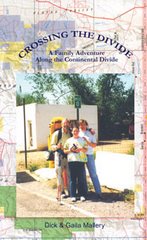
Read your post on the CDT List. Can you tell me a few things about the Great Divide Trail. I'm thinking of hiking it this year. Can I find stove alcohol along the way?


Here is my take on the GDT. It’s an incredible hike. I didn’t take any maps. I used Dustin’s book and it is all you need. You lose the trail occasionally and his GPS Coordinates will bring you back. Several times I had to bushwhack to get back to one of his points--no fun very thick tangles in some areas. The biggest problem is the clear cuts and that is where Dustin’s book is golden. Much of the Crown Land is heavily cut and log roaded. The people I talked to along the trail said it was because the Americans have such an appetite for their timber. A majority of the trail goes through protected areas.
The difference you will notice from the CDT is bigger water and more bears. I had two crossings I could not make at the trail proper--had to work up toward headwater to find a safe crossing-- and two Grizzly encounters. Fresh scat and mud prints are a very common sight. Let me give you a sure fire cure. I had a big male grizzly outside my Akto tent at Dutch Creek, which is Crown Land and heavily cut over.
No-see-ums were swarming about me en masse as I hung my food bag on the opposite side of the creek. On most nights I would sleep under my rain shelter only. With this horde of insects, I decided it would be wise to erect my tent inside the rain-fly if I wanted a good night’s sleep. I piled everything near the tent, threw it all inside, dove in myself and zipped the mesh door behind me.
It was fortunate that the bugs were menacing that evening, forcing me into the added protection of my fine-screened inner tent. I awoke suddenly in the early morning hours to a grunting sound outside my tent. With the fly open I had a clear view of a large male grizzly pacing back and forth, shaking his head and grunting as if he were irritated. Instead of grabbing my bear spray I grabbed my camera and completely opened the aperture in hopes of getting some pictures in the low light. I held it against the fine mesh tent wall and shot a roll of film. After exhausting the film I became concerned and started thinking about items that were still in my pack next to me in the tent vestibule. Fragrant things that should have been in the food bag, like baby wipes and toothpaste, were still in pack pockets and might be reason for this abrupt wake-up call. I decided it would be smart to subtly let the bear know I was in the tent, if he hadn’t figured it out already. I first cleared my throat. When that had no effect I coughed a couple times very loudly. The bear continued to pace and violently shake his head. What I did next could be better protection than bear spray. It worked so well I have had thoughts of sharing the procedure with the Forest Service. I took a deep breath and began to sing as loud as I could, "I’m in the mood for love. Simply because you’re near me. Funny but when you’re near me. I’m in the mood for love."
That bear went up the trail like a rocket leaving the Cape. He must have thought, "This guy not only smells bad, he’s horny." Never saw him again. The only other one I had to deal with personally was in the White Goat Wilderness. I do a lot of Robert Service poetry, especially "Bessie’s Boil" works as well if not better than my musical selections. I hiked in what the Canadians were calling "The Year of the Bear" so they may have stocked the area with more bruins for the celebration.
I use a zip ztove so know nothing about alcohol. I had no problem finding Crown Royal. In fact the last time I got a lot of heat (pun intended) from this list was when I said I used a zip ztove. Scathing posts about me using up endangered resources like ground litter--as if fueled stoves run on resources that have no impact.
I don’t want this to sound too much like my attitude on trespass, BUT--If you can stay on schedule from Waterton to Jasper your better packers than I. I told Dustin from the get-go that was impossible. He, of course, had to take the official stance that you pick your stops and stop at your picks but I think he realizes how impractical that is. I did the trail in 30 days, 21 of which were rain. I paid for my extended backcountry permit in Waterton (price has probably changed). I had to tell them every campsite I would use on each day. I did try hard to do that to keep myself on schedule. I had limited time. Unfortunately I never stayed in the right one once. Seldom found other hikers in any campsites (July 3rd to Aug 1st). Never found an occupied warden cabin.


Here are some high points (or maybe low points): Pages are from Dustin Lynx Book


1.I had problem at La Coulotte Peak, pg.24. Probably a stupid mistake on my part but I found it confusing. Ended up dropping into Castle River valley and walking through cold streams, game trails and logging roads to make it back to Castle Mtn. Ski Resort.
Mistake No. 2, pg. 76. was listening to a very nice fisherman who invited me to dinner. He said the last hiker he invited had been Chris Townsend. I would usually have gone but I was on a schedule. I hate that. Anyway he had seen a sow griz and two cubs near The Crown and told me I should go around. Once you leave Dustins trail info. you are on your own and its not fun. I ended up truly crawling through some thickets to get back on Dustins route past The Crown. Next time I would fight with a bear rather than listening to a generous fisherman.
Mistake No. 3 pg. 146 was trying to cross a small tributary at the very beginning of the David Thompson Heritage trail. The trail hasn’t been worked on since David went through. This is as close as I have ever come to getting seriously flushed into unforgiving water. I ended up finally going upstream just a ways and finding a very safe and easy crossing then dropping back down to the trail. More descriptive in the book.
When you reach the Howse River Delta pg. 160 just before The Crossing you will be better off staying on the main trail. Unless the water levels are down it would be painful to cross the many tribs to follow the Glacier Lake Trail. I tried several times because I’m not that smart. Follow the main trail all the way to Mistaya Canyon where you find a great foot bridge and it’s very scenic. The Saskatchewan River Crossing has restaurant, laundry, rooms. I can’t imagine they wouldn’t hold a package for you.
Overview: Good and well marked trail through parkland. Dustin’s book is very precise. I had few surprises. I can’t help you with food drops. Unlike most LDH’s I take my whole family with me when I go. Their job is to pick me up when I emerge and not spend too much money while I’m gone.
The Sunshine area was very distinctive. I never saw the lodge but the trail turned into a regular expressway through the ski area. I couple good shelters at Bryant Creek and Eygpt Lake. Bryant was empty but I didn’t stay there, Eygpt was packed to the gills and I did. Did I ever mention I hate shelters.
Leaving The Sas. River Crossing the trail becomes a compound angle. You follow a steep, rockysided streambed that climbs for several miles. The forest that border the stream is to thick to maneuver in. Slow going but well worth the price of admission once you reach the top. Then easy climbing.
Pinto Lake to Cataract Creek into the White Goat were confusing to me but I followed a tributary and finally hooked up again. If I had stayed on the main trail I think I would have found a junction but I got impatient and decided to play Daniel Boone again.
It’s is a wonderful trail. They call the Highway the Calendar Highway, the trail is much more magnificent.

--Keep Smilin’, Dick E. Bird

Monday, May 28, 2007

CDT--Glacier National Park Section


If you are a northbounder on the Continental Divide National Scenic Trail you last week on the trail will be spent in Glacier National Park. It will be 100+ miles of the most beautiful trail on the planet.

The breathtaking vistas of Glacier National Park draw visitors from all over the world.
This 1-million-acre national park preserves some of America’s most gorgeous country — including 106 miles of the Continental Divide — and the abundant wildlife that inhabits its wilderness.
Rochester, Minn. "We hiked to Avalanche Lake yesterday. I had my bear bells on, so I was protected."
Barnhart and her sister, Paula Muschinske of Great Falls, didn’t see any grizzly bears, but they were amazed by the wildlife that didn’t fear them.
"We had a deer pass us (within about 10 feet) on the trail," Barnhart said.
"And we’ve been watching the goats here," said Muschinske, standing on the Goat Lick Overlook along Highway 2 near Essex.
Each year, nearly 10 million out-of-state tourists make a pilgrimage to play in Montana.
Glacier and Yellowstone national parks attract more than 60 percent of summer visitors to the state — more than half of all Montana’s visitors each year, according to the National Parks Conservation Association.
It also found that tourism is estimated to account for 12 percent of Montana’s economic base.
Park visitors make up 75 percent of all expenditures by Montana’s summer visitors.
Summer visitors tend to stay in Montana longer if they visit a national park. Of more than 5.5 million summer visitors to Montana in 2001, 62 percent visited Glacier, Yellowstone or both parks, spending an average of five nights in Montana.
In Montana’s gateway communities, within roughly a 30-mile radius of a national park, visitors spend about $226 million a year, according to the report.
Roughly 1.6 million tourists pay to enter Glacier from June through September.
But it’s not just the out-of-staters. Many Montanans also flock to Glacier.
Glacier National Park has been revered by the Plains Indians for many generations.
Archeologists have found evidence of human activity in the Glacier Park area that dates back 10,000 years.
These early people may have been the ancestors of the Blackfeet, Salish and Kootenai Indians.
Meriwether Lewis came close to the southern tip of Glacier in 1806, checking how far north the Missouri River watershed extended.
White explorers kept searching for the perfect mountain pass through which to run a railroad line over the Rockies. Although many of the region’s Native Americans knew the location of Marias Pass, the Blackfeet guarded it closely.
In 1889, an explorer for the Great Northern Railway, John F. Stevens, finally figured out where Marias Pass lay. Marias was the lowest mountain pass between Canada and Mexico. Its low altitude and easy grade made it perfect for trains to cross the Continental Divide.
The mountains east of the Continental Divide were acquired from the Blackfeet in 1895 and designated a national wilderness forest preserve in 1900, opening it to mining.
President William Howard Taft signed the bill to establish Glacier as a national park in 1910.
"I know that we got robbed," said Blackfeet historian Curly Bear Wagner.
"But we’re thankful it is a national park because we have the migration of wildlife — the four-legged ones, the winged ones, and those that creep and crawl — they have a home," said Wagner.
Visitors to the park are equally grateful.
"This is incredibly beautiful," said Dana Smith of Salt Lake City. "Now I know why they call this the last best place."

Tuesday, May 22, 2007

Continental Divide National Scenic Trail--BLM


Continental Divide National Scenic Trail--BLM
The 3,100-mile long Continental Divide National Scenic Trail (CDNST) runs from Canada to Mexico through the states of Montana, Idaho, Wyoming, Colorado, and New Mexico. Crossing the spine of the North American continent numerous times, it traverses some of America’s most spectacular and isolated scenery, offering views unlike any other trail in the world.
In Wyoming, the trail passes through Yellowstone National Park; the Bridger/Teton, Shoshone, and Medicine Bow-Routt National Forests; and public lands managed by the Bureau of Land Management (BLM).
Allowable uses of the BLM-portion of the CDNST include hiking, mountain biking, horseback riding, and limited motor vehicle use. The BLM portion of the trail is 95% primitive two-track roads, 4% is improved roads, and 1% requires cross-country travel. Cross-country segments are closed to motorized vehicles.
Please Tread Lightly on public and private lands and Leave No Trace.

Continental Divide National Scenic Trail--Rocky Mountain National Park Route


The following is a little history lesson in the politics of Rocky Mountain National Park, Elk and the Continental Divide National Scenic Trail. When I hiked the CDT in 1999 I was told not to follow the Divide because it would interrupt Elk calving. Now their shooting the beasts with guns equipped with silencers and night-vision scopes. The route the park service is suggesting is a beautiful loop through the park. Okay, that’s nice, but by the time you reach the park you have been through mega spectacular heights already, why not stay on route? The marked route in 1999 was still leaving Grand Lake, hiking about twenty minutes up the Great Kickalatapoo Trail (Tanahutu trail), the trail used by horse riding stables in Grand Lake to take short rides into the park, and exiting the park at Kawuneeche visitor center. A better option would be this:
tanahutu trail
to the Onahu Creek Trail
to Timber Lake Trail
to the Colorado River Trailhead
From there you can take a couple options back south to Bowen Lake.


HISTORY:
On November 10,1978, the President signed the "National Parks and Recreation Act" amending the "National Trails Act of 1968." The amended legislation addressed the proposed Continental Divide National Scenic Trail (CDNST). Congress directed the Forest Service to prepare and submit a comprehensive plan for the management and use of the scenic trail. This plan was completed in cooperation with other federal agencies, the public and interested private landowners in November 1985. The plan was adopted after public comment.
The entire Continental Divide National Scenic Trail corridor is approximately 3,100 miles long, extending from the Canadian border in Montana to the border of Mexico in New Mexico. About 1,900 miles of the corridor contains existing trails or primitive routes. Considerable trip planning will be necessary to determine your specific route. The corridor varies from 4,000 feet to over 13,000 feet elevation above sea level. Existing and proposed trails along the route traverse a variety of privately and publicly owned lands. The variety of situations encountered in the 3,100-mile corridor necessitate different land use and travel regulations and conditions.
The CDNST Through Rocky Mountain National Park
In 1997 the route through Rocky Mountain National Park was adjusted and now consists of approximately 30 miles of spectacular scenery. In the park, the Continental Divide National Scenic Trail route does not entirely travel the actual Divide, however the most breathtaking section is above treeline, consisting of high peaks and fragile alpine tundra. Travel is through the montane and sub-alpine life systems at elevations of 8,000 to 11,500 feet.
In north to south direction, the route enters the park on County Road 491. It then follows the River Trail north until it intersects with Trail Ridge Road (Highway 34) Near Green Mountain Trailhead. At this point the route follows the Green Mountain Trail east to the Tonahutu Creek Trail where it heads north and east to the junction of the North Inlet Trail. Here the route touches the actual continental divide at an elevation of 12,324. The North Inlet Trail is followed south and west to the town of Grand Lake. Once through Grand Lake, the route heads south along the East Shore Trail and exits the park at the south boundary. The route is entirely along existing, well-maintained trails.
Should you decide to travel the Continental Divide National Scenic Trail through the park for a few hours or several days, here are a few considerations: The air is thin at these high altitudes between 10,500 feet and 13,000 feet. Travel is slow and strenuous. Lightning danger accompanies early afternoon thunderstorms. Travel above treeline should be accomplished early in the day. Winter lasts about nine months on the Divide, from September through May. Arctic conditions prevail making travel extremely hazardous, if not impossible, during this season. Always practice Leave No Trace hiking and camping skills.
Camping Permits:
A backcountry permit is required in Rocky Mountain National Park for any overnight trips. The permits can be obtained by writing to Rocky Mountain National Park, Backcountry Office, Estes Park, Colorado 80517-8397 or call 970.586.1242.
The elk whose mating rituals draw thousands of visitors to Rocky Mountain National Park each fall are in the cross hairs — literally — because there are too many of them.
The problem is the elk have altered the park’s ecosystem by eating aspens and willows into near oblivion, wiping out habitat for beavers and birds. They also amble through the yards and gardens of homes outside the park, increasing chances for conflicts with people.
But the park’s recommended solution — using sharpshooters to cull the herd at night.
"I think everyone agrees there’s a problem," said John Baudek, mayor of Estes Park, the park’s eastern gateway.
Park officials recommended that the shooting be done at night with guns equipped with silencers and night-vision scopes to keep the culling out of public view. The program’s cost was estimated at $18 million, although Patterson said it likely will be lower in the final document. The cost includes research, monitoring and fencing to protect vegetation from overgrazing.
Other alternatives in the plan include elk birth control and releasing a limited number of wolves in the park. Biologist Johnson said the wolves’ biggest benefit would be keeping the elk on the run so they wouldn’t graze too much in one spot.
More than 100 years ago, there were no elk in the park. They were eliminated late in the 19th century by unregulated hunting.
An Estes Park civic club rallied a couple years before the park was created in 1915 to restore elk to the area by relocating them from other areas. With wolves wiped out by hunting and government extermination, elk flourished. The park controlled the size of the herd by moving some elk to other areas and culling by federal and state wildlife officers.
The herd started expanding in the late 1960s when National Park Service philosophy began relying on natural processes — predators, weather, hunting outside parks — to manage wildlife.
Environmentalists see the restoration of wolves to the area as the best answer and one that has worked in Yellowstone National Park.
Yellowstone’s elk herd grew largely unchecked in part because of the loss of most predators. That changed when wolves were released there in 1995.
"The Park Service has a mandate to restore and protect natural ecological processes," said Rob Edward of Sinapu, a Boulder-based group that advocates restoration of wolves in the southern Rockies.
Edward said his group will sue if the National Park Service decides against using wolves to manage the elk.
The Colorado Division of Wildlife has its own preference: using licensed hunters rather than federal employees or contractors to shoot the elk. State officials say hunters would do it for free and use the meat.
"What a horrible waste of the resource and a waste of the taxpayers’ money," Rick Enstrom, a former state wildlife commissioner, said of the plan to hire sharpshooters.
The idea has also gained bipartisan support in Congress. Rep. Mark Udall, D-Colo., Sen. Wayne Allard, R-Colo., and Sen. Byron Dorgan, D-N.D., have sponsored bills authorizing the two parks in their states to allow hunters to thin elk herds.
Johnson said Rocky Mountain National Park drafted its elk-reduction plan after years of study, public meetings and consulting with other states and Canadian agencies.
What seems like an obvious solution — ship excess elk to areas that want them — won’t work, Johnson said.
The herd has a low level of chronic wasting disease, a brain-wasting ailment in deer and elk that’s in the same family as mad cow disease.
State and federal laws prevent the transfer of elk for that reason. There is no economical live test for the disease. Deer and elk are tested after they’re dead.
The disease also complicates what the park can do with elk that are shot. Patterson said people have urged the park to give the meat to food banks and shelters, but federal law requires that each individual who gets the meat give consent.
"We would like to see as much of the meat used as possible," Patterson said.
cdt, Continental Divide National Scenic Trail News Blog

Monday, May 21, 2007

National Trail Days June 2nd


June 2 is the 15th annual National Trails Day, a day created by the National Hiking Society.
The hiking group bills it as the largest annual single-day trails and outdoor celebration in the country.
Nationwide hundreds of thousands of people are expected to go outdoors and participate in one of more than 1,000 events.
The Continental Divide Trail Alliance celebrates on May 31, the latest donation of private land easements from Anadarko Petroleum Corporation for the Continental Divide Trail.
That ceremony is in Rawlins, Wyo., but the trail passes just west of Great Falls, MT — it’s on the Divide — and you can go there and hike any time. The Anadarko easements go a long way toward completing the 3,100-mile trail.
National Trails Day helps individuals, communities and the environment.
Individuals benefit because the day promotes hiking’s health benefits.
Hiking gets your heart pumping, lungs expanding and muscles working. It relieves stress and hastens weight loss, it controls high blood pressure and helps prevent heart disease and diabetes. It is good for your joints.
National Trails Day fosters community-building. It brings together people from all ages and backgrounds, from toddlers to seasoned hikers who have logged thousands of miles.
It also provides local governments and trail clubs with volunteer sweat equity hours to restore and maintain trails. Last year volunteers spent more than 135,000 hours establishing, maintaining and cleaning-up nearly 1,700 miles of trail — labor worth an estimated $2.5 million.
National Trails Day raises public awareness about the environmental benefits of trails, which serve as conservation corridors, help protect plants and wildlife, and are classrooms for nature study. You really do connect with nature on a trail.

Saturday, May 19, 2007

Continental Divide National Scenic Trail--Wind River


The 90-mile long Wind River Mountain range form the Continental Divide of the Rocky Mountains in western Wyoming. These rugged and scenic mountains contain four wilderness areas and over 2,900 lakes and ponds. Wyoming’s highest mountain, Gannett Peak, is in this mountain range. Favorite destinations include Gannett Peak, Cirque of the Towers, Green River Lakes, Square Top Mountain and Photographer’s Point.
The crest of the Continental Divide is composed of towering mountains from 12,000-13,000 feet high, with over 35 named peaks over 13,000 feet that attract climbers and backpackers from around the world. The Continental Divide National Scenic Trail traverses the Wind River Mountains.
These mountains are home to grizzly and black bear, elk, moose, deer, wolves and many other wildlife species. This is the headwaters for the Snake, Missouri and Colorado River drainages.
The high Wind River Mountains typically don’t free up from snow until around mid-July. "Summer" in the high country is about 3 months long, usually lasting until mid-September before snows return. That being said, it can snow ANY day of the year in the mountains given the right weather conditions.
Four designated wilderness areas are located within the Wind River Mountains. Three are managed by the U.S. Forest Service from two National Forests, the fourth is managed by the Shoshone and Arapho Tribes from the Wind River Indian Reservation.
All users should be aware that in the wilderness setting, help can sometimes be days away should misfortune or emergencies arise. Cell phones often do not have reception in many remote areas, so visitors should come prepared to take care of medical emergencies and subsist without help for days.
Be sure to bring good maps, compass and research the area you plan to visit so you are aware of what you can expect to encounter when there. Be alert for signs of hypothermia and altitude sickness.
Wind River Range Wilderness Areas: Bridger Wilderness ( Bridger-Teton National Forest)Popo Agie Wilderness ( Shoshone National Forest) Fitzpatrick Wilderness ( Shoshone National Forest)
Wind River Roadless Area ( Wind River Indian Reservation)
Continental Divide National Scenic Trail
Approximately 80 miles of the Continental Divide National Scenic Trail (CDT) runs through Wyoming. This scenic trail goes from Mexico to Canada. In Wyoming, it goes from the Sierra Madre mountains to the western edge of Yellowstone National Park along the Continental Divide. The trail passes through the Big Sandy Opening in the southern part of the Winds to Green River Lakes on the northern end of the range. The trail is marked with CDT signs, wooden signs, tree blazes or rock cairns. In some places, the trail is obscure, so it is helpful to have good maps and a compass with you. This is a very scenic segment of the CDT, making this hike a memorable one that will last a lifetime.
Livestock Grazing
Livestock grazing is permitted in certain special allotments of the Wind River Range and in wilderness areas. Sheep graze the southern end of the Bridger Wilderness from July to September. Herding practices are designed to minimize contact with recreationists. Brief encounters may occur in meadows from Cooks Lake south to the Sweetwater River. Cattle graze in the Upper Green River area and some of the western fringes of the Bridger Wilderness. Animals come off these allotments in the fall, usually before hunting season starts or when cold temperatures cause them to drift down out of the mountains. Backcountry users might encounter domestic sheep and cattle in certain areas during the summer, as well as occasional cowboys on horses or sheepherders managing the herds.

CDT, Continental Divide National Scenic Trail News--Wilderness Act

Continental Divide Trail540 miles of established Continental Divide National Scenic Trail pass through these 20 wilderness areas — Great Bear, Bob Marshall, Scapegoat, Anaconda-Pintler, Teton-Bridger, Huston Park, Mount Zirkel, Indian Peaks, James Peak, Vazquez Peak, Holy Cross, Mount Massive, La Garita, Weminuche, South San Juan, Chama River Canyon, San Pedro Parks, Aldo Leopold, Gila — all managed by the USDA-Forest Service. Another 660 miles of the Trail is projected to pass through wilderness areas.
During the 1960s a foresighted Congress created a splendid array of important Federal programs to preserve lands and waters of the United States. These include the National Trails System Act (1968), Wild and Scenic Rivers Act (1968), establishment of the Land & Water Conservation Fund (1964) and the Wilderness Act (1964). The bold systems of resource preservation authorized by the Congress in the 1960s invigorated many grassroots conservation projects throughout the United States and changed the way we understand and appreciate key components of America’s landscape. As we know very well, the National Trails System is still a "work in progress." So are the Wild Rivers and Wilderness Systems of the United States.The year2004 marked the 40th Anniversary of America’s Wilderness System. On September 3, 1964 President Lyndon Johnson signed the Wilderness Act passed by Congress that established the National Wilderness Preservation System by designating 54 wilderness areas covering 9.1 million acres in 13 states. Today the Wilderness Preservation System includes 662 areas covering about 105.7 million acres in 44 states — about 4.67% of the land in the United States. The National Park Service manages 43.6 million acres of wilderness in national parks, the Forest Service manages 406 federal wilderness areas comprising about 34.8 million acres, and the Bureau of Land Management manages 6.5 million acres of wilderness."More than half, or 57.5 million acres, of all designated wilderness is in the huge national parks, wildlife refuges, and forests of Alaska; more than one-third is in the 11 western-most contiguous 48 states. Less than 5% lies east of the 100th meridian, and almost half of that is in just two areas — Everglades National Park in Florida and the Boundary Waters Canoe Area in Minnesota. The nation’s largest wilderness area covers nine million acres in Wrangell-St. Elias National Park in Alaska. The smallest wilderness area, comprising just five acres, is at Pelican Island National Wildlife Refuge, located in the broad lagoon of the Indian River on the eastern coast of Florida."Components of the National Trails System pass through at least 92 wilderness areas. At least 1700 miles of five of the national scenic trails and 114 miles of five national historic trails are located in or along the boundary of wilderness areas. Another 660 miles of yet to be completed trail are projected to cross wilderness areas.

Thursday, May 17, 2007

Continental Divide National Scenic Trail--Anaconda-Pintler


Leaving the Big Hole Battlefield I hiked north into a much anticipated trek through the Anaconda-Pintler Wilderness area. This is big country with a lot of elevation. High mileage days in this area involves climbing as much as 5,000 feet in elevation each day and that is just the upstroke. By this time in the hike my body responded very well to the task of crossing this demanding terrain.
This Wilderness, which straddles the Continental Divide in the Anaconda Range, has it all in terms of mountain grandeur, whether that entails high and rugged peaks, cirques, U-shaped valleys, or glacial moraines. Sparkling lakes and tumbling streams, fed by the icy water running off the snowfields above the timberline, enhance the beauty. Snow-free seasons are short. Precipitation, mostly in the form of snow, is heavy compared to the nearby valleys. The cold lakes I now drink from were frozen just a month ago and will be again in a month’s time. Snowstorms can occur at any time during the year, including July and August.
This section of the 3,200-mile Continental Divide National Scenic Trail (here called the Hi-Line Trail) traverses the length of the Wilderness and provides access to many of the most remote and rewarding spots.
Late in the afternoon I would stop to prepare my big meal for the day. I always eat near a lake or stream where I have access to water for cooking and cleaning my gear. In the Anaconda-Pintler complex, these areas are always calendar quality settings. I would be tempted each afternoon to set up camp early and stay in one of these picturesque spots, but finishing the trail before fall snows could stop me, demanded I continue on until dark each day.
As I sat along the trail one afternoon having a snack, Andy came around the bend in the trail. I had not seen him since Colorado nearly two months earlier. We did a lot of catching up and walked together, on and off, for the next couple days. My daily mileage destinations through this awesome wilderness area were passes. I would target a pass in the morning and it would be my goal to reach that pass before nightfall. Many experienced hikers will recommend that you hike high and sleep low. I am not part of that belief system. I like to sleep high. I prefer to sleep in the lofty, often windy, high country. Lower elevation often means more condensation in my tent and never the incredible aerial views offered from a towering tent site.
My second night I climbed until after dark. I had a full moon and good trail. The trail advanced at a gradual incline for the first few miles. As darkness fell I was making good time. I continued hiking after dark because as I neared the base of the peak, the slope became very steep and I could not find a flat area to set camp. Hiking after sunset, even with a full moon, is not the smartest decision to make in the back country. I had stopped many nights along the trail at dusk and set up my bivy tent in the middle of the trail because it was the only clear spot I could find. But that was not a choice in this case. I was near the top of Cutaway Pass and the terrain was steep for maintaining footing—sleeping was not an option.
When I reached the narrow pass above the Queener Basin I searched around with my flashlight for a flat spot to park my tent. I found a little nook in the rocks and slept beneath a moon that lit the landscape in shadowed relief. I was up and moving with first light. I did not realize until the next morning that Andy was camped just down the trail a few hundred yards. He was breaking camp in the morning as I passed and we continued on together that day to Rainbow Mountain. Andy was also trail hardened. He could eat up mountain trail as if it were flat path. We stopped at a junction to Storm and Seymour Lake. We had a snack and said our good-byes. I knew this would be our last reunion on the trail. Andy was taking the Anaconda-Cutoff which takes the trail northwest to the town of Anaconda where he planned for his next resupply. The cutoff would save him over a hundred miles. I was continuing to follow the Divide southeasterly which would take me down and around Butte, Montana. This decision would cost me a week of hiking but I wanted to stay with the Divide even though I knew it would mean a lot of forest road walking through populated areas.
From the open highlands I could see below me Upper Seymour Lake. It was a rugged mountain lake lit like a jewel by the afternoon sun. I marched down the trail into a wooded valley that held the lake and then followed a creek that helped it spill into the Big Hole.

Tuesday, May 15, 2007

CDT, Continental Divide National Scenic Trail News--General Info

In 1978, Congress made a monumental decision, one that secured the future of the most scenic, wild and remote landscapes in America. They designated the Continental Divide National Scenic Trail (CDT), also known as the "King of Trails". Congress recognized the unique scenic quality and cultural characteristics of this remarkable environment and identified a 100-mile-wide corridor straddling the Divide for the future placement of the Continental Divide Trail.The Continental Divide Trail climbs and descends the peaks of the Rocky Mountains from Canada to Mexico, traversing mountainside meadows, granite peaks and high-desert saddles. Through five states, 25 National Forests, 20 Wilderness areas, 3 National Parks, 1 National Monument and 8 Bureau of Land Management Resource areas- the CDT travels 3,100 miles through America’s most dramatic and wild backcountry."
—Continental Divide Trail Alliance
One of the unique challenges of the CDT is that it is only 70% complete. While the vision for the CDT is to be a 3,100 wilderness path, it will be years before the trail is fully completed and protected. This makes our adventure even more interesting as we will be creating our own route in many places by route-finding, bush-whacking, and road-walking. This may cause our total mileages to vary as much as 300 miles, but we will always maintain the goal of connecting our footprints from Mexico to Canada- no matter which path we take.Another unique challenge of the CDT is the seasonal window. There is a very limited time period with which we can hike, based on regional climate and snow pack in the mountain ranges. The seasonal window is perhaps shorter with this trail than any of the other long-distance trails in the United States, and the mileages are greater.

CDT, Continental Divide National Scenic Trail News--NM Bootheel Post on CDT List


I can see I'm taking a lot of heat on this list. I don't mind the Troll definition, BUT Ignorant. Come on Mr. Ward! First of all you have absolutely no say in this matter. For a year prior to heading out on this hike in the spring of 1999, I left voice mail, email and snail mail for you and your organization with questions about routing-- especially the bootheel. I never heard a word from you. I know you have my address because you now send pleas for money several times a year. So don't waltz in here several years later, all "High and Mighty" critiquing my route through New Mexico. You did get me laughing with your stretch that long-distance hikers cannot cross the bootheel because they have a tendency to be vandals and pyromaniacs. I think you might have spent too much time in the sun with Mr. Brown. You say, "This is a ranch dedicated to experimenting with ways to allow cattle in arid country without harming the environment." As Dr. Phil would say, "How's that working out for ya?" Arguing that cattle roaming the Western states form one of the most destructive uses of the country’s natural resources is not the point I am arguing today.
You say, "It does encompass some public land. But unlike hikers, it pays rent on that land." I don't want to say the word ignorant again because I find that very offensive. But I would like you and your organization to try this: Call the BLM and show your interest in leasing all the BLM land along the CDT. It is currently $1.43 "per animal unit month." Tell them you will pay twice that "per hiker unit month." I will then personally help you raise a few grand every year to fully fund those leases. I won't wait by the phone because you aren't going to get any of that rancher welfare.
"BLM leased lands are open for use to the general public the same as non-leased BLM lands. BLM permit holders cannot charge the general public for access to, or for use of BLM leased lands. There are BLM recreational permitees who charge their clients for their services, however, they are not allowed to charge the general public for use of those same BLM public lands they use for their services"
"BLM lands are often fragmented, and access to them can be difficult. There is often times no legal access to isolated public lands located beyond private land boundaries. Legal access across private land only exists if the road you are traveling on is a state or federal highway, county road or a BLM or Forest Service access road. All other roads should be considered private and to travel on such roads would require permission from the private land owner."
If you were to breakdown the bootheel into land jurisdictions you would find a legal path across the gray ranch.
Gray Ranch issue aside--If you take a 1999 New Mexico DeLorme Topo you can follow my route north of Hwy. 9 by following the Divide. 90% of that map area indicates BLM or State land to Silver City. A State cop happened by while I was crossing just east of Antelope. He swung around to check me out. We talked about the Gray Ranch and I said, "Who owns the land north of here?" He said, "Land out here changes hands faster than money in a crap game. You won't have any problem hiking across this area except it is the crossroads for Southwestern Drug Traffic and full of rattlesnakes this time of year." I never saw a drug dealer of a rattlesnake.
I did have to cut through a copper mine just south of Silver City. I had no idea it was there or I would have gone around it. I bet Mr. Ward knows all about it and has even hiked it with the manager, but I never heard from him so I was just blindly finding my own way. I'm blind in my right eye but I think I am fully qualified to now write a CDT guide (braille edition).
A short note to Mr. Herberg: If you are leasing your backyard from the BLM you can look for me to cross anytime. Your backyard belongs to me brother. (See Above BLM rules) If I want water I will pay you for it--unless of course I find out that your windmill was developed with US tax dollars as so many of them are. I was never in the Special Forces, but crossing the bootheel did remind me of my time in the Marines. I wasn't sneaking across the ranch because I thought it was illegal. That is your take on my story. I just didn't want to ask Dr. Brown for a deed when he tried to toss me off. I was just trying to get my 25 miles a day in without a lot of hassle.
I don't want to stir up another bees nest BUT--I also hiked straight across the Great Basin. The Red Desert is mostly BLM land leased by the big energy companies (you know, unlike hikers, they pay rent on that land). Does that again make me "disrespectful and pathetically ignorant?" If so let's all kiss the Upper Green River Valley good-bye too.
Last but not least: Please post the Official Mr. Ward and Mr. Herberg route through New Mexico. 12 million acres of New Mexico are under BLM jurisdiction. I am more than curious how you cross without a severe case of jaundice breaking out. I never experienced the prejudice to hikers you so worry about. Every rancher I encountered was more than congenial. I respect their property and their life-style. If they respect my right to cross government land I’m a happy camper and we have no problem. If not--get the deeds out boys!
I was going to ask this list about a route across Arizona--but on second thought I think I will just use the braille method again. --Keep Smilin', Dick E. Bird, a.k.a. Pathetically Ignorant Troll

CDT, Continental Divide National Scenic Trail News--General Route Description


The Continental Divide Trail provides spectacular backcountry travel the length of the Rocky Mountains from Mexico to Canada. It is the most rugged long-distance National Scenic Trail.
Trail users wind their way through some of the most spectacular scenery in the United States and have an opportunity to enjoy a greater diversity of physical and natural qualities than found on any other extended trail. The route of the Continental Divide Trail crosses five ecological life zones, and users can take in the topography, climate, vegetation and wildlife of the Rocky Mountain West. The trail travels from Canada to Mexico, through five western states—Montana, Idaho, Wyoming, Colorado and New Mexico.
The trail’s southern node is the Mexican border near Antelope Wells, New Mexico. The trail shoots north through the desert into the Gila National Forest and the Aldo Leopold Wilderness. It then crosses the El Malpais National Monument, picking up the 1,000-year-old Zuni-Acoma trade route. Before reaching Colorado, the trail travels through the Cibola National Forest and the Carson and Santa Fe National Forests.
Entering Colorado from the south, the Trail passes through remote, rugged alpine terrain like the South San Juan, Weminuche and La Garita Wilderness Areas. There are several crossings of the Continental Divide and the Colorado Trail — for over 100 miles, the routes of the CT and the Continental Divide Trail are contiguous.
The trail is almost entirely on national forest land, including San Juan, Rio Grande, San Isabel, Gunnison, White River, Pike, Arapaho, Medicine Bow-Routt. A chunk of the trail passes through Rocky Mountain National Park and the Mt. Zirkel Wilderness.
The trail ventures into Wyoming at Routt National Forest. It then crosses BLM land before reaching the Bridger-Teton National Forest, and the Popo Agie and Fitzpatrick wildernesses. From there it’s on to Yellowstone National Park.
The trail crosses into Idaho at the Targhee National Forest. It stays close to the Montana border, and after it finally jumps the line, users get to explore the Salmon National Forest, Anaconda-Pintler Wilderness, Helena National Forest. The trail transverses the Scapegoat, Bob Marshall and Great Bear Wilderness. Finally, after passing through Glacier National Park, the trail ends at the Canadian border.

CDT, Continental Divide National Scenic Trail News--Tierra Amarilla, Rio Arriba County


by Frank Clifford, LA Times
Caught in a thicket of ancient enmities, the Continental Divide National Scenic Trail stops in northern New Mexicos Piedra Lumbre basin - a river valley of silvery cottonwood, yellow tipped sage and deceptive serenity.
Once completed, the trail will be the longest transcontinental trek in the U.S. The tranquil beauty of the Piedra Lumbre, flanked by the burnt umber battlements of the Canjilon Mountains would make for one of the most scenic passages along the 3,200 mile route.
But the people who inhabit this valley do not want a trail threading through land they have clung to jealously since Philip III of Spain left their ancestors here to deal with harsh winters, hostile Indians and a succession of Yankee profiteers.
Northern New Mexico is crisscrossed with trails, its destiny is bound up with them. The Camino Real from Mexico brought Juan de Onate, the explorer who escorted the first settlers in 1598.
In the early 1820s, the Santa Fe Trail brought fur trappers who wiped out the beaver, pocketed the profits and awakened the young nation to the rewards of westerly expansion. In 1846, Col. Stephen Watts Kearny and his Army of the West marched down the Sana Fe Trail to stake America’s claim to all of New Mexico.
The Continental Divide Trail is the most challenging of 19 national scenic and historic trails that follow the footsteps of famous explorers. All together, the trails extend across more than 30,000 miles and attract millions of visitors, but they are not always a hit with the people who live along the way.
"Whatever it takes, we are going to stop it from coming through our community," said Moises Morales, a Rio Arriba County Commissioner who sees the coming of the Continental Divide Trail as yet another chapter in a bitter saga of trespass and usurpation.
In northern New Mexico, today, many people tend to regard a stranger with a backpack not a whole lot differently from the buckskin adventurer of old. The modern explorer covets the scenery the way the frontiersmen lusted after beaver hides, turquoise and timber. The result is often similar. A resource is exploited. An outsider benefits.
For more than 30 years, Morales has been a leader in an occasionally violent struggle to regain control of millions of acres of ancestral lands. Much of it was lost to speculators who made their way down the Santa Fe Trail in the years following the war with Mexico.
In recent times, Morales and other land rights activists have clashed with promoters of ski resorts, second home developments and conservation groups who want to ban livestock from pastures that were once part of a vast commons where sheep and cattle were free to roam.
As Morales sees it, a well-publicized national scenic trail is a vector for alien values—in particular, rural gentrification and environmentalism.
"Who’s got time to walk a Continental Divide Trail? Just rich people and tree huggers," he asked. "First thing you know, they are complaining about our cows, or trying to buy up our land."
Moreover, he said, the trail would funnel a steady stream of unwanted tourists past secluded communities, mountain meadows and moradas—the mud sided houses of worship used by the Penitentes, the secretive order of Catholic men established after the Catholic Church all but abandoned these villages in the 18th century.
"We are not interested in satisfying a tourist’s curiosity," Morales said. "Our villages are not stage sets."
Northern New Mexico is an impoverished stronghold of ethnic traditions unique in America. Yet, the people here are not alone in their resistance to a new west where recreation and real estate fuel an economy once powered by chain saws, drill rigs, dynamite and men on horseback.
Two-thirds complete, the divide trail is a potent symbol of the changing scene. It is also a testament to Americas enduring appetite for the spiritual and material rewards of high adventure.
Like the westward trails that preceded it, this one has the backing of businesses, including about 25 outdoor equipment companies, who believe the market for mountain recreation could easily rival the fads for animal furs and mineral wealth that lured the first trail blazers across the divide.
Twenty years in the making, the trail, which will lead from Canada to Mexico, was conceived as a wilder, longer and more daunting version of the Appalachian Trail.
The Divide Trail goes through five states, three national parks, a dozen wilderness areas, and 20 national forests. It passes ghost towns, battlefields and forts and skirts the summits of 14,000-foot mountains.
Tracing the crest of the Rockies, the Continental Divide marks the parting of Americas western watershed. Moisture spilling off the west flank of the range flows to the Pacific Ocean. From the east side of the range water flows to the Atlantic.
But the country along the divide is also riven by social and ethnic tensions that have set people against each other ever since a member of the Lewis and Clark expedition killed a Blackfeet Indian near the Continental Divide in northern Montana in 1806.
Today, as the architects of the trail attempt to negotiate rights of way across old land grants, grazing allotments, mining claims, oil fields, Indian reservations, ranches and new subdivisions, the project has become a sounding board for a larger debate over who controls the area’s magnificent natural resources.
At stake are water and property rights, native sovereignty, the future of open space and wild animals, the survival of cowboy culture and the ability of places like Rio Arriba County to preserve their identity against an onslaught of new people and new money.
Driving the debate is a fear of rural diaspora in a region that has been undergoing the most intense urbanization in the country for the past decade.
The trail has gotten snagged in the underbrush of regional politics, despite our efforts to avoid controversy, said Bruce Ward, who with his wife, Paula, heads the Continental Divide Trail Alliance, one of two organizations promoting the trail.
Road blocks have gone up in Colorado, Wyoming and southern New Mexico. But most of the obstacles are small compared with the cultural minefield that must be negotiated in Rio Arriba County.
The specter of dispossession has hung heavy here since the Treaty of Guadalupe Hidalgo which ended the war with Mexico in 1848.
The treaty annexed much of the Southwest to the new American empire, but it also assured the people of Hispanic descent who were already living there that the land grants made to them by Spain and Mexico would be honored by the U.S. Government.
In the years following the treaty, however, Congress and the courts, perplexed by vague boundary descriptions and overlapping claims, balked at validating many of the land grants. The hesitation left many of the old claims in limbo. Cash poor Hispanic settlers, who neither understood English or the American legal system, became easy prey for speculators and their allies in a predatory frontier judicial system.
In Rio Arriba County, nearly 60% of native land claims were invalidated.
Eventually, more than two million acres of the disputed land wound up in the hands of the federal government and now makes up a big portion of the two national forests in Rio Arriba County. That acreage, which encompasses virtually the entire route of the Continental Divide Trail through northern New Mexico, is a principal target of land grant activists.
The struggle to reclaim these lands began in the 1880s when a group of hooded night riders, Las Gorras Blancas (the white hats) protested the loss of ancestral land by cutting fences, burning haystacks, barns and houses.
Today, the unofficial headquarters of the land rights movement is the MM Auto Repair shop beside U.S. Highway 84 outside Tierra Amarilla in northern Rio Arriba County.
MM stands for Moises Morales.
"These lands are going to be given back to us," Morales insists, "and we’re going to get damages. The government has made millions of dollars off the forests though timber contracts and oil and gas royalties, and they have given us crumbs."
Morales was part of an armed insurrection on behalf of the cause.
A mural on the wall of his auto repair shop tells the story. Painted by local highschool students, it commemorates the day 32 years ago when Morales and 19 other members of the Alianza Federal de Mercedes—loosely translated, the federal alliance of land grant heirs—waged a brief but bloody gun battle with sheriffs officers on the steps of the county courthouse.
The Alianza had gone to the courthouse to confront a district attorney who had been breaking up the group’s meetings and arresting its leaders.
Morales turned himself in after the shoot-out and eventually served time in jail.
But he did not give up right away. For several days, he hid out in the mountains, eluding troops and tanks of the New Mexico National Guard, called in by the governor as part of the largest man-hunt in the state’s history.
Morales escaped by following logging roads and stock trails that now make up a portion of the proposed route of the Continental Divide Trail.
He said he spent two rainy nights along the route, sleeping under trees, before braving 10 miles of open country across the Piedra Lumbre to a safe house owned by a farmer, Ubaldo Velasquez, who was an Alianza sympathizer.
Velasquez still lives in the same house and at 80 years old still believes that the lands of the Piedre Lumbra should be given back to the heirs of the land grantees. He claims to be one of them.
From an old brown chiffonier, he produced a raft of documents, copies of grants and surveys and genealogies reinforcing his assertion that his family was among the original recipients of the land grant when it was made by the Spanish territorial governor in 1766.
Although the courts have rebuffed him countless times, he continues to petition, hoping he will live long enough to find a sympathetic judge.
Meanwhile, a developer has acquired several hundred acres of the Piedra Lumbre. The land has been subdivided and fenced, blocking the old cattle trail that Velasquez and his neighbors used to lead their small herds to summer pastures.
"I got rid of my cattle," Velasquez said bitterly. "It was going to be too expensive to trailer them over there, which is what we have to do now."
No homes have been built yet in the new subdivision, and Velasquez still takes pleasure in looking out over the unblemished landscape.
To get the best view, he maneuvers his old pick-up truck up a dirt track to a knoll above his house. Back lit by a flaming sunset, the terraced uplands of the Piedra Lumbre glow green and orange like the gaudy layers of a child’s birthday cake.
The painter, Georgia O’Keeffe, who lived in this valley and immortalized the landscape, called it a "wonderful emptiness."
Velasquez pointed to a spot in the foreground where two rivers, the Rio Puerco and the Rio Chama, converge. "There. That’s where they are going to build. People from California, Texas, New York, all over."
"They are building on our land."

Wednesday, May 9, 2007

CDT, Continental Divide National Scenic Trail--Woolrich Inc. Sponsorship

Woolrich Inc. is teaming up with the Continental Divide Trail Alliance to help complete the “King of Trails.” The Continental Divide Trail is a 3,100-mile-long national scenic trail that extends from Canada to Mexico, along the backbone of America. The trail links many nationally significant natural, cultural and historical wonders.“Thanks to the generous support of sponsors like Woolrich, the CDTA has been able to expand our volunteer programs,” said alliance chairwoman Rebecca Watson. “This year we will put more than 1,000 volunteers on the ground to build, repair and maintain portions of the trail.”For more than 175 years, Woolrich has produced quality clothing for hardworking, everyday Americans, as well as for extreme adventurers on expeditions to the Himalayas and Antarctica. Through a conservation initiative, the company supports organizations that encourage outdoor recreation and that protect and enhance the environment.“True to the heritage and nature of Woolrich, we continue our dedication to the support of outdoor adventure,” said Tim Joseph, company director of marketing and media. “We are a proud supporter of the organization dedicated to the completion of this national treasure — the Continental Divide Trail.”

Crossing The Divide--Back Light and Eat Right

Trying to eat right and pack light while backpacking can be challenging. On extended long distant hikes, as when I hiked the CDT and the GDT, menu selection takes on a new dimension—variety. Everyone develops their own personal meal choices and often it takes many trial trail concoctions to settle into a nutritious and desirable assortment of food items that keep you going and make you happy.
My first meals were not my last. I tried many ideas before I settled into a normal routine of meals that seemed to work for me. Let me first discuss some of my mistakes. Long-distance hiker Ray Jardine’s suggested in one of his books that corn pasta packed a punch and he would even eat it cold on the trail. I bought a case of the stuff. I learned quickly that I hate corn pasta, I would not only refuse to eat it cold I wouldn’t eat it hot or sprinkled on top of a New York strip. I couldn’t even get my squirrels to eat the stuff.
After meeting Laura and Leslie on the trail I learned that they would eat mostly couscous . It’s not that I dislike pasta I just didn’t care for it the size of buckshot. Andy ate a lot of black beans. These are all great choices if they appeal to you, but I’m a meat and potato Irishman. I’m a vegetarian in a way. Cows eat grass, and I eat cows.
No I didn’t carry T-bones in my back. The only meat I carried consisted of ham or beef sandwiches the first day back on the trail after a town stop and one freeze-dried meal a week, usually sweet and sour pork.
Everything get old after awhile. I love Ritz-Bits, put after a month of them they lose some appeal. When I first started across the high desert of New Mexico my body was breaking into the new routine of hiking hard all day. Though I carried over a pound of food for each day out, I often came in to town stops with many food items not touched. For whatever reasons I had little appetite. Few things seemed appealing. It was part of the reason for losing 30+ pounds the first few weeks on the trail.
The menu I developed during the months of hiking the Continental Divide consisted of things like Helper Meals without the meat. Mostly pasta and sauce packages such as Hamburger Helper, Tuna Helper, Chicken Helper. I used tortilla for bread and often made burritos with packaged, dried, refried bean mixes. I discovered a company in El Paso called Old El Paso. Their dried refried bean mix is used by thousands of restaurants around the country. Just adding hot water makes wonder bean mix. It made a tasty and fulfilling meal, delivering a real energy punch—you just didn’t want to be hiking behind me.
Breakfast consisted of maple flavored oatmeal, powdered milk on dry cereal or breakfast fruit bars. Powdered milk does not appeal to many people but it’s not bad if you mix it with mountain stream water so cold you can chew it.
I would eat breakfast and dinner and snack all day. Snicker bars, Oreo’s, Cashews, Crackers, Nutella and various trail mixes. Preparing for the trip I found power bars at a Walmart that had been reduced in price several times. I bought one to test. I figured if no one was buying them they must really be nasty. I went out in the parking lot and munched on it awhile. It was really good. I went back into the store and bought the whole shelf. I took well over a hundred power bars to the check out counter and the woman at the cash register started scanning each bar individually. I said, "I know Sam Walton must have equipment that can scan one barcode and multiply it by 150." She assured me that the way she was doing it was the way she was trained.
I started out each segment of the trail with two bottles of GatorAid. These two bottles would become my water bottles as I slowly drained off the contents. For hot drinks I would use mixes such as specialty coffee and Tang.
I had my experiments with instant potatoes, gravy mixes and powdered puddings, but often they were more hassle than they were worth. I settled for quick and easy meals that had the most appeal and thought of them as fuel instead of cuisine.
I am not suggesting that is the way it should be. I continue to experiment with trail food and new items now available in most grocery stores. Meat in foil pouch containers have added greatly to my Helper meals. I now use a metal grid in the bottom of my cooking pot called a BakePacker. This allows me to steam bake many wonderful meals in a quick, easy, no mess fashion. Everything goes into an oven bag and the pot stays perfectly clean.
When I am long-distant hiking I do not take extended meal breaks. I never eat where I sleep. I usually cook a meal in the late afternoon and hike for several hours before I make camp. Cooking consists basically of boiling water and adding dry ingredients.
With enough trail and error a backpacker can achieve a well balanced menu that both satisfies the palate and the bodies energy needs. The rule of thumb most bandied about in the hiker community is two pounds of food per day for high mileage hikers. I have never carried that much food. I do lose weight on long hikes but I try to make up for light meals when I make a town stop. I graze all the time I’m off the trail and dream about grazing all the time I’m on the trail. I have never heard of a backpacker starving to death. I have run out of food two days out and I have to say, "I didn’t enjoy it." But I knew I was not the first go without food for 48 hours. Like many other situations in life, you suck it up and keep moving. MALLERYBOOKS.COM

Sunday, May 6, 2007

CDT, Continental Divide National Scenic Trail--Progress in New Mexico


A memorandum of understanding was signed in May 2007 by state and federal agencies, a nonprofit and Acoma Pueblo to make completing, maintaining and protecting the Continental Divide National Scenic Trail a statewide priority.
The 3,100-mile-long trail runs from Canada to Mexico and connects numerous cultural, natural and historical treasures. Gov. Bill Richardson applauded the signing of the MOU as a boost for tourism and rural economic development in New Mexico. He says it will complement his efforts to promote trail building across the state, including $4 million for trail extensions and improvements.
The MOU was signed by: the Continental Divide Trail Alliance, a nonprofit working on completion and management of the Trail; Acoma Pueblo; the New Mexico State Land Office; the New Mexico Energy, Minerals and Natural Resources Department; the National Park Service; the federal Bureau of Land Management; and the U.S. Forest Service.
The inter-agency MOU is the first of its kind in the five states through which the Trail passes. The New Mexico Legislature also was the first among the five states to formally urge completion of the Trail, which it did through the passage of House Memorial 39.
About 740 miles of the Trail are within New Mexico, but only 46 percent of the New Mexico portion is complete, compared to 63 percent of the Trail overall. It will link sites such as the El Malpais National Monument, Mount Taylor, the Big Hatchet Mountains, the Gila Cliff Dwellings National Monument, El Morro National Monument and the Zuni-Acoma Trail.
Part of the MOU involves conserving and managing the Trail in a way that "fosters support of local community relationship building." The Continental Divide Trail Alliance is planning community initiatives in Cuba, Grants and Lordsburg to foster local involvement for the long-term care and protection of the Trail.
The Continental Divide Trail was established by Congress as a National Scenic Trail in 1978. When complete, it will be the most significant trail system in the world.