Opinion Is Split On Continental Divide Trail -- Push To Finish 3, 100-Mile Path Stirs Up Old Territorial Disputes
Los Angeles Times
MONARCH PASS, Colo. - In return for a handful of beads, a pound of flour, an American flag and a vague promise of firearms, Shoshone Indians granted Lewis and Clark safe passage over the Continental Divide nearly 200 years ago.
Modern trailblazers should be so lucky.
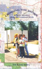
A well-heeled alliance of hikers and outdoor-equipment manufacturers has returned to the country made famous by the 19th-century explorers, this time to build the nation's longest wilderness hiking trail - one stretching the length of the Continental Divide, from Canada to Mexico.
The vision of a 3,100-mile route through some of the West's most rugged and historic countryside has won the approval of Congress, prompted contributions from a dozen major corporations, inspired hundreds of volunteers to work on the trail and led towns to link up their parks and jogging paths with the trail.
But not everyone welcomes the project; it has become a lightning rod for a broader debate about the impact of recreation and tourism on rural communities and remote, wild country.
The route runs through five states, three national parks - Glacier, Yellowstone and Rocky Mountain - a dozen wilderness areas and a score of national forests.
But it also goes by 300-year-old villages whose defiant residents still identify with their Spanish pioneer ancestors, and through Indian reservations and ranches where there are strong suspicions that modern-day trails bring trouble - urban refugees, environmental zealots, cultural conflicts, land-use disputes and a higher cost of living.
"We try to tell people we are not leading a wagon train full of cappuccino machines and California expatriates," said one member of the Continental Divide Trail Alliance, the nonprofit group leading the campaign to complete the trail.
But it's difficult to win over people like Moises Morales, a county commissioner from one of the old Spanish settlements who has helped bring the project to a halt at the Colorado-New Mexico border. "The last thing we need," he said, "is a bunch of backpackers and tree huggers tramping through our yards."
Tracing the crest of the Rocky Mountains for much of its length, the Continental Divide gets its name because it is the demarcation separating the headwaters of streams flowing east and west.
The impetus for a hiking trail following the entire route - making it longer than either the Appalachian Trail or the Pacific Crest Trail - came largely from two men.
The first champion, in the 1960s, was the late Benton MacKaye, a forester who decades earlier had suggested the idea of an official Appalachian Trail following the longest chain of mountains in the East.
He was succeeded by another devotee of the Appalachian Trail, Baltimore lawyer Jim Wolf, who set out to sell Congress on the idea of an even more spectacular route that would allow people to experience the American West as the pioneers did.
Congress endorsed creation of a Continental Divide Trail in 1978, but there was never enough money to get the job done. So there was only sporadic work on the project by the U.S. Forest Service, which began linking an extensive system of primitive logging roads and existing trails.
The government effort fell 1,000 miles short of completing the trail - setting the stage for the current push.
The trail is largely complete from the Canadian border south to the lower end of Yellowstone Park, and through virtually all of Colorado.
Hikers in Idaho can cross the same high passes used by Meriwether Lewis and William Clark during their 1804-1806 expedition to explore newly acquired Western territories.
In southern Wyoming, where the trail is not complete, its sponsors hope to track the wagon ruts of the old Oregon Trail for several miles.
In Colorado, it goes through ghost towns, past the sites of 19th-century forts and battlefields and over a 14,000-foot mountain. Hikers taking it through the San Juan Mountains don't cross a paved road for 146 miles. Farther north, it takes them down the main street of Grand Lake, Colo.
From snow-covered summits to waterless lowlands, the Divide can be a terror to traverse. During the summer, volunteers working on a section of the trail in northern Wyoming encountered many of the same hazards that 19th-century expeditions endured.
"Two mules temporarily lost. One washed downstream. One horseman kicked in the head. One camp torn up by a grizzly bear. One person unhappy with food, campsites, group leader, weather, etc.," surveyor Dick Inberg wrote in his notes of two weeks supervising trail work in the mountains south of Yellowstone Park.
Inberg's crew members were among more than 700 volunteers working this year to complete the job that was begun by the government, but which stalled by the early 1990s because of budget cuts and competing priorities.
The renewed enthusiasm to finish the trail is part of a surge of interest in outdoor recreation that is pumping new life and money into old mining and ranching communities up and down the Rockies.
Recognizing the benefits of high-profile public trails, the American Recreation Coalition, an industry trade group, began working with Bruce and Paula Ward - he was the president of the American Hiking Society, she a landscape architect. Headed by the couple, the 2-year-old Continental Divide Trail Alliance boasts an impressive list of business partners, including the Coleman Co., Vasque, REI, L.L. Bean, Walmart, Amgen and the Sporting Goods Manufacturing Association.
The alliance is counting on its corporate partners to pay at least one-third of the $10 million cost.
In return, sponsors will have their names engraved on trail heads and will be given the opportunity to mention the trail and their support on products and commercials. To fund the rest, the alliance is looking to foundations, environmental groups, individuals and the federal government.
Besides the physical work of clearing a trail where none exists and erecting signs and markers, the job involves acquiring easements across private property and trying to convince skeptical land owners and environmentalists that the project is worthwhile.
Meanwhile, some features of the trail have been the subject of continuing debate even among its sponsors - most notably the issue of motorized access by all-terrain vehicles, jeeps and snowmobiles.
Others worry that corporate sponsors will want to tame the trail, providing too much access and too many conveniences.
But it will require some doing to take the wilderness out of the trail. Passing through 12 official wilderness areas, where even mountain bikes are prohibited, the route runs through the last grizzly bear habitat in the lower 48 states and runs above timberline for many miles, exposing travelers to lightning and avalanches.