Monday, September 22, 2008

Continental Divide Through the Wyoming Great Basin

Rock Cairn Just South of South Pass City


The Great Basin is the only place that the Continental Divide splits, creating a basin. Official CDT routes go around it East and West. I think the best route is right through the middle. Leaving the Oxbow Nat. Forest I suggest cutting cross country to Wamsutter which puts you right in position to cross the Basin in three long days of hiking. This was my experience:


As it turned out, the dragon was fairly tame. I had given much more thought to the Great Basin than was necessary. I left Wamsutter, Wyoming, with two gallons of water and my purifier. I made the crossing in three days and found plenty of water along the way.


My original plan was to head straight north from Wamsutter until I reached a junction with the official CDT route and follow the trail west to Atlantic City. An hour after I left Wamsutter, I was still considering other options. According to my map, the Hay Reservoir was off to the northwest which held the promise of water and a much more direct route to Atlantic and South Pass City.


Shortcuts do not always work out the way you plan them. I considered the Donner Party and their peril as they took the shortcut through the Sierras in the 1800s—one good reason not to deviate from my original plan worked out with the Bureau of Land Management staff. But in this case, my original plan had no more merit than any other cockamamie idea I could come up with. I decided to take the shortest route to the Sweetwater River, the only water source I knew I could rely on.


Because of gas exploration and development in the lower Basin, there are roads going in every direction. Even here in this remote and barren moonscape, the Earth seems in chaos, dealing with the constant onslaught of man. When in doubt which road to take, I pulled out my GPS and cut across the sagebrush until I junctioned with a road that seemed to be going in the same direction that I was. Even though I had not seen a rattlesnake in over two months of hiking, I kept thinking about my breakfast tutor (Oldtimer who told me there were rattlesnakes all over the basin) and looking for serpents on top of each of the million plants I brushed.


The second morning, I found a flowing well at Lost Creek Fork. By noon I ate lunch near the Hay Reservoir, and, though it was dried up, I found enough puddles to pump water through my purifier and wash down my cheese tortilla. The morning of my third day, I passed Scotty Lake which was not saline as I had been told and there was plenty of water. At this point I cut cross country and north around the west side of Picket Lake to reach the Forks-Atlantic City Rd., a two-track which would lead to South Pass City.


During the afternoon, I came across another flowing well near a stock tank. By evening, I was sitting on the shore of the Sweetwater River, drinking my fill. Because of cloudy overcast days with sprinkles now and then, I was able to hike thirty plus miles each day, reaching the trail to South Pass City on the third day.


For me, the Great Basin was a quiet land of solitude with its own magical landscape. I sat in the ruts of the Oregon Trail and looked back over the terrain and time. I realized, once again, that knowledge and experience turn fears into facts, dragons into friends.


For nearly a hundred miles, I could see the Wind River range to the northwest. It seemed like an oasis to be reached, rewarding me for crossing this dry alkali basin. I could see rain from the Winds dissipate as it was blown across the basin.

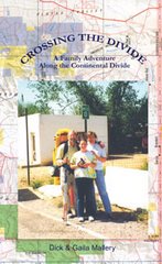
From "Crossing the Divide" by Richard Mallery

thenewspaperthatwalks.com

Sunday, September 21, 2008

Finishing the Continental Divide Trail in Glacier National Park


The first part of September, northbound CDT hikers begin showing up in Glacier National Park to finish an incredible journey that has taken them months of hiking along the rocky spine of North America. They are feeling euphoric. They have hiked to Glacier from the U.S. border with Mexico. The weather is usually perfect in Glacier the first part of September, and the hordes of tourist have left for the season.


I remember several casual conversations with people I ran into during the five days it took me to hike through Glacier at the end of my CDT hike. Near the end of the trek it was always worth a laugh when explaining to people that I started in Mexico.


I ran into a guided group returning from Grinnell Glacier. Telling them about my hike I mentioned Andy, Laura and Leslie (the three other Northbound hikers in 1999) also in the vicinity. When I said I hadn’t seen the girls since Colorado and that I had only hiked with Andy for 500 miles, they all thought that was hilarious. Yelling things like, "SINCE COLORADO!—500 MILES!"


Another humorous incident took place hiking through the Many Glacier Lodge area. It was almost dark and a woman sitting out on the balcony of her hotel asked me where I was headed. I told her I was going down the road to the Swiftcurrent campground. She said, "That’s a long way and it’s getting dark."

I said, "It’s only about a mile."
"Where are you coming from," she inquired.
"Mexico," I replied. "I started in April and hiked the Continental Divide."
She almost fell out of her chair.


Once you reach Glacier you can choose several routes through the park to finish your hike. I used what I assume is the default route. For me it was a five day easy hike. With 3,000 miles under my belt I felt bullet-proof. Long mileage days were enjoyable in the perfect Indian Summer weather I was gifted with.


Some Choices (in my opinion)
Once you exit "The Bob" you cross Hwy. 2 at Marias Pass. You will see CDT signs if you cross the road and the RR tracks and look along the tree line. My five days took me first to Two Medicine where I picked up a hiking permit, then Red Eagle Lake, Swiftcurrent, Granite Park, Fifty Mtn. and out at Waterton townsite. The first half of the first day from Marias Pass to the town of East Glacier is boring. You end up hiking through thick vegetation that is not used often. It is not the kind of trails people travel to Glacier to explore. It is a necessary link to the park proper. From East Glacier to Canada you are on some of the premiere hiking tread in the world. Well worth the price of admission.


My suggestion would be not to exit the park at Chief Mountain unless that is logistically better for you because of transportation or scheduling reasons. Going to Goat Haunt and crossing the border into Waterton is so spectacular and uplifting.


Other route choices: a. Instead of going up to historic Granite Park from Swiftcurrent, go north through the Ptarmigan Tunnel and follow the valley up and over Stoney Indian Pass. This is another spectacular route.


b. If you want to stay closer to the Divide proper you can head west from Two Medicine, through the Nyack to Sperry and then take the Floral Park route across to Logan Pass, the Highline Trail to Granite Park and on to Goat Haunt. This is awesome terrain, but needs more respect than it gets. You are not a novice hiker if you have come this far but Floral Park is not a trail, it is only a route. You should be familiar with this route before you tackle it.


Backpacker Magazine did a short story on this route a couple years ago making it sound like a day hike in the alpine that anyone can pull off. No so. An example would be A hiker named, Yi-Jien Hwa, who attempted it this fall and has not been found yet. Thousands of hours of search and rescue with hundreds of volunteers have turned up no sign of him.
I'm not trying to scare anyone from using this route I am just making a point. Wilderness can be unforgiving if you are not prepared, and sometimes even if you are.


If you are as thankful as I am about the many wilderness areas that have been protected by forward thinking individuals in our short history, you will be interested in watching for this documentary set for release next year:


"The National Parks: America's Best Idea" is to air in autumn 2009 on PBS. This will be a six- part, 12 hour series produced by Ken Burns, a name we all equate with quality film.
One of the country's most startling innovations, Burns says, was the creation of a national park system in the late 19th and early 20th centuries.
"For the first time in human history, land was set aside not for the pleasure of kings and noblemen and the very, very rich, but for everybody, for all time."
With the parks project, he says, he wants to explore the movement that set aside Yellowstone and Yosemite and created the national park system. These seem like astonishing, out-of-character moves, he says, "in a culture so dedicated to the almighty dollar, so dedicated to a kind of extractive and acquisitive mentality. So how did this happen? Who were these people?"


These areas continue to be threatened by all of us--all of our needs, wants and desires. Let's pray we make the wise decisions that have protected these areas in the past and have preserved them for our generation. Let's hope we can continue to pass them along to a respectful upcoming generation of conservationist. --Keep Smilin', Dick E. Bird

Thursday, September 4, 2008

BLM to Kill Our Wild Horses


The Bureau of Land Management (BLM) has announced plans to kill America's wild horses rather than effectively manage our wild natural heritage. BLM claims it can no longer afford to round up wild horses and confine them until it finds people to adopt them, and the agency wants to euthanize these majestic wild beauties or sell them to the highest bidder "without limitation" - meaning sell them to anyone, even if the bidder also plans to kill these horses.


Why does BLM need to round up wild horses and send them to slaughter? The BLM claims that the agency can't "allow horses to multiply unchecked on the range without causing an environmental disaster." But there are less than 30,000 wild horses on the range versus at least 3 million grazing cows. So rather than address the environmental damage caused by cattle overgrazing and expanding oil and gas exploration on our public lands, the BLM would rather placate corporate cattle ranchers who view mustangs as competition for forage, and drive wild horses - our country's symbol of freedom and independent spirit - to extinction.


If you have hiked the Continental Divide Trail across the Red Desert (Rawlins, Wyo. to South Pass City) you have seen some of these incredible animals and they have made you pause.

Continental Divide/The Backbone of the World

The Backbone of the World is another book I would like to recommend. I bought it because the prologue said the author hiked the Continental Divide Trail the same year I did, starting in April of 1999. I was curious why I never saw or heard of him. As it turns out he only made it to the first stop—Silver City. But he does go on with his vehicle over a period of years and interviews people and covers many of the political issues that plague the progress of putting this thin line of pathway on the ground from Mexico to Canada. Frank Clifford is a talented writer as is Bill Bryson. They just seem to have a hard time putting one foot in front of the other for too many miles and sleeping on hard ground. I found this book to be a great read and highly recommend it to anyone with an interest in the Rocky Mountain region and the Continental Divide.

Sunday, August 17, 2008

El Morro National Monument


Your CDT hike may or may not include a stop at El Morro Nationa Monument depending on the route you choose. It is well worth a visit.


El Morro National Monument, a much-carved bluff in the high desert of western New Mexico.
Anasazi, with one layer of Spanish colonialism and another of American Manifest Destiny, all seen through the lens of National Park Service stewardship.

OVERALL
Don't think of it as a landscape. Think of it as the best guest ledger in the West, about 200 feet, top to bottom, and made of sandstone.
On it you can find handprints, stick-figure animals and signatures in fancy looping script -- more than 2,000 inscriptions, carved over seven centuries by overland travelers who stopped here to dull their thirst.
"Governor Don Juan de Oñate passed through here, from the discovery of the Sea of the South on the 16th of April, 1605," says one entry in Spanish.
"Miss A.F. Baley," says another, from 1858.
Still, you may not have heard of El Morro National Monument, a.k.a. Inscription Rock, because it's out of the way, even by rural New Mexico standards. South of Gallup, west of Grants. Just up the road from the Pueblo of Zuni, just down the road from the ancient cinders and lava tubes of El Malpais National Monument.

To reach it from Albuquerque, you drive 85 miles west on Interstate 40 to Grants, then take New Mexico 53 for 42 miles. On the way, you climb from the high desert and red rock to the even higher desert with its forests of ponderosa and pinyon pine. You cross the Continental Divide, surrounded by scrub that grows thick and green during the monsoons of July and August, and then a white-orange bluff rises abruptly from the plain, its base about 7,200 feet above sea level. This is El Morro, which translates, more or less, from Spanish as "the headland."
In landscape terms, it's a not a mesa but a cuesta, because it rises in a gradual slope at one end, then drops straight down at the other. Pine and juniper congregate on and around it. A pre-Columbian condo complex sits on top -- about a dozen rooms exposed among an estimated 875 that once held 1,000 residents in the 13th and 14th centuries.
But it's not those dwellings nor the shape of the rock that makes El Morro unique. It's the water and the names.

For hundreds of years, the pool of collected rainfall and snowmelt at the foot of this rock was the only reliable water supply for 30 miles around, maybe more. That made it a standard stopping point for anybody passing through, including the Anasazi of the 13th century, Spanish explorers of the 17th century and American settlers of the 19th century.
Oñate, New Mexico's first Spanish governor, left his mark after a visit to the Gulf of California. Miss Baley, the first woman to sign, was part of a wagon expedition from Missouri to California. There's a 4-inch-high swastika, left by native peoples centuries before the Nazis adopted it. And there's the flowery script of Mr. E. Pen. Long of Baltimore, an 1859 visitor whom you could call the John Hancock of El Morro.

In 1906, the federal government stepped in and banned further inscriptions. Until the 1930s, early rangers used pencils to darken a few of the oldest inscriptions. In their bid to protect the past-tense graffiti from the present-day variety, rangers have put up a couple of sandstone rocks in front of the visitor center to channel the energies of scratch-happy kids.
"Certainly all the other rocks in America do not, all together, hold so much of American history," wrote Charles F. Lummis, the champion of Western history who founded the Southwest Museum in Los Angeles.
Visiting today, you browse the visitor center, then stroll a half-mile loop of the Inscription Trail, moving from petroglyph to signature. Hardier hikers continue up the Headland Trail, which adds 1.5 miles to the journey and climbs 200 feet to the Atsinna Pueblo on top of the rock.
I did the Headland Trail (also known as the Mesa Top Trail) with ranger Aleksu Hillerstrom, who pointed out a tree that had been struck by lightning a month before (that's common in summer) and helped me read between the inscription lines.
One Spanish explorer called himself a gentleman, but one of his contemporaries vigorously crossed out the word. An American in 1849 misspelled the word "inscription" and had to wedge the "r" in after the fact. (Copy editing in stone. Bummer.)
I wouldn't build an entire trip around El Morro, but if you're on the road anywhere between Flagstaff and Albuquerque, it's surely worth a few hours, perhaps an overnight.
You can spend the night at Grants (a town of about 9,000), but the summer temperatures are cooler and the scenery better up around El Morro. In summer, the park service opens nine primitive campsites at the monument. About a mile away on the highway, El Morro RV Park has about two-dozen hook-ups for $20 nightly, three cabins at $65 to $75, and a handful of tent sites for $10.
The neighboring Ancient Way Cafe offers breakfast, lunch and dinner, and the Inscription Rock Trading & Coffee Co. offers snacks and gifts, and the nonprofit Old School Gallery shows art.

Tuesday, August 12, 2008

'Blitz' to test water at hundreds of locations in Rocky Mountain National Park


by Bill Scanlon
Bears will puzzle over what's going on in their park Tuesday when dozens of researchers and trained volunteers dip flasks into streams, lakes and wetlands on both sides of the Continental Divide.
The great Water Blitz isn't the latest ride at Water World, but an ambitious one-day odyssey to test water at hundreds of different locations at Rocky Mountain National Park.
"It's one of the first efforts of this kind on such a scale in the world," Judy Visty, research administrator at RMNP, said.
The idea is to circumvent the kind of problem researchers face when they test one stream on a sunny day, another the next day after a rain, a third the following day when the algae are photosynthesizing to beat the band.
This "snapshot in time" will capture the state of the water throughout the park and help scientists understand where extra nutrients are harming the ecosystem.
"The park is a natural lab, more pristine than the surrounding area," yet affected by fertilizers and pollution from the rest of Colorado, Visty said.
They're hoping to find some patterns that could explain why the massive beetle kill of lodgepole pines and other trees is so much larger than in past infestations.
As the lodgepole pines go, so do the sapsuckers and other birds that feed on their bounty.
Scientists want to learn more about the species of algae that have proliferated in lakes, multiplying ever since the 1950s with the explosion of nitrogen-based fertilizers.
"If we have nitrogen pollution arriving with precipitation, is it worse in some places than others?" Visty said. "How does it show up in the streams? We know it collects in precipitation, but what actually happens when it goes into the water?"
Researchers will be in charge of the veteran volunteers who, for this project, got hour-long training in water-sample-collection techniques.
"This is a citizen science project," Visty said. "It shows how citizens can make really tremendous contributions. Many pairs of helping hands allow scientists to investigate on a scale he or she could never dream of doing alone."

Monday, August 4, 2008

The Continental Divide National Scenic Trail Needs Work


Trail that traces the Rockies' backbone through Colorado still is far from complete more than 30 years after its start


By Scott WilloughbyThe Denver Post

You would never know from the smiling faces and feel-good vibes emanating from the hardy folks entrusted with keeping the fractured spine aligned, but after 30 years of rehab there's no denying the diagnosis. The Continental Divide Trail could use a little love.
Not familiar with the CDT? Join the club.
Despite more than 30 years in the making, the so-called "King of Trails" remains third in line to the throne occupied by its more popular cousins to the east (the Appalachian Trail) and west (the Pacific Crest) when it comes to hiking empires. Although all are recognized by Congress as a result of the National Trails System Act of 1968, the 3,100-mile CDT running right down the spine of the Rocky Mountains through Colorado remains a full 1,000 miles away from fulfilling its destiny. "The trail is actually the longest north-to-south in the U.S., but there are a thousand miles of it that we haven't actually completed, that are either missing or are on roads," said Teresa Martinez, director of field operations for the Pine-based Continental Divide Trail Alliance (CDTA). "It's supposed to be kind of 'the people's trail system,' owned and maintained by the public for future generations. But people are often unaware that it even exists."
The notion of a hiking trail spanning the backbone of America would seem like a natural to many Coloradans. And indeed it did to David Maceyka of the now-defunct Rocky Mountain Trail Association, who joined Appalachian Trail founder Brenton Mackaye and members of the Colorado Mountain Club in walking a segment of the proposed CDT through Colorado back in 1966.
The so-called "Blue Can Trail" that Maceyka hiked and marked (with blue cans) for the Forest Service to locate and approve between Empire and Rocky Mountain National Park became the first leg of what now spans some 800 miles of CDT through Colorado and the impetus behind the National Trails System Act. Congress
A hiker encounters lingering snow on the Continental Divide Trail, which some call the nation's "King of Trails." ultimately voted to include a trail spanning the length of the Divide from Canada to Mexico among the National Scenic Trail system in 1978, identifying a 50-mile wide corridor on either side of the Divide to locate its final route. Problem is, Congress didn't allocate any actual land (beyond 1,900 miles of existing trails and primitive roads) or any money to the cause, leaving the trail to find its own way.
"One reason the Act was written the way it was is their belief in volunteerism, through that public engagement and empowering and ownership of this trail system, that money would not be as critical because you'd have these volunteers and that support system to work with the (federal) agencies to accomplish great things," said Martinez, a former trail program manager for the Appalachian Trail Conservancy. "With the CDT, the organization is preceding the cause in many ways. A lot of clubs have embraced the trail, but they're not organized solely as trail clubs that maintain and manage and advocate for the CDT. That's where the CDTA has been really strong in providing that volunteer component."
Minimal coordination among agencies and nearly nonexistent public involvement for almost two decades ultimately led to the 1995 creation of the CDTA, whose 3,000 members remain devoted to the completion, maintenance and protection of the trail 30 years after its nascence.
CDTA officials estimate that 70 percent of the often stunning trail spanning five states, 20 wilderness areas, three national parks and 25 national forests is usable today. The estimated cost to complete a scenic trail away from motorized routes is another $27 million. The return, according to some, is priceless.
"I feel sorry for people who don't ever get to see this," said Ken Thompson, who made the trip from Lawrence, Mich., to attend last weekend's annual Trailfest celebration of the CDT in Buena Vista.
Thompson and his wife, Kim, were hiking a new segment of the CDT above 12,200-foot Cottonwood Pass to fulfill the wish of his recently deceased farming partner, Ray Miller, who donated 10 percent of his estate to the CDTA after through-hiking the trail years ago.
"He wanted me to come here with him for years," Thompson said. "Now I can see why."
Hundreds of others took part in the CDTA's annual awareness event, which included guided hikes as both a showcase and a recruiting effort for the trail. While the remoteness of the CDT provides a memorable experience that is increasingly sought and difficult to find, it also speaks to the physical challenges trail managers face in fulfilling their vision.
"That elevation and exposure factor is a challenge that something like the AT doesn't have, but it's also the beauty of it," Martinez said. "That's why our volunteers are so uniquely special, because they buy into that hook, line and sinker — game on."
And not surprisingly, Colorado leads the CDTA's volunteer efforts with roughly half of the 900 annual trail builders hailing from the state with the highest concentration of tall peaks in the nation. Some 43 projects are in the works trailwide this summer. Still, of the 800 miles of the Divide Trail passing through Colorado, 225 remain to be completed or rerouted.
Completed or not, the CDTA has set a goal of 2018 to at least have the entire trail mapped out, away from roads and closer to the original vision of a truly scenic national trail.
"Will it ever be done? I think that's up to the American public to determine," Martinez said. "I think there will always be something to be done. It's a legacy project that engages every single one of our citizens and it will depend upon every generation to make sure that it continues to exist.
"A trail is a living organism. The public can be a part of that life. But it's a lot of work."
Get involved: The Pine-based Continental Divide Trail Alliance offers volunteer opportunities spanning from half a day to five days with levels of difficulty ranging from family-friendly to full-blown backpacking. Find out more by visiting http://www.cdtrail.org/ or calling 303-838-3760 or 800-909-CDTA.

Thursday, July 17, 2008

Two Lads From Across the Pond Take The Challenge


All European hikes seem like a walk in the park compared to the adventure Paul Hayton of Eaglescliffe has embarked on.

The 31-year-old senior designer is on a mission to cover 3,100 miles on foot from Mexico to Canada.

Together with his old university pal, Simon Cook of London, Paul is walking across the USA following the Continental Divide Trail. The wilderness trail runs along The Rocky Mountain range crossing five states, 25 national forests, three national parks and three Indian reservations.

Carrying all they need to survive on their backs, the duo are walking more than 20 miles a day, six days a week for six months through mountainous terrain.

Paul and Simon started out on May 1 and have encountered heavy snow, water scarcity and their first bear.

Paul’s mum Barbara, 53, a machine operator from Eaglescliffe, said: “They are doing this to raise funds for The Cystic Fibrosis Trust as they both have friends who suffer from this currently incurable disease.

“Paul’s one of these lads who will push and push and he just lives for a challenge.”

Paul said: “Back in 2000 when we left university we made a pact to walk the Continental Divide Trail in 2008. We chose it purely because it was the longest walk we could find any information on.”

The former Egglescliffe School pupil and Yarm Army Cadet, said the San Juan mountains were one of the best sections of the trail so far.

Simon, 31, said: “There is something great about being the first people to make tracks in the snow but it does mean that you have to be constantly alert to where you are and where you’re heading.”

Paul said their shortest pit stop was when they almost came face to face with a bear.

“Before our packs hit the ground I heard a deep grunting or growling sound that sounded nothing like any animal we had heard before.

“Our packs were on our backs quicker than we took them off and as we moved away talking very loudly and making as much noise as possible I turned to see a bear the size of a small car pounding down the hill before it stopped under a tree a short distance away. We did not stick around to appreciate this animal.”

Wednesday, July 16, 2008

The Continental Divide Trail Planning


by Joseph Hazelbaker
The Continental Divide Trail (CDT) was created by Congress in 1978 and covers 3,100 miles through five U.S. states from the Canadian to Mexican borders. Nicknamed the "King of Trails" as it will be the longest continuous backcountry trail in the U.S., the CDT is scheduled to be complete in 2008. Currently, seventy percent of the trail is hikeable.

Tackling a trail of this magnitude requires complex planning. Due to its relative youth, and incompleteness, the CDT lacks the "thru-hiking" infrastructure and reconnaissance that more established trails like the Appalachian and Pacific Crest Trails have. If you are planning on hiking the CDT, your first stop should be the Continental Divide Trail Alliance (CDTA). There website is located at www.cdtrail.org.

CDTA manages the trail and publishes and sells several guidebooks and videos that will be critical for you to reference. These include the four volumes of the CDT official guide. You will also find books about the other two long trails in the U.S. helpful. For example, Ray Jardine's PCT Hiker's Handbook is considered not just a classic guidebook for the Pacific Crest Trail, but also a vital handbook for hiking long trails. Other examples of useful crossover resources are the AT Thru-Hiker Planner and the AT meal planner.

In addition, there are several books you should consider that address hiking long trails generally, such as Hiking the Triple Crown: How to Hike America's Longest Trails. Good sites for these resources are:

www.appalachiantrail.org

www.pcta.org

In order to plan hiking the entire length of the CDT, you'll need to put in a lot of planning, more so than in hiking any of the other long trails in the U.S. You will also, undoubtedly, need to do a lot of scouting in advance to determine suitable towns for mail drops and to create emergency contingency plans. The good news is, if you pull off a CDT thru-hike, you'll have an experience that's worth writing about and that few others in the world will have.

Happy trails!

Tuesday, July 15, 2008

The Continental Divide Trail


Spanning from the Canadian border down to Mexico, the Continental Divide Trail is one of the most incredible hikes in America. And you don't need to be superhuman to do it.

By James Ross Gardner

You're never climbing Everest. There's no Arctic expedition in the cards. But the almost finished Continental Divide Trail you can do. No extensive training. No specialized gear. Just six months of doing what even the most accomplished long-distance hikers refer to as walking. Walking. Thirty-one hundred miles of walking, through some of the most rugged terrain in the country, from the Canadian border to Mexico.

Compared with the nation's other two big scenic hikes, the Appalachian Trail and the Pacific Crest Trail, which see hundreds of annual through-hikers, the CDT sees about thirty people complete it each year. That will change as the trail improves. And this past spring, a new forty-mile section of trail in Wyoming opened, and another sixty miles are being blazed through the Colorado Rockies in time for the 2009 season. For now, hikers navigate "unfinished" sections with topo maps from the Continental Divide Trail Alliance (cdtrail.org) -- and in some cases circumambulate via dirt roads. Despite the improvements, the CDT will still be tough enough for lifetime bragging rights. Montana is especially grueling: In Glacier National Park, you cross snow bridges in mid-June -- only to endure 90 degree heat in thistle-choked cow pastures a week later.

Your concerns are mostly about survival. Will I make the next ridge by nightfall? Where will I find water? But you're asking those questions amid what is arguably the most spectacular and variegated stretch of land in North America: from the red-rock skyscrapers of New Mexico's El Malpais National Monument to Montana's Chinese Wall (twelve miles of thousand-foot limestone cliffs).

Expert hikers do it in 145 days. Expect to take 180. And to have a story no one can top.

Monday, July 14, 2008

Opinion Is Split On Continental Divide Trail -- Push To Finish 3, 100-Mile Path Stirs Up Old Territorial Disputes


Opinion Is Split On Continental Divide Trail -- Push To Finish 3, 100-Mile Path Stirs Up Old Territorial Disputes

Los Angeles Times
MONARCH PASS, Colo. - In return for a handful of beads, a pound of flour, an American flag and a vague promise of firearms, Shoshone Indians granted Lewis and Clark safe passage over the Continental Divide nearly 200 years ago.
Modern trailblazers should be so lucky.
A well-heeled alliance of hikers and outdoor-equipment manufacturers has returned to the country made famous by the 19th-century explorers, this time to build the nation's longest wilderness hiking trail - one stretching the length of the Continental Divide, from Canada to Mexico.
The vision of a 3,100-mile route through some of the West's most rugged and historic countryside has won the approval of Congress, prompted contributions from a dozen major corporations, inspired hundreds of volunteers to work on the trail and led towns to link up their parks and jogging paths with the trail.
But not everyone welcomes the project; it has become a lightning rod for a broader debate about the impact of recreation and tourism on rural communities and remote, wild country.
The route runs through five states, three national parks - Glacier, Yellowstone and Rocky Mountain - a dozen wilderness areas and a score of national forests.
But it also goes by 300-year-old villages whose defiant residents still identify with their Spanish pioneer ancestors, and through Indian reservations and ranches where there are strong suspicions that modern-day trails bring trouble - urban refugees, environmental zealots, cultural conflicts, land-use disputes and a higher cost of living.
"We try to tell people we are not leading a wagon train full of cappuccino machines and California expatriates," said one member of the Continental Divide Trail Alliance, the nonprofit group leading the campaign to complete the trail.
But it's difficult to win over people like Moises Morales, a county commissioner from one of the old Spanish settlements who has helped bring the project to a halt at the Colorado-New Mexico border. "The last thing we need," he said, "is a bunch of backpackers and tree huggers tramping through our yards."
Tracing the crest of the Rocky Mountains for much of its length, the Continental Divide gets its name because it is the demarcation separating the headwaters of streams flowing east and west.
The impetus for a hiking trail following the entire route - making it longer than either the Appalachian Trail or the Pacific Crest Trail - came largely from two men.
The first champion, in the 1960s, was the late Benton MacKaye, a forester who decades earlier had suggested the idea of an official Appalachian Trail following the longest chain of mountains in the East.
He was succeeded by another devotee of the Appalachian Trail, Baltimore lawyer Jim Wolf, who set out to sell Congress on the idea of an even more spectacular route that would allow people to experience the American West as the pioneers did.
Congress endorsed creation of a Continental Divide Trail in 1978, but there was never enough money to get the job done. So there was only sporadic work on the project by the U.S. Forest Service, which began linking an extensive system of primitive logging roads and existing trails.
The government effort fell 1,000 miles short of completing the trail - setting the stage for the current push.
The trail is largely complete from the Canadian border south to the lower end of Yellowstone Park, and through virtually all of Colorado.
Hikers in Idaho can cross the same high passes used by Meriwether Lewis and William Clark during their 1804-1806 expedition to explore newly acquired Western territories.
In southern Wyoming, where the trail is not complete, its sponsors hope to track the wagon ruts of the old Oregon Trail for several miles.
In Colorado, it goes through ghost towns, past the sites of 19th-century forts and battlefields and over a 14,000-foot mountain. Hikers taking it through the San Juan Mountains don't cross a paved road for 146 miles. Farther north, it takes them down the main street of Grand Lake, Colo.
From snow-covered summits to waterless lowlands, the Divide can be a terror to traverse. During the summer, volunteers working on a section of the trail in northern Wyoming encountered many of the same hazards that 19th-century expeditions endured.
"Two mules temporarily lost. One washed downstream. One horseman kicked in the head. One camp torn up by a grizzly bear. One person unhappy with food, campsites, group leader, weather, etc.," surveyor Dick Inberg wrote in his notes of two weeks supervising trail work in the mountains south of Yellowstone Park.
Inberg's crew members were among more than 700 volunteers working this year to complete the job that was begun by the government, but which stalled by the early 1990s because of budget cuts and competing priorities.
The renewed enthusiasm to finish the trail is part of a surge of interest in outdoor recreation that is pumping new life and money into old mining and ranching communities up and down the Rockies.
Recognizing the benefits of high-profile public trails, the American Recreation Coalition, an industry trade group, began working with Bruce and Paula Ward - he was the president of the American Hiking Society, she a landscape architect. Headed by the couple, the 2-year-old Continental Divide Trail Alliance boasts an impressive list of business partners, including the Coleman Co., Vasque, REI, L.L. Bean, Walmart, Amgen and the Sporting Goods Manufacturing Association.
The alliance is counting on its corporate partners to pay at least one-third of the $10 million cost.
In return, sponsors will have their names engraved on trail heads and will be given the opportunity to mention the trail and their support on products and commercials. To fund the rest, the alliance is looking to foundations, environmental groups, individuals and the federal government.
Besides the physical work of clearing a trail where none exists and erecting signs and markers, the job involves acquiring easements across private property and trying to convince skeptical land owners and environmentalists that the project is worthwhile.
Meanwhile, some features of the trail have been the subject of continuing debate even among its sponsors - most notably the issue of motorized access by all-terrain vehicles, jeeps and snowmobiles.
Others worry that corporate sponsors will want to tame the trail, providing too much access and too many conveniences.
But it will require some doing to take the wilderness out of the trail. Passing through 12 official wilderness areas, where even mountain bikes are prohibited, the route runs through the last grizzly bear habitat in the lower 48 states and runs above timberline for many miles, exposing travelers to lightning and avalanches.

Monday, January 21, 2008

The Amazon Outdoor Store
Fulfilling a lifelong dream Mallerys publish book on trek along the Continental Divide


By MARTA HEPLER DRAHOS-Traverse City Record Eagle


What does it take to walk 3,800 miles through some of North America's most rugged — and beautiful — country.


Click here to visit mallerybooks.com


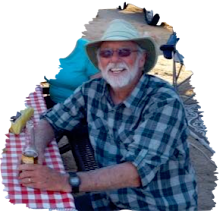
Wanderlust, tenacity and lots of family support, said Dick Mallery, co-author of the book "Crossing the Divide: A Family Adventure along the Continental Divide” (MalleryBooks, $18.95).Mallery, publisher and founder of the bird-feeding and nature newspaper The Dick E. Bird News, fulfilled a 30-year dream in 2003 by completing the Continental Divide Trail from New Mexico to Jasper, Alberta. Instead of leaving his family behind, he shared the adventure with wife Gaila and daughter Maggie, who followed in the front country in the family's 27-foot motor home towing a Saturn.


Dick Mallery heads back on the Continental Divide Trail after resupplying in Twin Lakes, Colo.,in 1999.

The family began their adventure in 1999, the year Mallery turned 50. That year, he walked 3,200 miles along the Continental Divide from New Mexico to the Canadian border — a trip that would take him through five states in five months. Gaila and Maggie, then 12, were his support team, driving the motor home to campgrounds paralleling his route and meeting him on his weekly exits from the trail for more supplies and a little R&R.A few years later, the family returned to where they left off for the next leg of the journey, a 30-day 600-mile hike of the Canadian Continental Divide from Waterton to Jaspar, Alberta.The Continental Divide Trail follows an imaginary line running along the peaks of the Rocky Mountains that divides the continent's principal drainage eastward or westward. Mallery, now 58, said the rugged trip was not designed to recapture his youth but rather to challenge himself, push his personal limits and achieve that lifelong dream."I knew that was on my list of things to do before I died,” he said, adding that his passion for trekking and backpacking was fueled by childhood camping trips out West in his family's 1957 Airstream. "I kind of wanted to do it while Maggie was still home so we could make a family adventure of it.”Hiking alone with a 26-pound pack, he traveled 25 to 30 miles a day over mountains, across deserts and through streams and valleys, contending with everything from weather extremes to blisters and leg cramps. But he said one of the biggest challenges was water — locating enough to drink on the first trip and finding ways to bridge it on the second."There were a couple hairy times in the Canadian Rockies where I just couldn't cross,” he said. "The river was just 30 feet across, but so powerful it would knock you over.”Another problem was navigation, he said. Although the trail is considered the "king of trails,” it was only 60 percent complete at the time — and finding maps for it wasn't easy."I was lost a lot, especially in New Mexico,” despite such aids as then-unsophisticated versions of the GPS, the satellite communicator and the cell phone, he said. "I'd just go north and stay on the Divide as much as I could.”For their part, Gaila and Maggie restocked Mallery's supplies — strawberry milkshakes and pizza for off the trail, dehydrated beans and Ritz Bits for on it — and scouted campgrounds with hot showers, his first request after emerging from the trail. They also kept the business going with the help of a laptop computer, even passing out sample issues of the newspaper everywhere from bakeries and libraries to campgrounds and parks. (To prepare for the trip, the family scaled back the publication to a bi-monthly, printed three issues in advance and asked Mallery's father to deliver them to the post office one issue at a time.)The trip was a bonding experience for Gaila, whose parents from Arizona accompanied her and Maggie for much of the way."We became so close,” she said. "It was something that I'll never forget. I think families that travel together, there's just that bond there. And it's really good for children. We have this tradition: We play (the card game) Skip-Bo and have hot chocolate at night. We don't do that at home. I didn't want to come back. It was like, 'I don't want this to end.'"As far as exciting and fun adventures, I think it was going into these little towns that we never would have found otherwise and meeting the people.” Special among them were store owners who extended credit when they didn't take credit cards and librarians who let Maggie check out library books and drop them off at the next community library, she said.The couple recount their adventure from alternating perspectives in the book, which is available online at Amazon.com and at mallerybooks.com. Part of their story is the strangers they met along the way, from hikers to the occasional odd character like Bob Sundown, who traveled from New Mexico to Arizona every spring with his chickens and dog in a mule-drawn covered wagon, and James Cotton, a writer penning the encyclopedic volume of the word "free.”Mallery said he's glad he got the chance to hike on the Divide while there is still some wilderness left. His next goal is a 1,000-mile trek from Jasper to the Yukon, through even more remote and wild areas."I just love doing long-distance hikes. I'm after the solitude,” he said. "I like to get up in the mountains. To me it's magical, to me it's rare.”Meanwhile, he said he hopes the book encourages others to follow their own adventures."I guess the impact it had on me is just that life is short and if you want to do something, you should do it now,” he said.

Monday, January 14, 2008

CDT Southern Terminus Project

For years the southern end of the cdt has been a crap shoot. Hikers leaving and arriving have used a shotgun pattern of routes from Silver City to the border and from the border to Silver City. That is all changing. A lot of good trail now exists in the bootheel and beyond. The CDTA is interested in what you would like to see at the CDT Southern Terminus. The PCT has a nice monument. But this is the King of Trails. I think our neighbor Drummond Hadley, heir to Anhesier Busch should build a cantina and stock it with beer. It seems like the neighborly thing to do. Let the CDTA know what you think!


CDT Southern Terminus Project
What would you like to see at the southern end of the CDT?
The Continental Divide Trail Alliance is designing the site for the Southern Terminus for the CDNST at the New Mexico – Mexico border in cooperation with our agency partners (BLM, USFS, NPS). The Northern Terminus for the CDNST, located in Glacier Waterton International Peace Park on the Canada – Montana border is marked with a single concrete pillar. In designing the landmark for the Southern Terminus, we are providing an opportunity for our many important stakeholders who may have thoughts or ideas about this site to be involved in this process.
Provide your input as CDTA and the federal land managers work together to design the Southern Terminus of the Continental Divide Trail. By involving key stakeholders, volunteers and Trail supporters in this effort, we hope to create a fitting symbol for this national treasure and for the epic journey it represents. All work is slated for completion by the end of 2008.
Take the brief Southern Terminus Project survey here.
Please complete this survey by January 21st, 2008 so we can start the design and construction phases of this project. Please forward this survey to others who may be interested.

Sunday, January 6, 2008

CONTINENTAL DIVIDE TRAIL/Idaho, Montana Guide


When I was gathering information in 1998 preparing to hike the Continental Divide National Scenic Trail, there was little to be had. I bought a couple of Jim Wolf’s guide books, DeLorme Atlas & Gazetteer Series did not even have a New Mexico edition until a couple months before my departure date. I had two boxes of assorted route information I collected. CDT guide books were just beginning to show up on the horizon. Lynna Howard was kind enough to send me a proof copy of her up and coming Montana/Idaho CDT guidebook. It was of great value to me once I left Yellowstone. It is still a great resource. You can find this guide and Lynna’s other writings at: http://myweb.cableone.net/prueheart/

Thursday, January 3, 2008

Continental Divide Trail Fires

Fires have been the biggest obstacle in finishing the CDT in one season in recent years.


Wildfires topped the news for northern Flathead County in 2007, and by the end of the fire season about a dozen fires has burned timber in the Bob Marshall Wilderness. The Chippy Creek fire was the largest in the state and burned nearly 100,000 acres. The Ahorn and Fool Creek fires burned a swath through a combined 110,000 acres of forest land. The Skyland Fire, south of Marias Pass, spent some time rated as the top priority in the nation after it went from a few hundred acres to more than 16,000 acres is about a week.


(More Continental Divide Trail Info)

Wednesday, January 2, 2008

CONTINENTAL DIVIDE TRAIL / CUBA, NEW MEXICO


This delicious looking breakfast is what I had as I left Cuba and headed up into the San Pedro. It was a great breakfast but the worst case of food poison I have ever experienced.

Thoughts on Cuba
From: Crossing the Divide

I hiked into Cuba, New Mexico, on a Saturday evening. It was a town of impoverished appearance. I was greeted by a group of zombie-glazed men—vacant eyes, tough wrinkled skin, tattered clothing, addicted to the hopelessness of life around them. I walked through town, surveying the opportunities to eat and sleep here for a night. I reached the northern city limits, crossed the road and walked back south, hoping I had missed something, knowing I had not.The walk from Grants had been five days with few opportunities for water. My legs were very tired, and I desperately wanted to soak in a tub of hot water and scrub the desert out of my skin. I bought a room in a dingy ’50s-era motel with a three-quarter-length tub. Filled with water as hot as I could stand, I folded my body into the shallow basin and soaked for over an hour. I would wash my clothes in this same tub but first I wanted a meal. I carried only the clothing I wore. Now that my body and my senses were cleansed, my sweat-soaked clothing had the appeal of rotted garbage. But the urge to eat a hot meal lured me into them and down the street to a small cafe. I slipped into a corner table of a mom-and-pop pizzeria under the watchful eyes of the owners. I knew what they were looking at. It was the gaunt, sun-baked, hollow-looking character I had just seen minutes earlier in the mirror in my room. I answered their questioning eyes with my story. “I’m a thru-hiker. I’m headed for Canada. I look bad and I smell bad, but I feel good.” That brought a smile to their faces. They opened up completely to my adventure. It tore down all barriers between our curiosities. In the short time it takes to enjoy a large pizza with four items, we shared each other’s life stories and were the spontaneous kind of friends that assume from introduction that we will probably never meet again but cherish the moment of fellowship at hand.
(More CDT News and Info)

Tuesday, January 1, 2008

CONTINENTAL DIVIDE TRAIL NEWS


Playing ‘save the toes’
by Tom Sherlin


Long distance hiker Bert Emmerson is home in Maryville recovering from frostbite. He survived being stranded in a snowstorm for days in frigid temperatures while hiking the Continental Divide Trail earlier this month.

By Rick Laneyof The Daily Times Staff
Bert Emmerson is back home after being stranded in the Gila Wilderness Area of New Mexico above 10,000 feet during a four-day snowstorm.
Since arriving back in Maryville shortly before Christmas, he has been to hospitals and doctors’ offices regularly. Although Emmerson’s feet were badly frostbitten during the incident, he believes he will keep his toes.
Emmerson is calm and reflective as he describes his ordeal — a common characteristic of long-distance hikers who sometimes spend months alone on the trail. He is even casual as he pulls back his socks to reveal his ravaged feet that look more like they lost a battle with a lawn mower than the victims of frigid temperatures.
“I’m playing ‘save the toes’ right now,” Emmerson said. “It looks like I’ll get to keep them.
“It’s really amazing how much better they are now. The first night was very painful — like a severe burn.”
Until a few weeks ago, Emmerson was hiking the Continental Divide Trail, a 2,567-mile trail from Canada to Mexico that stretches through Montana, Idaho, Wyoming, Colorado and New Mexico. He started his journey at Glacier National Park in Montana on June 15 and has been hiking ever since. His plan was to reach the Mexico border and be home with his wife, Becky Emmerson, by Christmas.