Sunday, December 30, 2007

CONTINENTAL DIVIDE TRAIL FACES MORE THAN JUST THE THREAT OF MOUNTAIN BIKES


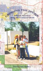
The article below shows how politics erode Wilderness Protection as much as the physical presence of mountain bikes and motorized vehicles. Lately the mountain bike issue on the CDT enjoyed a large sympathy vote from many CDT hikers because so many hikers are also bikers. Lobby’s are cropping up all over the wilderness landscape and threaten to change the face and the personality of Wilderness Protection. Like so many environmental issues it is a silent invasion that creeps in like a virus. It destroys precious resources over generations of time so that what is lost has never been known to those who have lost it. —Dick Mallery


DURANGO, Colo. — In the San Juan National Forest here, an iron-rod gate is the last barrier to the Weminuche Wilderness, a mountain redoubt above 10,000 feet where wheels are not allowed.
But the gate has been knocked down repeatedly, shot at and generally disregarded. Miles beyond it, a two-track trail has been punched into the wilderness by errant all-terrain-vehicle riders who have insisted on going their own way, on-trail or off.
From Colorado's forests to Utah's sandstone canyons and the evergreen mountains of Montana, federally owned lands are rapidly being transformed into the new playgrounds — and battlegrounds — of the American West.
Outdoor enthusiasts are flocking in record numbers to lesser-known forests, deserts and mountains, where the rules of use have been lax and enforcement infrequent.
The federal government has been struggling to come up with plans to accommodate the growing numbers of off-highway vehicles — mostly with proposed maps directing them toward designated trails — but all-terrain-vehicle users have started formidable lobbying campaigns when favorite trails have been left off the maps.
Even with the plans, federal officials describe an almost impossible enforcement situation because the government does not begin to have the manpower to deal with those who will not follow the rules. To keep the lawbreakers in check, said Don Banks, the deputy state director in Salt Lake City for the federal Bureau of Land Management, the biggest landowner in states like Utah and Nevada, "You'd have to have Patton's army."

The growing allure of the federal lands coincides with marked changes in how people play, with outdoor recreation now a multibillion-dollar industry. It also comes at a time, according to data compiled by Volker C. Radeloff of the University of Wisconsin, when more than 28 million homes sit less than 30 miles from federally owned land that millions of people increasingly view as their extended back yards.
"Forty years ago when I was out cowboying, I never saw a soul," said Heidi Redd, who operates the Dugout Ranch near Canyonlands National Park in southeastern Utah. "Now it's at a point where you realize the public land is not yours, you're just one of the users. And whether it's ATVs, horses or climbers, it's a traffic jam."
Any user can contribute to the traffic jam, but the off-highway vehicles do damage disproportionate to their numbers. In addition to loud engines, they have soft tires and deep treads that bite more deeply than a foot or a hoof. When they go off-trail, consequences often follow: erosion, destruction of fragile desert soils or historical artifacts and disturbance of wildlife habitats.
The temptation to go off-trail, legally or not, comes from the desire for variety, federal land managers say. "The more a route is used, the less challenging it becomes," said Mark Stiles, the San Juan forest supervisor. "You end up getting lots of little spurs off the main route." Even a few errant riders, he said, "can do a lot of damage."
Visitor numbers soar
The federal government does a spotty job counting the visitors to public lands — most do not have traditional visitors centers or staffed entry gates — but recent estimates by federal land managers in Utah signal the trend.
About 2.7 million people participated in outdoor activities on federal lands near Arches National Park so far this year, roughly double the estimates for 2000. And the number of participants in off-highway vehicle trips grew twice as fast as those in other activities, including things like rafting and sightseeing.
This explosive growth — coming at a time when attendance at many of the country's prized national parks has been below historic highs — has reignited the debate over just what should be done with the country's public lands.
In eastern Utah, six offices of the federal land management agency recently released proposed land-use plans that, among other things, cover recreational uses and the closing of areas to all-terrain vehicles. The proposals have drawn fierce reactions.
Campaigns to save popular trails have cropped up on the Internet. "Help us Save Factory Butte," says one appeal, in reference to a rock formation, a favorite area for daring motorcyclists and ATV riders that was closed on an emergency basis last year to protect cactuses. Another appeal says that a proposal to fence off cottonwood trees at White Wash Dunes near Moab, a popular playground for all-terrain vehicles, "must be opposed, en masse, by the off-highway community."
On the other side, opponents of the trails have been alarmed that the proposed networks of authorized paths would permanently eliminate large areas of Utah's unroaded wild lands from consideration as federally protected wilderness areas.
Members of the Southern Utah Wilderness Alliance, an environmental group that wants greater restrictions placed on motorized users, have tallied the total miles of motorized trails that would be allowed (about 15,000 miles) and the number of currently roadless acres that would no longer be eligible for federal wilderness protections (more than 2.5 million acres).
Lawyers for the group estimate that 82 percent of the lands in Utah that the Bureau of Land Management said had wilderness character in 1999 are now open for energy, mining or motorized recreation.
"Everybody's losing something they thought they had," said Clifton Koontz, an avid dirt-motorbike rider and co-founder of Ride With Respect, a group that teaches people about the bikes and how to minimize damage to the environment.
A balancing act
The preservation movement that coalesced around John Muir in the late 19th century focused on setting aside public lands, first as parks, then wildlife refuges, then after passage of the 1964 Wilderness Act, as wilderness areas "untrammeled by man."
But by the 1990s, federal designations were increasingly disputed by the mining and energy industries. Groups representing makers and riders of off-highway vehicles also had objections, casting the suggested wilderness designations as hostile acts designed to strip riders of their rights.
"They want everybody out," said Russ Englund, who owns a motorcycle shop outside the Bitterroot National Forest, which straddles the Montana-Idaho border and is one of the many flash points. "They think it has to be kept in this pristine state. These people don't even use it."
Riders of all varieties complain that their critics are off the mark, that motorized sports are about more than a handful of renegades. They say the activities are enjoyed in large part by law-abiding families and that the motorized vehicles allow older people and the infirm to visit beautiful and remote places otherwise inaccessible to them.
"I don't like being looked at as a bad guy all the time," said Bob Turri, 79, who likes to ride his all-terrain vehicle near his home in Monticello in southeastern Utah.
On a recent trip to Hidden Canyon, 20 miles from Moab and two miles from the nearest paved road, Koontz of Ride With Respect said it was possible to design trails that separated the machines from the wildlife.
Bighorn sheep sometimes visit Hidden Canyon, and Koontz pointed to the faint sheep tracks crossing the imprint of tires.
"You build the trails below the ridgelines," he said, explaining that sheep, when startled, are more comfortable heading up to ridges rather than down into canyons, and therefore would naturally stay away from the riders.
But federal managers say the outlaw fringe of motor-vehicle users is driving the need for more regulation. While sales of all-terrain vehicles have dipped slightly since 2004, the slippage comes after astronomical growth. Registrations of all-terrain vehicles and motorbikes in Utah, California, Colorado and Idaho tripled from 1998 to 2006; in Riverside County, east of Los Angeles and a couple hours drive from the popular Algodones Dunes, registrations went up fourfold. In Wyoming, the registration increases were starker: up fivefold, to 45,000, from 2002 to 2006.
Many motorized users say wealthy homeowners are selfish, pushing for restrictions to preserve postcard views. So-called quiet users, those who do not use motorcycles or all-terrain vehicles, often portray those riders as reckless people in their 20s who seek out meadows simply to shred them.
Not so black and white
In truth, there are some young thrill-seekers and wealthy armchair environmentalists, but the demographics on both sides are complicated.
Many all-terrain-vehicle riders take their grandchildren with them and go fishing. In Utah, where in some rural counties there is one off-highway vehicle for every three or four people, 8-year-olds ride scaled-down versions and older people use them for Sunday outings.
Many quiet users, meanwhile, are not rich newcomers but longtime locals who spent their lives in the forest. One of them, Tom Powers, a backcountry hunter in Montana who first hunted elk in the Bitterroot as a young man in 1969, still takes his horse into the woods, but less than before, to avoid the summertime traffic of motorcycles, pickups and all-terrain vehicles.
"They've ruined what used to be a quality experience in the backcountry, where you were just up there with nature," Powers said.
The list of complaints is long and varied.
Though some hunters enjoy all-terrain vehicles, others complain that hunters using them get so close that their engines spook the game.
"There are so many of these machines," said Dave Petersen, a bow hunter who monitors public lands issues in Durango for the environmental group Trout Unlimited. "It's made our big public lands much smaller, for the wildlife and for us."
Environmentalists worry about the destruction of fragile soils and erosion, when outsize Western rainfalls course through the ruts left by hill-climbing all-terrain vehicles. There are also concerns for streams, rivers and wetlands, precious resources in the arid West and magnets for those who think all-terrain-vehicle riding is best when muddy. "They wouldn't do this in their back yard," said Liz Thomas, a lawyer for the Southern Utah Wilderness Alliance. "But it's not their back yard."
Trespassing is another problem. Since most land used for outdoor recreation is publicly owned, some riders and hikers pay little heed to "No Trespassing" signs on property that abuts popular federal lands. The hikers are not hard to identify and prosecute, but the all-terrain-vehicle riders can be. A Colorado man, Joe Jepson, ordered two riders off his land last year. One ran him down, breaking his leg. The riders were never identified.
Perhaps the biggest damage to the sport's reputation has come from mass holiday gatherings that have turned ugly or dangerous on public lands like Algodones Dunes in California, a favorite spot at New Year's. Last Easter weekend at the Little Sahara sand dunes in Utah — a popular spring-break getaway like Florida's beaches — there was a near-riot, with, among other things, drunken riders forcing women to expose their breasts. ATV fans argue that drunken rowdies are not unique to any particular group.
"We have two groups, one that wants to be quiet and then one that wants to have motorized use," said Mary Laws, the recreation program manager for Bitterroot National Forest. "They both want to be in the forest, so we get the great task of coming up somewhere in the middle."


MORE BACKPACKING AND HIKING NEWS AT: thenewspaperthatwalks.com

Saturday, December 29, 2007

Continental Divide Trail Getting Close to Completion


By Carl Benjamin


It is not Mt. Everest but, the Continental Divide Trail will soon be covered with hikers and backpackers. Since 1978, the trail has been being prepared for the day that individuals can navigate the 3100 mile trail.
The beginning actually goes back to 1966, when the idea of a trail was first talked about. Then in 1968, Congress had the National Trails System Act passed to study the feasibility of completing a trail. In 1973, Jim Wolf walked the Divide from Canada to Rogers Pass, Montana. He did a guidebook for that area. Then in 1978, Wolf started the Continental divide society. A profit group to raise funds for guidebooks about the trail. The main vision for the CDT was to establish a trail that not only brought physical and mental challenges for hikers but, also an appreciation for some of the best scenery in the Rocky Mountains.
Each year some sort of construction has been going on to open up certain sections of the trail for outdoor enthusiasts. This past spring a 41 mile section opened in Wyoming. In 2009 a 60 mile section will blaze through Colorado. Once it is completed it will go through some of the rugged terrain in America. There are many other trails in the US. Two that come to mind is the Pacific Crest Trail and the Appalachian Trail. There are also smaller trails too like the Katy Trail in Missouri and the Great Mississippi River Road Trail. However, these will be dwarfs when compared to the CDT. The CDT has been called the "backbone of America."
The CDT is tough enough to leave memories that will have backpackers and hikers boasting of their exploits the rest of their life. The stretch in Montana is especially grueling. In Glacier National Park, individuals will cross snow bridges in mid June only to reach 90 degree cow pastures a week later. As you hike, your major concerns will shift to survival. Will you make the next ridge by nightfall? Where will you find water? Where is the safest place to camp? What type of critters lurk in my path? These questions and more will more than challenge anyones character.An experience hiker can cover the entire trail in about 145 days, the novice 180 to 200 days. Like Everest, it will be a challenge because it is there. Records will be set in the early stages and broken within a year. Despite all of this, the one thing that will stand out more than anything is the spectacular views that an individual will encounter. This past year saw only about 35 complete the journey. That is going to grow quickly.
There are even specials set up for the different seasons. One for the fall season is now being done at different locations throughout the four States that the trail goes through.
If you decide to tackle this trail before it is finished, topo maps can be obtained at the CDT website (http://www.cdtrail.org/) . The website is also looking for volunteers to work and get involved in the construction of the trail. That alone would be something to leave behind in your family tree. They are looking for people from all walks of life to help in putting this trail together. The site lists the days you would be involved and the degree of difficulty involved in the work needed to be done.
Once you have registered, you will be notified in about 6 to 8 weeks on your status. If you decide to volunteer, make sure that you set aside dates on your calender and be flexible enough to be able to help out. Keep in mind, that this isn't for everyone. An individual needs to have a positive attitude and is in pretty good physical condition. Volunteer ages vary from 10 years in age to Senior Citizens. There is even opportunities for different groups to work together on projects throughout the trail.
Even though the trail isn't finished yet, there are many places to hike and backpack. If you are up to the challenge of a lifetime, you can actually discover what it was like to be a Mountain Man. If you want to be a part of the construction of this soon to be gem of America, then checkout their website.

Friday, December 28, 2007

CONTINENTAL DIVIDE NATIONAL SCENIC TRAIL/One of the Big Three

Photo: Walkin' Jim

A number of major hiking trails are scattered throughout the United States.
The Appalachian Trail is 2,144 miles, running from Springer Mountain, Ga., to Maine's highest peak, Mt. Katahdin. It crosses 14 states. The trail is used by an estimated 4 million people a year, but only about 175 hikers complete the five- to seven-month journey annually.
The longest major trail is the Continental Divide. It follows what is referred to as the backbone of the U.S. The 3,200-mile trail begins at Antelope Wells, N.M., along the Mexican border and concludes with a spectacular hike through the heart of Glacier National Park at the Montana/Canadian border. Following the trail across Colorado takes hikers over 22 peaks that exceed 14,000 feet. With the extreme altitude changes, this rugged trail is not for the faint of heart.
Ranking third is Pacific Crest. Being the counterpart of the east's Appalachian Trail, it wanders about 2,650 miles along the shoulders of the beautiful Cascade and Sierra Nevada Mountains. The three states bordering the Pacific Ocean offer spectacular scenery.

Thursday, December 27, 2007

Continental Divide Trail/Rawlins, Wyo. Area


Generous Wyoming Easement Furthers Continental Divide Trail Completion Efforts


By Dick Todd and Gary Long


On May 31st 2007 representatives from Congress and the Wyoming State Legislature; the City of Rawlins, Wyoming; the Bureau of Land Management; the U. S. Forest Service; the Anadarko Land Corporation; the Continental Divide Trail Alliance; and the Wind River Back Country Horsemen; as well as members of the general public joined together at a location on the Continental Divide National Scenic Trail to celebrate the granting of a public easement by Anadarko Land Corporation across nineteen miles of its private land along the Continental Divide National Scenic Trail. Nearly one hundred people attended the dedication ceremony. The Bureau of Land Management will hold and manage the easement in the Great Divide Basin region of Wyoming.In the Rawlins area the Continental Divide Trail crosses an area known as the Checkerboard, where every other square mile of land in a checkerboard pattern is in private ownership. This land ownership pattern is a result of the land grants given by the Federal government in the 1860s to encourage and assist the Union Pacific Railroad in construction of the first transcontinental railroad. The area is about forty miles wide so to cross it with a legal right-of-way, about twenty miles of easement are required. Anadarko’s donated trail easement preserves legal public access over approximately 18.85 miles of Anadarko property for the Continental Divide National Scenic Trail, which opens up 40 miles of continuous legal access along the route of the Trail.The importance of this acquisition is more about the accomplishments of private/public partnerships than the actual easement itself. This wasn’t simply a matter of the BLM going out and purchasing an easement. As always, the story is much more complicated.This was not simply a negotiating process between the BLM and the Anadarko Land Corporation, the owner of the land through which the trail would pass. The participants included the Continental Divide Trail Alliance, the Wyoming State Legislature, BLM, and Anadarko. Volunteers from the Back Country Horsemen played a role as did the Wyoming Congressional Delegation. It’s important to realize that the easement wouldn’t have happened if the forces listed above hadn’t joined together to make it happen.During the Dedication Ceremony Rebecca Watson, Chair of the Continental Divide Trail Alliance, praised this cooperative effort: “Today we celebrate the generous contribution to the work of the Trail of a new partner, Anadarko Petroleum Corporation. Anadarko has donated the largest easement ever given in the history of the Trail. Acquisition of private land easements is one of the most difficult challenges to the completion of this great Trail, and we could not do it without partners like Anadarko.” Constrained by ill health and so unable to attend the ceremony, a staffer for Senator Craig Thomas (R-WY) read a statement in which the now late senator praised Anadarko, the BLM and the CDTA for their efforts, noting, “In a state where we highly value public lands and access to them, this dedication is a true celebration of the ability of many in the private and public sectors to come together in partnership.”In his remarks, James Kleckner, Anadarko’s Vice-President of Operations mentioned his family’s experience with helping to build the Colorado Trail and emphasized Anadarko’s commitment to giving back. Dave Hunsaker, Deputy Director of the National Landscape Conservation System, and Robert Bennett, Wyoming State Director reaffirmed the commitment of the BLM to seek other recreation easements in their efforts to complete the Continental Divide National Scenic Trail.
Dick Todd is a Senior Realty Specialist for the Bureau of Land Management.Gary Long is Outdoor Recreation Planner in the Wyoming State Office, Bureau of Land Management.

Sunday, December 23, 2007

Continental Divide Trail/Guinness Mirage


By SCOTT McMILLION

Jim Horan saw a startling thing. Rounding a corner on a trail in Glacier National Park, he saw a vision: a Guinness beer standing in the middle of a bridge, all by itself.
“It stopped me in my tracks,” he said. “Like seeing a grizzly bear.”
Horan's thirst is understandable. He was on the last leg of a 2,500 mile, five-month hike from the Mexican border to the Canadian border, all of it along the Continental Divide.
His adventure was coming to an end and he'd been having reveries involving good beer and the Lazy Boy recliner in his Livingston home. And then one of those dreams came true, courtesy of his friend Norman Miller, who'd placed the beer on the bridge and hidden himself, waiting to see Horan's reaction.
Miller had more beers with him and when he emerged from hiding, the friends had a laugh and drank them all, celebrating on the trail.
Horan had a lot to celebrate. Hiking the Continental Divide Trail is an incredible undertaking, one attempted by many and accomplished by few.
The route led him through alpine blizzards, incredible thunderstorms, sparse deserts and more than a few dicey crossings of busy highways.
“Sometimes, the most dangerous part of the hike was getting across roads -- trying to run across four lanes of traffic when everyone's trying to pass each other,” Horan said.
There were other adventures.
One time, postholing through deep snow on a high ridge in Colorado, the kind of hike where you need an ice axe, a storm blew through with winds strong enough to knock him down.
Later, along the Montana-Idaho border, fierce lightning came down so fast and frequent he could have read a book in the near-constant glow. So Horan and his companions skedaddled down into some timber.
“But the wind was blowing over trees all around us,” he said.
So they hunkered down and suffered out the storm, which was their only option.
For most of the hike, Horan traveled with a friend, Colorado resident Mark Dixon. But Dixon had to return to his U.S. Forest Service job before the trip was complete, so Horan, a book distributor, soloed the final miles through the Bob Marshall Wilderness and Glacier Park, where grizzly bears left steaming reminders of their presence along the brush-choked trails.
And then there was the drudgery. The trail is a national scenic trail, designated as such in 1978 by the federal government. But about a third of it remains “undesignated,” said trail administrator Greg Warren. That means hikers must rely on their own devices to plan routes.
“Lots of it is unmarked,” Horan said, although maps can be downloaded from the Internet and overlaid with Forest Service maps.
No routes stick to the divide every foot of the way. But all of them require you to cross it dozens of times.
Just preparing for the hike is a lot of work. The two men bought, loaded and shipped 35 boxes of food to post offices along the route. They had to arrange for long absences from home and work. And they had to keep themselves motivated to keep moving.
“It's not just the physical skills,” said Josh Shusko, spokesman for the Continental Divide Trail Alliance, a Colorado-based group. “You also need navigational skills and the mental attitude.”
Horan said he and Dixon were on the trail most mornings by 7:15 a.m. and generally covered 20 to 25 miles a day, slowing only when laid up by illness or injury, which came in the form of shin splints, intestinal distress and blisters. Only about once a month did they take a full day off.
Although he ate steadily - lots of noodles, pop tarts, sausage, tortillas and tuna, and all the beer and ice cream he could find - Horan said he was hungry all the time and lost about 25 pounds from his 191 pound frame,.
Hardships came, but so did pleasures, in the form of seeing new country under his own steam, arriving at previously hidden caches of tequila and beer, and meeting new people, both on the trail and in the small towns they hiked into every few days.
While hiking across the Great Divide Basin near Rawlins, Wyo., Horan and Dixon met a particularly friendly couple traveling the area in a van. Every night, the couple showed up at a prearranged campsite with cold drinks, watermelon and a sunshade in that parched and empty section of the Cowboy State.
“It was like it was catered,” Horan said. “We loved it.”
The occasional town usually meant a hot shower, a place to do laundry and restaurants to break the food monotony.
Ironically, when Horan checked into motels every few days, he often found himself unable to sleep well. After weeks on the trail, the town noises were too distracting and he found himself eager to go.
“We were always jonesing to get back on the trail,” he said.
Horan is no stranger to mega hikes. He hiked 650 miles spanning Arizona from south to north, including part of the Grand Canyon, and took on the East Coast Trail in Newfoundland, in the sodden month of November.
The Canadians thought he was a little kooky, he said.
In 1998, he and Dixon completed the 2,650-mile Pacific Crest Trail, tracing a different route from the Mexican border to Canada. And he's got his eye on the 2,175-mile Appalachian Trail, which would make him one of only a few dozen people to complete the “Triple Crown” of distance hiking.
“I'm 45,” he said. “There's time.”

Saturday, December 22, 2007

Mustangs Patrol U.S.-Canada Border


Descendants of the same horses that carried soldiers, prospectors, Plains Indians and Spanish conquistadors are now deployed by the federal government to help patrol the most rugged reaches of the northern border.

When I finished the CDT in the fall of 1999 there was not a lot of border patrol activity on the northern border with Canada as there seemed to be on the southern border with Mexico. Hiking across the bootheel of New Mexico and north to Silver City the border patrol fly low overhead three or four times to check me out. Finishing the trek my concern was that the Canadian border patrol might take my forty-five dollar canister of bear spray. They did confiscate our mace coming out of Alaska. We had it on a shelf in our trailer. Customs came in and said we had to "abandon it to the Crown." I didn’t want to abandon my bear spray to the Crown so I stuffed it in the bottom of my pack at Goat Haunt for the last nine miles to Waterton. My wife brought the boat down the lake from Waterton to meet me at Goat Haunt and hike the last nine miles and cross the border with me. An hour up the trail we noticed a big, fresh, steamy pile of berry flavored bear scat in the trail. My wife said, "Where is your bear spray?" I said, "I have it hidden in my pack." She just shook her head. We didn’t see bears or border patrol. That has all changed since 9/11. Starting or finishing your CDT adventure today you can expect to see a presence at the borderAstride sturdy mustangs named "Okanogan" and "Spurs," U.S. Border Patrol agents Darrel Williams and Justin Hefker ride quietly along a trail in Montana’s Glacier National Park along the Continental Divide.The mustangs are among a dozen the Border Patrol’s Spokane Sector has bought to patrol a 308-mile-long section of the U.S.-Canadian border from the crest of the Cascade Range in Washington state to the Continental Divide in Montana."The reason we went with the horses was to get into those hard-to-reach areas," said the patrol’s assistant chief of the region, Agent Lee Pinkerton. "We can really reach out to some of these remote locations."The Border Patrol, a division of the Department of Homeland Security’s Customs and Border Protection, routinely uses horses on the southern border with Mexico. But the mustangs owned by the patrol’s Spokane Sector are the first to watch the northern border, said Pinkerton.The Border Patrol’s "Operation Noble Mustang" adopts horses from the U.S. Bureau of Land Management’s wild horse and burro program, blending today’s technology with yesterday’s law enforcement traditions, the agency said.The breed’s big bones and large hoofs give them a sure-footedness that makes them a perfect fit for scaling the steep hillsides and thick forests along the border, Graham said. They also have less of an impact on the fragile wilderness ground than motorized vehicles, he said."These horses are truly American. They are a product that’s unique to the United States and we are putting them in a position to help us protect the U.S.," Pinkerton said. "There’s something inherently right in doing that."The mustangs were rounded up in the BLM wild horse adoption program, broken by inmate wranglers at a Colorado prison, then sent to the Border Patrol’s Colville station in Washington state for final training.Along the Spokane sector, agents also patrol the smaller Salmo-Priest wilderness of northeastern Washington state, as well as Montana’s Glacier National Park, where it abuts Canada’s Waterton Lakes National Park.Graham’s station has four mustangs, as well as three mules and a handful of horses leased from local ranches for use on their patrols. Others are assigned to stations in Metaline Falls and Curlew in Washington state, as well as Whitefish, Mont.Law enforcement aircraft have limited use in the wild, Pinkerton said. It is difficult to see people hiding beneath the tree canopy and wilderness laws limit how low aircraft can fly, he said.
"We’re going back to the 1800s style of doing this because it is successful," he said. "On the ground, a horse is going to be the best mode of transportation in those areas."

FOR MORE CDT INFO:
http://www.thenewspaperthatwalks.com/

Friday, December 21, 2007

Continental Divide Trail--Hiker's Close Call


Bert Emmerson is trying to bag hiking’s Triple Crown, which includes the Appalachian Trail, the Pacific Crest Trail and the Continental Divide Trail.

By Rick Laney

Bert Emmerson is a serious hiker. The 59-year-old Maryville resident is chasing hiking’s “Triple Crown,” which includes the Appalachian Trail, the Pacific Crest Trail and the Continental Divide Trail. With more than 7,000 miles logged and two of the three trails finished, Emmerson is less than 200 miles from achieving his goal — but his plans were put on hold this week in a remote area of southwest New Mexico.On Monday afternoon, Emmerson knocked on the door of a complete stranger in Gila, N.M., and asked for help. His lips were black, and he couldn’t feel his hands. The toes on both of his feet were frostbitten, and he was running low on food after being caught above 10,000 feet in a four-day snowstorm. Temperatures were 10- to 20-degrees below zero and, as he tried to hike, the snow was nearly to his waist.“It started snowing on Saturday, Dec. 8, and continued for the next four days,” Emmerson said during a telephone interview from New Mexico. “I’m 5 feet 10 inches tall, and it got to where the tips of my mittens were dragging in the snow while I was walking.“When my toes started to get numb, I got in my tent and crawled into my sleeping bag. My socks were frozen to my toes, and I knew I was in big trouble.“The next morning, my toes were black — so I tried to follow a route down through the Gila Wilderness Area to a road that I planned to hike out on.”The Continental DivideThe route Emmerson was taking on the Continental Divide Trail is 2,567 miles long and stretches through Montana, Idaho, Wyoming, Colorado and New Mexico.Emmerson started his journey at Glacier National Park on June 15 and has been hiking ever since. His plan was to reach the Mexico border and be home with his wife, Becky Emmerson, by Christmas.The Continental Divide Trail climbs and descends the peaks of the Rocky Mountains from Canada to Mexico, traversing mountainside meadows, granite peaks and high-desert saddles. Through five states, 25 National Forests, 20 Wilderness areas, three National Parks, one National Monument and eight Bureau of Land Management Resource areas, the trail travels along the “backbone of America” through dramatic and wild backcountry.Although he started his trek with a small group of other hikers, Emmerson had been hiking solo since he left the trail for a while at the beginning of September to attend his son’s wedding in New Hampshire.“I had resupplied in Pie Town, N.M., on Dec. 3 and had about one week’s worth of food with me,” Emmerson said. “I had planned to make it to a place called Doc Campbell’s in about nine days but, when it started snowing, I decided to do a road walk rather than risk getting lost on the trail. “The road was 39 miles straight to the west — and as I walked, the snow just kept getting deeper and deeper.“By the time I made it to the house in Gila, I had been out for two entire weeks.”Back home in Maryville, Becky Emmerson was hours away from asking the New Mexico Police to launch a full-scale search and rescue mission.
(See Full Story)

Thursday, December 20, 2007

Continental Divide Trail/Red Desert--Great Basin


As it turned out, the dragon was fairly tame. I had given much more thought to the Great Basin than was necessary. I left Wamsutter, Wyoming, with two gallons of water and my purifier. I made the crossing in three days and found plenty of water along the way. My original plan was to head straight north from Wamsutter until I reached a junction with the official CDT route and follow the trail west to Atlantic City. An hour after I left Wamsutter, I was still considering other options. According to my map, the Hay Reservoir was off to the northwest which held the promise of water and a much more direct route to Atlantic and South Pass City. Shortcuts do not always work out the way you plan them. I considered the Donner Party and their peril as they took the shortcut through the Sierras in the 1800s—one good reason not to deviate from my original plan worked out with the Bureau of Land Management staff. But in this case, my original plan had no more merit than any other cockamamie idea I could come up with. I decided to take the shortest route to the Sweetwater River, the only water source I knew I could rely on.
Because of gas exploration and development in the lower Basin, there are roads going in every direction. Even here in this remote and barren moonscape, the Earth seems in chaos, dealing with the constant onslaught of man. When in doubt which road to take, I pulled out my GPS and cut across the sagebrush until I junctioned with a road that seemed to be going in the same direction that I was. Even though I had not seen a rattlesnake in over two months of hiking, I kept thinking about my breakfast tutor and looking for serpents on top of each of the million plants I brushed.
The second morning, I found a flowing well at Lost Creek Fork. By noon I ate lunch near the Hay Reservoir, and, though it was dried up, I found enough puddles to pump water through my purifier and wash down my cheese tortilla. The morning of my third day, I passed Scotty Lake which was not saline as I had been told and there was plenty of water. At this point I cut cross country and north around the west side of Picket Lake to reach the Forks-Atlantic City Rd., a two-track which would lead to South Pass City. During the afternoon, I came across another flowing well near a stock tank. By evening, I was sitting on the shore of the Sweetwater River, drinking my fill. Because of cloudy overcast days with sprinkles now and then, I was able to hike thirty plus miles each day, reaching the trail to South Pass City on the third day.
For me, the Great Basin was a quiet land of solitude with its own magical landscape. I sat in the ruts of the Oregon Trail and looked back over the terrain and time. I realized, once again, that knowledge and experience turn fears into facts, dragons into friends.
For nearly a hundred miles, I could see the Wind River range to the northwest. It seemed like an oasis to be reached, rewarding me for crossing this dry alkali basin. I could see rain from the Winds dissipate as it was blown across the basin.

Wednesday, December 19, 2007

CONTINENTAL DIVIDE NATIONAL SCENIC TRAIL THROUGH ROCKY MOUNTAIN NATIONAL PARK


1997 the route through Rocky Mountain National Park was adjusted and now consists of approximately 30 miles of spectacular scenery. In the park, the Continental Divide National Scenic Trail route does not entirely travel the actual Divide, however the most breathtaking section is above treeline, consisting of high peaks and fragile alpine tundra. Travel is through the montane and sub-alpine life systems at elevations of 8,000 (2,438 m) to 11,500 feet (3,505 m).In north to south direction, the route enters the park on County Road 491. It then follows the River Trail north until it intersects with Trail Ridge Road (Highway 34) Near Green Mountain Trailhead. At this point the route follows the Green Mountain Trail east to the Tonahutu Creek Trail where it heads north and east to the junction of the North Inlet Trail. Here the route touches the actual continental divide at an elevation of 12,324. The North Inlet Trail is followed south and west to the town of Grand Lake. Once through Grand Lake, the route heads south along the East Shore Trail and exits the park at the south boundary. The route is entirely along existing, well-maintained trails.Should you decide to travel the Continental Divide National Scenic Trail through the park for a few hours or several days, here are a few considerations:
The air is thin at these high altitudes between 10,500 feet (3,200 km) and 13,000 feet (3,962 km). Travel is slow and strenuous.
Lightning danger accompanies early afternoon thunderstorms. Travel above treeline should be accomplished early in the day.
Winter lasts about nine months on the Divide, from September through May. Arctic conditions prevail making travel extremely hazardous, if not impossible, during this season.
Always practice Leave No Trace hiking and camping skills.
Camping Permits:A backcountry permit is required in Rocky Mountain National Park for any overnight trips. The permits can be obtained by writing to Rocky Mountain National Park, Backcountry Office, Estes Park, Colorado 80517-8397 or call 970.586.1242.Water and Fire:Water sources are from lakes and streams and should be treated or boiled before drinking. Self-contained stoves are required at most backcountry campsites. Wood fires are allowed only at a few specific designated campsites. Where permitted, all campfires must be in metal grates provided.Pets:Pets are prohibited on all trails and in backcountry areas of Rocky Mountain National Park. If you bring a pet on the Continental Divide National Scenic Trail, an alternate route to bypass the park (north to south) is to travel along County Road 491 and U.S. Highway 34 past Grand Lake to the Arapaho Bay Road rejoining the actual route south of the park. Pets are allowed along park roads and must be on a leash and under physical control at all times.Fishing and Hunting:Fishing in Rocky Mountain National Park requires a license from the State of Colorado. Specific park regulations list open and closed waters. Fish populations in high elevation lakes and streams are spotty. The park does not stock, except to reintroduce native species. Hunting is prohibited in Rocky Mountain National Park. Firearms or any projectile weapons are prohibited in the park.

Tuesday, December 18, 2007

Continental Divide and Trail Info


Continental Divide or Great Divide is the name given to the North American portion of the mountainous ridge which separates the watersheds that drain into the Pacific Ocean from, 1) those river systems which drain into the Atlantic Ocean (including those which drain via the Gulf of Mexico), and 2) along the northernmost reaches of the Divide, those river systems which drain into the Arctic Ocean. A secondary, non-mountainous divide further separates other river systems that drain into the Arctic Ocean (including those which drain via Hudson Bay, James Bay, and Ungava Bay) from those which drain into the Atlantic Ocean (including those which drain via the Great Lakes and Saint Lawrence Seaway).
The divide begins at Cape Prince of Wales in Alaska. It runs northeast-/eastward across the north of the state into the Yukon Territory, Canada, where it turns south and travels through British Columbia (forming part of the B.C.-Alberta boundary), in Canada; then through Montana (forming part of the Montana-Idaho boundary), Wyoming, Colorado, and New Mexico, in the United States; then along the crest of the Sierra Madre Occidental through the Mexican states of Chihuahua, Durango, Zacatecas, Aguascalientes, Jalisco, Guanajuato, México and the Distrito Federal, Morelos, Puebla, Oaxaca, and Chiapas; thence through southern Guatemala, southwestern Honduras, western Nicaragua, and western/southwestern Costa Rica, and southern Panama.
The physical divide continues (though the name "Great Divide" does not) into South America, where it follows the peaks of the Andes Mountains, traversing western Colombia, central Ecuador, western and southwestern Peru, and eastern Chile (essentially conforming to the Chile-Bolivia and Chile-Argentina boundaries), southward to the southern end of Patagonia and Tierra del Fuego.
In North America, Triple Divide Peak in Glacier National Park, in Montana, is the point at which the three principal continental divides in North America converge. From this point, waters flow to the Pacific, the Atlantic and the Arctic Oceans. Another calculation, however, puts a lesser triple divide within the Columbia Icefield in Alberta, by separating Hudson Bay (thus, the rivers that drain into it) from the Arctic Ocean.
The Continental Divide Trail follows the divide through the U.S. from the Mexican border to the Canadian border.

Monday, December 17, 2007

Continental Divide Trail---La Garita, Weminuche, and South San Juan Wildernesses.


Elevations of Rio Grande National Forest Continental Divide Trail routes range from 10,500 feet to near 13,000 feet at a few isolated locations. At times, the trail will cross back and forth over the Continental Divide. A substantial portion of the Continental Divide Trail is above timberline. The trail along the Continental Divide travels through segments of the La Garita, Weminuche, and South San Juan Wildernesses.
Travel along the trail is difficult and sometimes impossible in early June when many northbounders arrive. When planning a schedule that puts you at Cumbres Pass around Memorial Day you should be prepared for winter mountaineering conditions and high water at stream crossings. Weather conditions along the Continental Divide will change by the hour. Trail routes will often be hidden by drifted snow, making route finding very difficult, if not impossible. High winds can also be expected. Expect lightning and thunder snowstorms in June at high elevation.
Forget snowshoes. You will still posthole in rotten spring snow, and now you have a snowshoe strapped to your foot. I tried it with little success. I also tore the deck off both shoes in the first day crossing shallow streams and rocky ground. If you take the shoes off between snow patches you will average about 2 miles a day, spending most of your time strapping shoes on and off.
If you are planning to hike the Continental Divide Trail information is your best preparation. Good maps and good gear can make all the difference. At this point in the trail you will experience the biggest contrast of the trek. You will most likely leave drought conditions in New Mexico and be forced to deal with Colorado moisture in many forms, snow, rain, sleet, water crossings and sweat.
The trail section from Cumbres Pass to Spring Creek Pass offers vast, panoramic views in all directions. It is well worth the price of admission.

Friday, December 14, 2007

Continental Divide Trail Mt. Zirkel Section


The Continental Divide Trail runs through Mt Zirkel from Rabbit Ears Pass above Steamboat Springs all the way to the Wyoming border. The spectacular Mt. Zirkel Wilderness encompasses about 160,000 acres in the Routt National Forests in Colorado. The wilderness is located within the Sawtooth Range north of Steamboat Springs. Elevations within the Wilderness range from 7,000 feet to 12,180 feet atop Mt. Zirkel. . This rugged area is characterized by beautiful broad valleys and numerous alpine lakes and cirques. The Zirkel encompasses 160,650 acres of some of the most beautiful terrain in Colorado. To be sure, the Zirkel is in transition from the 1997 blowdown, pine and spruce beetle infestation, and the summer fires in 2002 and 2003... Sounds great doesn't it? Well, these are naturally occuring events that have happened numerous times before we got here and will occur again long after we are gone. Even in early July you will find a lot of snow along this section of trail. It is well marked with rock cairns and tread. You will find it to be one of the most spectacular areas in Colorado and if you are headed north you have already experienced a lot of spectacular trail. When I did the CDT in '99 I was welcomed into Wyoming with one of the biggest CDT signs I have ever seen. It took me two days of hiking from Rabbit Ears to the Wyoming border. The images of the Mt. Zirkel Wilderness are still fresh in my memory of this trek.
(An excerpt from "Crossing the Divide") When I reached Wyoming I thought the CDT would fizzle out. To my surprise, it was the best I had seen so far. It looked as though the hundreds of new CDT poles from the border to Battle Pass had just been put in. Hauled by mule, I am told. The trail was very well marked through an incredibly welcoming piece of Wyoming.

Thursday, December 13, 2007

continental Divide Trail and More, Much More


Q&A with Hiking Phenom Andrew Skurka
from "Outside Blog"


In 2005, Andrew Skurka became the first person to hike the entire Sea-to-Sea Route, a nearly 7,800-mile trek from Cape Gaspe, Quebec, to the Olympic Peninsula that took him 339 days to complete. The following summer he cooked up his next big trip: a 6,875-mile journey through the American West linking the Pacific Crest Trail, Pacific Northwest Trail, Continental Divide Trail, Grand Enchantment Trail, and Arizona Trail, plus a trail-less segment through the Sonoran and Mojave deserts. Demetri Coupounas, president of GoLite, Skurka’s lead sponsor, later dubbed this hike the Great Western Loop. Skurka finished the Great Western Loop on November 3, 2007, after 208 days of hiking.
Here he talks about the most indispensible gear he used (it involves a can of cat food), how he put back 11 energy bars a day, and where he’s off to next.
Outside Online: How did you prepare for the hike? Physically, the best way to prepare for a long-distance hike is to go hiking. But prior to this hike I was still working and was very busy planning. So instead I ran in the foothills of Boulder for one hour on weekdays and two or three hours on weekends. I also commuted 35 minutes each way to work and lifted weights five days a week.
Mentally, I had to recognize that the Great Western Loop would be the most difficult thing I had ever done—my most intense, sustained effort—but that the experience would be worthwhile, partly because of this adversity.
You have also talked a lot about another motivating factor for the hike: seeking out the effects of global warming on the West first-hand. Were you successful in this respect?Because climate change is a long-term trend, it was unreasonable to think that every predicted effect of global warming would be observable during my hike. The only effect I could really count on was the much smaller, or all-together disappearance of, glaciers in the Cascades and northern Rockies.
But many other effects were observed too, like prolonged drought in the Southwest, significantly reduced snowpack in the Sierra Nevada, a record-breaking heat wave in the Northwest, an unusually long and intense fire season in Montana, and a catastrophic outbreak of mountain pine beetles in Colorado. While each of these events may be attributable to something else—La Niña, or poor forest management, for example—it is perhaps not a mere coincidence, and if nothing else provides a glimpse of the West’s future.
You hiked some 33 miles a day. Can the average Joe, in reasonably good shape, also conquer the Great Western Loop?A more accessible approach might be to hike it over two years, figuring about 150 or 180 days a year, at 20 miles per day, which is a completely doable pace for someone who is reasonably fit, who carries lightweight gear, and who can resist frequent temptations to spend lots of time in civilization.
What was your favorite section of the hike?The best section was through Colorado, from the Indian Peaks Wilderness to the South San Juan Wilderness, about 500 miles. No other state can boast as much consistently world-class trail and scenery as Colorado—in the San Juan’s there is so much alpine walking that I actually was looking forward to getting back in the timber. Also, the elk were in the peak of their rutting season, the aspens were glowing gold, and the trails were essentially empty.
Did you have any major setbacks along the way?In August, a few weeks after I had reached the halfway point, my grandmother passed away unexpectedly, and I lost five days to travel and to the wake and funeral. I was on pace when it happened, and I was able to make up two of the lost days in Montana, so I managed okay. The bigger issue, though, was that I was emotionally numb for two weeks.
Was being on the trail therapeutic during that grief? Or did it make it worse?The trail made it both easier and more difficult. After I was given the news, I had another 70 miles to hike until I could hitchhike to the airport. They were miserable miles. I really just wanted to be with my family, not hiking by myself. After I returned, the trail forced me to get my focus back earlier than I might have otherwise. The task at hand needed my attention.
What was the most valuable piece of gear you had with you?My pack usually weighed in at a mere 7.5 pounds (sans food, water, and fuel), and every piece of gear I carried was valuable to my survival, comfort, and/or enjoyment. But there were definitely a few standout items. My GoLite Jam2 backpack went the entire distance and looks no worse for it now, except a permanent odor. Another GoLite product was the Wisp windshirt, which I used almost daily to protect myself from wind, drizzle, snow, and bugs. My .3-oz alcohol stove, which I made from a Fancy Feast cat-food can, never broke or clogged, and it served up seven months of steaming hot dinners. My Komperdell trekking poles offered traction on sketchy surfaces, provided stability on technical terrain, and diverted stress and impact away from my leg joints and muscles. And in Arizona, I once used them to fight off a gang of aggressive javelinas.
We read that you ate an average of 11 energy/granola bars a day on the trail. Didn’t you get sick of them? Have you eaten one since?I ate more than 1,200 Balance Bars during my trip, plus 650 other energy bars, 250 candy bars, 600 ounces of Pringles, 600 ounces of deluxe mixed nuts, and more than 750 ounces of Hershey’s Special Dark chocolate. I ate essentially the same stuff everyday, but I never got tired of it—hunger is definitely the best seasoning. Since I’ve been off the trail, I’ve toned down my consumption of trail food, but not entirely since energy bars are convenient and nutritious, and since I have about a month’s supply of them still around.
What’s the first thing you ate after you got off the trail?On the ride back to Flagstaff from the Grand Canyon I had a half-dozen homemade chocolate-chip cookies, followed by a half-pound burger with fries and a few beers for dinner.
Now that you’re settled back in Boulder, what’s next?The next big trip will probably have to wait until 2009, just because of the time required to develop the idea and plan for it. Recently I’ve been scheduling slideshows, writing a book proposal, and figuring out where I’m going to hike in 2008. I’ll probably do a handful of shorter trips—the biggest, if it happens, will be in the Canadian Arctic.
Anything else you want to tell us?Yes, lots of things, but I’ll save them for a book.
--Kate O'Mara

Wednesday, December 12, 2007

El Malpais National Conservation Area


El Malpais National Conservation Area was established in 1987 at the same time as the adjoining El Malpais National Monument. These two areas are managed by different federal agencies. The 263,000-acre El Malpais NCA is managed by the Bureau of Land Management (BLM). The NCA includes two wilderness areas -- West Malpais and Cebolla -- covering almost 100,000 acres.
El Malpais translates to "the badlands" in Spanish and is pronounced Mal-(rhymes with wall)-pie-ees. El Malpais NCA was established to protect nationally significant geological, archaeological, ecological, cultural, scenic, scientific, and wilderness resources surrounding the Grants Lava Flows.
In addition to the two wilderness areas, the NCA includes dramatic sandstone cliffs, canyons, La Ventana Natural Arch, the Chain of Craters Back Country Byway and the Narrows Picnic Area where primitive camping is possible. There are many opportunities for photography, hiking, camping and wildlife viewing within this unique NCA.
For more than 10,000 years people have interacted with the El Malpais landscape. Historic and prehistoric sites provide connections to past times. More than mere artifacts, these cultural resources are kept alive by the spiritual and physical presence of contemporary Indian groups, including the Puebloan peoples of Acoma, Laguna and Zuni, and the Ramah Navajo. These tribes continue their ancestral uses of El Malpais including gathering plant materials, paying respect, and renewing ties.
Continental Divide National Scenic Trail (both NPS & BLM) is part of the national trail stretching from Mexico to Canada along the continental divide. You can hike existing trail or bushwhack your way through this spectacular landscape.

Tuesday, December 11, 2007

CONTINENTAL DIVIDE TRAIL 101


You're never climbing Everest. There's no Arctic expedition in the cards. But the almost finished Continental Divide Trail you can do. No extensive training. No specialized gear. Just six months of doing what even the most accomplished long-distance hikers refer to as walking. Walking. Thirty-one hundred miles of walking, through some of the most rugged terrain in the country, from the Canadian border to Mexico. Compared with the nation's other two big scenic hikes, the Appalachian Trail and the Pacific Crest Trail, which see hundreds of annual through-hikers, the CDT sees about thirty people complete it each year. That will change as the trail improves. And this past spring, a new forty-mile section of trail in Wyoming opened, and another sixty miles are being blazed through the Colorado Rockies in time for the 2009 season. For now, hikers navigate "unfinished" sections with topo maps from the Continental Divide Trail Alliance (cdtrail.org) -- and in some cases circumambulate via dirt roads. Despite the improvements, the CDT will still be tough enough for lifetime bragging rights. Montana is especially grueling: In Glacier National Park, you cross snow bridges in mid-June -- only to endure 90 degree heat in thistle-choked cow pastures a week later. Your concerns are mostly about survival. Will I make the next ridge by nightfall? Where will I find water? But you're asking those questions amid what is arguably the most spectacular and variegated stretch of land in North America: from the red-rock skyscrapers of New Mexico's El Malpais National Monument to Montana's Chinese Wall (twelve miles of thousand-foot limestone cliffs).Expert hikers do it in 145 days. Expect to take 180. And to have a story no one can top.

Monday, December 10, 2007

San Pedro Parks Wilderness


The Continental Divide National Scenic Trail crosses through the San Pedro Parks Wilderness from Cuba, NM to the Carson National Forest. Its route follows along Los Pinos, Vacas, Penas Negras and Rio Capulin trails.
San Pedro Parks Wilderness began as a Primitive Area, established by the Chief of the Forest Service in 1931. In 1941 the Secretary of Agriculture classified it as a Wild Area and set its acreage at 41,132 acres. It became the San Pedro Parks Wilderness as part of the original Wilderness Act in July 1964.
I went through the San Pedro in May and it was major wet in the form of a sleet storm. May is known as a dry month here, don't count on it. Make sure you carry foul weather gear when you reach this point on the CDT. I did not and paid big time for it in the form of the most uncomfortable night I have ever spent in the backcountry.
Although the elevation averages 10,000 feet above sea level, San Pedro Parks Wilderness is bereft of the usual dramatic peaks and picturesque cliffs. Instead, expect high, relatively moist, rolling mountaintops with numerous meadows and large grassy "parks." Dense stands of Engelmann spruce and mixed conifers compete for space with small stands of aspen. Clear streams wander through the forest openings and rarely send trout-seeking anglers away empty-handed. Be prepared for frequent afternoon rainfall in July and August. This rainfall enables the meadows to flourish with bluegrass, oat grass, sedge, rush, and the extravagant Rocky Mountain iris, only to be covered with snow come November.

Friday, December 7, 2007

PIE TOWN, NEW MEXICO INFO


Nearly 160 miles, or three hours southwest of Albuquerque, Pie Town is situated on the Continental Divide. Stories tell of Pie Town receiving its name in the 1920s because of a local Texan named Clyde Norman, who liked to bake tasty apple pies. Word soon spread that the best pies could be found in "Pie Town," and the rest is history.

(TO SEE FULL STORY CLICK HERE)

Thursday, December 6, 2007

Energy Corridors Slice CDT

Details on proposed “energy corridors” in 11 Western states emerged this week with the release of a draft Programmatic Environmental Impact Statement.In Montana, the proposed corridors cover 102 miles over 42,000 acres of federal land, including four segments on the Continental Divide National Scenic Trail and through the Italian Peak Roadless Area in the Beaverhead National Forest.Corridors include segments southwest of Basin, southeast of Butte along I-15, as well as west of Missoula along I-15.Overall, the corridors include 6,000 miles over almost 3 million acres in Montana, California, Nevada, Colorado, Utah, Washington, Oregon, Wyoming, Idaho, New Mexico and Arizona.

Wednesday, December 5, 2007

Continental Divide Trail Fundraising Event


Climbing pioneer Royal Robbins will tackle a classic Colorado mountain, the Third Flatiron, as a special fundraising event for the Continental Divide Trail Alliance on October 5. Robbins, a long time member of the CDTA’s Board and Honorary Board will be climbing the Boulder mountain to raise awareness of the efforts to complete the Continental Divide National Scenic Trail that stretches from Canada to Mexico along the spine of the continent.